Rawson is the capital of the Argentine province of Chubut, in Patagonia. It has 24,616 inhabitants in 2010, and it is the chief town of the Rawson Department.
Pehuajó is a city in the Pehuajó Partido in the province of Buenos Aires, Argentina. The partido has about 38,400 inhabitants as per the 2001 census [INDEC]. The name of this relatively small city is well known in Argentina because of María Elena Walsh's song Manuelita, about an adventurous turtle (tortoise); a dilapidated concrete statue of María Elena Walsh's Manuelita lies just outside the city, beside Ruta Nacional 5.

Paso de los Libres is a city in the east of the province of Corrientes in the Argentine Mesopotamia. It had about 44,000 inhabitants at the 2010 census [INDEC], and is the head town of the department of the same name.
Tinogasta is a city in the west of the province of Catamarca, Argentina, on the right-hand shore of the Abaucán River, about 280 km from the provincial capital San Fernando del Valle de Catamarca. It had about 11,500 inhabitants at the 2010 census [INDEC]. It is the head town of the department of the same name. The name of the city comes from the Kakana words tino ("meeting") and gasta ("town").
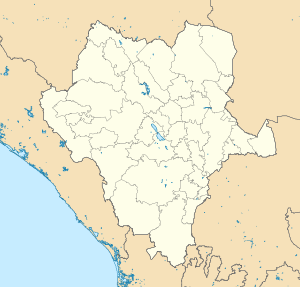
Tepehuanes Municipality is a municipality in the Mexican state of Durango. It is located in the North West of Durango at 25°12'"-26°25'"N 105°23'"-106°40'"W, at an elevation of about 1,830 meters (6000 feet).
Tres Arroyos is a city in Buenos Aires Province, Argentina. It is the administrative seat of Tres Arroyos Partido.
Santiago Papasquiaro is a city located in a valley situated on the eastern slopes of the Sierra Madre Occidental in the state of Durango, Mexico. As of 2010, the city of Santiago Papasquiaro had a population of 26,121, while the municipality has a census population of 48,482 as of 2015. It is the fourth largest community in the state in terms of population, and is the municipal seat of the municipality of the same name. The municipality has an area of 7,238.4 km².
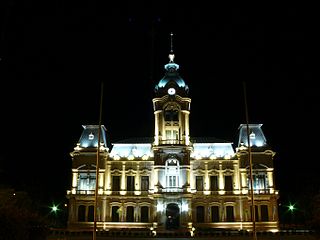
Laboulaye is a city in the southeast of the province of Córdoba, Argentina. It has 20,534 inhabitants as per the 2010 census [INDEC]. It lies on National Route 7, near the provincial borders of Santa Fe and Buenos Aires, about 315 km south from Córdoba City and 285 km west from Rosario.
Huajicori is both a municipality and the municipal seat of the same in the Mexican state of Nayarit. The population of the municipality was 10,294 in 2000 in a total area of 2,603.5 km2. Its area makes up almost 10% of the state. The population of the town was 2,201 (2005).
Bernardo de Irigoyen is a city in the province of Misiones, Argentina. It has 10,889 inhabitants as per the 2001 census [INDEC], and is the head town of the General Manuel Belgrano Department. It carries the name of prominent politician and diplomat Bernardo de Irigoyen.
Cuencamé is a small city and the seat of the municipality of Cuencamé in the state of Durango, which is in northern Mexico. As of 2015, the city had a total population of 9,848.
San Carlos de Bolívar is a town in Buenos Aires Province, Argentina. It is the administrative centre for Bolívar Partido.

Dolores is a town in Buenos Aires Province, Argentina. It is the administrative centre for Dolores Partido. The town settlement was officially founded by Ramón Lara on 21 August 1817.

Tula is a town located in Tula Municipality in the Mexican state of Tamaulipas.
Guadalupe Victoria is a city and seat of Guadalupe Victoria Municipality, in the state of Durango, north-western Mexico. In 2010, the city of Guadalupe Victoria had a population of 16,506.
Alcozauca de Guerrero is one of the 81 municipalities of Guerrero, in south-western Mexico. The municipal seat lies at Alcozauca de Guerrero. The municipality covers an area of 55,160 hectares.

Acatzingo Municipality is a municipality in the Mexican state of Puebla in south-eastern Mexico.

Ahuazotepec Municipality is a municipality in the Mexican state of Puebla in south-eastern Mexico.
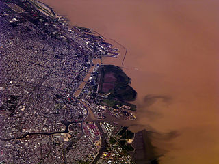
Buenos Aires, the capital of Argentina, has a temperate climate, which is classified as a humid subtropical climate (Cfa) under the Köppen climate classification with four distinct seasons. Summers are hot and humid with frequent thunderstorms while winters are cool and drier with frosts that occurs on average twice per year. Spring and fall are transition seasons characterized by changeable weather. At the central observatory, the highest temperature recorded is 43.3 °C (109.9 °F), and the lowest temperature recorded is −5.4 °C (22.3 °F).