El Salto | |
|---|---|
Municipal Seat and city | |
 Locomotive in El Salto | |
 El Salto  El Salto | |
| Coordinates: 23°46′56.424″N105°21′30.5958″W / 23.78234000°N 105.358498833°W | |
| Country | |
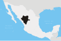
| State | Durango |
| Municipality | Pueblo Nuevo |
| Elevation | 2,580 m (8,460 ft) |
| Population (2015) | |
• Total | 24,241 |
| Time zone | UTC-6 (Central) |
El Salto is a city and seat of the municipality of Pueblo Nuevo in the southwestern part of the Mexican state of Durango. In 2015, the town had a total population of 24,241, [1] Situated on a pine-forested plateau about 2,580 meters (8,464 feet) above sea level in the Sierra Madre mountain range, the town is home to a large lumber industry. It also has a military base. The surrounding municipality has a population of 50,417 and an area of 6,178.3 km² (2,385.45 sq mi). [2]