Clandonagh

Last updated

Clandonagh

Clann Donnchadha (Irish)
OCBorrisInOssory 055w.jpg
Round tower and church in Borris-in-Ossory
Baronies of Laois.jpg
Barony map of Queen's County, 1900; Clandonagh is peach-coloured and in the southwest.
Sovereign state Republic of Ireland
Province Leinster
County Laois
Area
  Total176.98 km2 (68.33 sq mi)

Clandonagh (Irish : Clann Donncha [1] ) is a barony in County Laois (formerly called Queen's County or County Leix), Republic of Ireland. A barony was a historical subdivision of a county; mainly cadastral rather than administrative. [2] [3] [4]

Contents

Etymology

Clandonagh barony is named after the Ó Donnchadha (Dunphy) clan who ruled the area during the Middle Ages.

Geography

Clandonagh is in the southwest corner of Laois; it is bordered by Upper Woods to the north, Clarmallagh to the east, County Kilkenny to the south and County Tipperary to the west. The Erkina River flows through it, and the Slieve Bloom Mountains are in its north. [5]

History

Clandonagh was one of three traditional subunits of Upper Ossory, which was extant as a barony by 1657 and formally abolished in 1846, and divided into Clandonagh, Upper Woods and Clarmallagh. [6] [7] [8] The name refers to the "Clan Dunphy", referring to the Ó Donnchadha, who claimed descent from Donnchad Midi (AD 733–797). [9] [10] They were related to the Fitzpatricks. [11]

Clan Moroghoe migrated from Clandonagh to their seat in County Cork in 1709. [12]

It is referred to in the topographical poem Tuilleadh feasa ar Éirinn óigh (Giolla na Naomh Ó hUidhrín, d. 1420):

O'Cearḃaill dar corcraḋ croinn,
O'Donnchaḋa dreaċ dioghoinn,
Sloiġ liag as don tár toraid,
Dá riġ iad a haonchonair.

("O'Cearbhaill for whom trees are ruddy, O'Donnchadha of honest aspect, Whose rocklike hosts possess the fruitful land, Are two kings of the same territory.") [13] This refers to Ely O'Carroll, located to the immediate west of Clandonagh.

List of settlements

Below is a list of settlements in Clandonagh barony:

Related Research Articles

Brophy Surname list

Brophy is an Irish surname of ancient origin, which is derived from the Irish "Uí Bhróithe" or "Ó Bróithe" septs that were located mostly around Ballybrophy, Laois, and in counties Carlow and Kilkenny. The family has been prominent in the history of Ireland for nearly 1000 years and has included petty kings (Rí), clerics, soldiers, and writers. The family was first mentioned in the late 11th century, but as a member of the Dál Birn dynasty, its semi-legendary genealogy stretches back to AD 200 according to the Bodleian Library, MS Rawlinson B 502. As such, it remains one of Ireland's oldest extant pre-Norman Conquest noble families.

Castlecomer Plateau

The Castlecomer Plateau, or 'South Leinster Coalfield', is an upland area in the North of County Kilkenny, Ireland, extending into County Laois and County Carlow at its northern edge. The plateau is bounded on the east and south by the R448 regional road, on the west by the N77. The River Nore flows southward past the plateau's western flank, the River Barrow past its eastern flank and it is dissected by the River Dinin, which flows through Castlecomer itself.

Mac Amhlaoibh and Mac Amhalghaidh (Irish septs)

Mac Amhlaoibh and Mac Amhalghaidh are two different Gaelic patronymic names with different origins and meanings, but which share the same or similar Anglicisations. These Gaelic names are borne by at least three unrelated native Irish clans or septs.
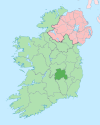
Galmoy (barony) Barony in Leinster, Ireland

Galmoy is a barony in the north western part of County Kilkenny, Ireland. It is one of 12 baronies in County Kilkenny. The size of the barony is 162.7 square kilometres (62.8 sq mi). There are 12 civil parishes in Galmoy. While it is named after the village of Galmoy, today the chief town of the barony is Urlingford. Galmoy barony lies at the north-western corner of the county between Fassadinin to the east, and Crannagh to the south. It is surrounded on two sides by counties Tipperary to the west and Laois to the north. The M8 Dublin/Cork motorway bisects the barony. It is situated 121 kilometres (75 mi) from Dublin city and 131 kilometres (81 mi) from Cork city. Galmoy is currently administered by Kilkenny County Council. The barony was part of in the historic kingdom of Osraige (Ossory).

Cranagh (barony) Barony in Leinster, Ireland

Crannagh, sometimes written Cranagh or Granagh, is a barony in the north western part of County Kilkenny, Ireland. It is one of 12 baronies in County Kilkenny. The size of the barony is 210.8 square kilometres (81.4 sq mi). There are 19 civil parishes in Crannagh, made up of 182 townlands. The chief town Freshford, with highest point at Clomantagh Hill. Crannagh lies at the north west of the county, with the baronies of Galmoy and Fassadinin to the north, and the barony of the Kilkenny to the east and Shillelogher to the south. It is buffers County Tipperary on the west. The R693 road crosses the barony.

Mac Giolla Phádraig dynasty

Mac Giolla Phádraig (pronunciation) is a native Irish dynastic surname which translates into English as "Son of the Devotee of (St.) Patrick". In the medieval period, the Mac Giolla Phádraigs were hereditary kings of Osraige; today, the name is commonly translated to "Fitzpatrick".

Callan (barony) Barony in Leinster, Ireland

The barony of Callan is a barony in the west of County Kilkenny, Ireland. The barony is 22.9 square kilometres (8.8 sq mi) in size. It is one of 12 baronies in County Kilkenny. Unusually for a barony, it contains only two civil parishes which together comprise 65 townlands. The chief town is Callan. The barony is bordered by the baronies of Shillelogher to the north and by Kells to the south. The N76 road bisects the barony. Notable features include Callan Motte and Callan Augustinian Friary.

Fassadinin Barony in Leinster, Ireland

Fassadinin, sometimes written Fassadining, is a barony in the north of County Kilkenny, Ireland. It is one of 12 baronies in County Kilkenny. The size of the barony is 276.2 square kilometres (106.6 sq mi). There are 19 civil parishes in Fassadinin. The chief town today is Castlecomer. The N78 Kilkenny/Athy road bisects the barony. Fassadinin is currently administered by Kilkenny County Council.

Ballyadams Barony in Leinster, Republic of Ireland

Ballyadams is a barony in County Laois, Republic of Ireland.

Upper Woods Barony in Leinster, Republic of Ireland

Upper Woods or Upperwoods is a barony in County Laois, Republic of Ireland.

Stradbally (barony) Barony in Leinster, Republic of Ireland

Stradbally is a barony in County Laois, Republic of Ireland.

Clarmallagh Barony in Leinster, Republic of Ireland

Clarmallagh is a barony in County Laois, Republic of Ireland.

Maryborough East Barony in Leinster, Republic of Ireland

Maryborough East or East Maryborough is a barony in County Laois, Republic of Ireland.

Maryborough West Barony in Leinster, Republic of Ireland

Maryborough West or West Maryborough is a barony in County Laois, Republic of Ireland.

Cullenagh Barony in Leinster, Republic of Ireland

Cullenagh or Cullinagh is a barony in County Laois, Republic of Ireland.

Portnahinch Barony in Leinster, Republic of Ireland

Portnahinch or Portnehinch (Irish: Port na hInse is a barony in County Laois, Republic of Ireland.

Tinnahinch (barony) Barony in Leinster, Republic of Ireland

Tinnahinch is a barony in County Laois, Republic of Ireland.

Moycarn Barony in Connacht, Republic of Ireland

Moycarn is a barony in County Roscommon, Republic of Ireland.

Roscommon (barony) Barony in Connacht, Republic of Ireland

Roscommon is a barony in County Roscommon, Republic of Ireland.

Ballintober North Barony in Connacht, Republic of Ireland

Ballintober North, also called Ballintober East, is a barony in County Roscommon, Republic of Ireland.

References

  1. "Clann Donncha/Clandonagh". Logainm.ie.
  2. "Clandonagh". www.townlands.ie.
  3. "Genuki: County Laois (Queens), Laois (Queens)". www.genuki.org.uk.
  4. 1 2 Lewis, Samuel (1 January 1849). "A Topographical Dictionary of Ireland: Comprising the Several Counties; Cities; Boroughs; Corporate, Market, and Post Towns; Parishes; and Villages; with Historical and Statistical Descriptions: Embellished with Engravings of the Arms of the Cities, Bishoprics, Corporate Towns, and Boroughs; and of the Seals of the Several Municipal Corporations". S. Lewis and Company via Google Books.
  5. "Queen's County (Laois)". www.libraryireland.com.
  6. "The Parliamentary Gazetteer of Ireland: Adapted to the New Poor-law, Franchise, Municipal and Ecclesiastical Arrangements, and Compiled with a Special Reference to the Lines of Railroad and Canal Communication, as Existing in 1814-45". A. Fullarton and Company. 1 January 1846 via Google Books.
  7. "Thom's Directory of Ireland". 1 January 1878 via Google Books.
  8. "A.D. 431-1056. Ed. by W.M. Hennessy". H.M. Stationery Office. 1 January 1887 via Google Books.
  9. "Sloinne". www.sloinne.ie.
  10. "Ó Donnchadha - Irish Names and Surnames". www.libraryireland.com.
  11. "O'Murphy (No.4) family genealogy - Irish Pedigrees". www.libraryireland.com.
  12. "O'Murphy (No.5) family genealogy - Irish Pedigrees". www.libraryireland.com.
  13. O'Dubhagain, John (1 January 1862). "The Topographical Poems of John O'Dubhagain and Giolla-na-naomh O'Huidhrin: Edited in the original Irish from MSS. in the Library of the Royal Irish Academy, Dublin, with translation, notes, and introductory dissertations, by John O'Donovan". A. Thom. via Google Books.