County Laois is a county in Ireland. It is part of the Eastern and Midland Region and in the province of Leinster. It was known as Queen's County from 1556 to 1922. The modern county takes its name from Loígis, a medieval kingdom. Historically, it has also been known as County Leix.
The kingdom of Uí Fháilghe, Uí Failge or Uíbh Fhailí was a Gaelic-Irish kingdom which existed to 1550, the name of which is preserved in the name of County Offaly, Ireland.
The Castlecomer Plateau, or 'South Leinster Coalfield', is an upland area in the North of County Kilkenny, Ireland, extending into County Laois and County Carlow at its northern edge. The plateau is bounded on the east and south by the R448 regional road, on the west by the N77. The River Nore flows southward past the plateau's western flank, the River Barrow past its eastern flank and it is dissected by the River Dinin, which flows through Castlecomer itself.

Galmoy is a barony in the north western part of County Kilkenny, Ireland. It is one of 12 baronies in County Kilkenny. The size of the barony is 162.7 square kilometres (62.8 sq mi). There are 12 civil parishes in Galmoy. While it is named after the village of Galmoy, today the chief town of the barony is Urlingford. Galmoy barony lies at the north-western corner of the county between Fassadinin to the east, and Crannagh to the south. It is surrounded on two sides by counties Tipperary to the west and Laois to the north. The M8 Dublin/Cork motorway bisects the barony. It is situated 121 kilometres (75 mi) from Dublin city and 131 kilometres (81 mi) from Cork city. Galmoy is currently administered by Kilkenny County Council. The barony was part of in the historic kingdom of Osraige (Ossory).

Upper Ossory was an administrative barony in the south and west of Queen's County in Ireland. In late Gaelic Ireland it was the túath of the Mac Giolla Phádraig (Fitzpatrick) family and a surviving remnant of the once larger kingdom of Ossory. The northernmost part of the Diocese of Ossory and medieval County Kilkenny, it was transferred to the newly created Queen's County, now known as County Laois, in 1600. In the 1840s its three component cantreds, Clarmallagh, Clandonagh, and Upperwoods, were promoted to barony status, thereby superseding Upper Ossory.

The barony of Callan is a barony in the west of County Kilkenny, Ireland. The barony is 22.9 square kilometres (8.8 sq mi) in size. It is one of 12 baronies in County Kilkenny. Unusually for a barony, it contains only two civil parishes which together comprise 65 townlands. The chief town is Callan. The barony is bordered by the baronies of Shillelogher to the north and by Kells to the south. The N76 road bisects the barony. Notable features include Callan Motte and Callan Augustinian Friary.
Kells is a barony in the south-west of County Kilkenny, Ireland. It is one of 12 baronies in County Kilkenny. The size of the barony is 155.6 square kilometres (60.1 sq mi). There are 10 civil parishes in Kells, made up of 167 townlands. The chief town is Kells.

The barony of Knocktopher is a barony in the west of County Kilkenny, Ireland. The barony is 46,765 acres (189.25 km2) in size. There are 16 civil parishes made up of 125 townlands. It is one of 12 baronies in the county. The chief town is Mullinavat and it contains the settlements of Stonyford, Ballyhale, Hugginstown, Knocktopher, and Dunnamaggan. The M9 motorway bisects the barony.

Fassadinin, sometimes written Fassadining, is a barony in the north of County Kilkenny, Ireland. It is one of 12 baronies in County Kilkenny. The size of the barony is 276.2 square kilometres (106.6 sq mi). There are 19 civil parishes in Fassadinin. The chief town today is Castlecomer. The N78 Kilkenny/Athy road bisects the barony. Fassadinin is currently administered by Kilkenny County Council.

Ballyadams is a barony in County Laois, Republic of Ireland.

Stradbally is a barony in County Laois, Ireland.

Clarmallagh is a barony in County Laois, Ireland.
Maryborough East or East Maryborough is a barony in County Laois, Ireland.

Cullenagh or Cullinagh is a barony in County Laois, Ireland.

Portnahinch or Portnehinch (Irish: Port na hInse is a barony in County Laois, Ireland.
Tinnahinch is a barony in County Laois, in the Republic of Ireland.
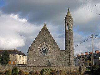
The barony of Shillelogher is a barony in the west of County Kilkenny, Ireland. The barony is 36,684 acres (148.45 km2) in size. It is one of 12 baronies in County Kilkenny. There are 19 civil parishes in Shillelogher, made up of 109 townlands. The chief town is Bennettsbridge. Shillelogher lies at the centre of the county, with the baronies of Crannagh and Kilkenny to the north (whose chief towns are Freshford and Kilkenny, and the barony of Gowran to the east. It is borders County Tipperary to the west. The N76 road bisects the barony. The river Nore flows through the barony. Danesfort Church is located in Shillelogher.
Moycarn is a barony in County Roscommon, Ireland.
Roscommon is a barony in County Roscommon, Ireland.
Clandonagh is a barony in County Laois, Republic of Ireland. A barony was a historical subdivision of a county; mainly cadastral rather than administrative.