Related Research Articles

The South Creek or Wianamatta, a creek that is part of the Hawkesbury-Nepean catchment, is located on the Cumberland Plain, also referred to as Greater Western Sydney, New South Wales, Australia.

Cranebrook is a suburb of Greater Western Sydney, in the state of New South Wales, Australia, and is located 50 km radially WNW of the Sydney central business district, in the local government area of the City of Penrith. Cranebrook is part of the Greater Western Sydney region.
Kingswood is a suburb in western Sydney, in the state of New South Wales in Australia. It is 52 kilometres west of the Sydney central business district, in the local government area of the City of Penrith. There are various other locations within the state of New South Wales that are also called Kingswood, and is often confused with the nearby suburb of Kingswood Park.

Blackett is a suburb of Sydney, in the state of New South Wales, Australia. Blackett is located 48 kilometres west of the Sydney central business district, in the local government area of the City of Blacktown and is part of the Greater Western Sydney region.

Lalor Park is a suburb of Sydney, in the state of New South Wales, Australia. Lalor Park is located 35 kilometres west of the Sydney central business district in the local government area of the City of Blacktown. Lalor Park is part of the Greater Western Sydney region. Lalor Park is commonly abbreviated as 'L.P'.
Werrington Downs is a suburb of Western Sydney. It is 52 kilometres (32 mi) west of the Sydney central business district, in the local government area of the City of Penrith and is part of the Greater Western Sydney region.

Werrington is a suburb of Sydney, in the state of New South Wales, Australia. It is 49.3 kilometres (30.6 mi) west of the Sydney central business district, in the local government area of the City of Penrith and is part of the Greater Western Sydney region.

St Marys is a suburb in western Sydney, in the state of New South Wales, Australia. It is 45 kilometres west of the Sydney central business district, in the local government area of the City of Penrith.
Jamisontown is a suburb of Sydney, in the state of New South Wales, Australia. It is 56 kilometres west of the Sydney central business district, in the local government area of the City of Penrith, and is part of the Greater Western Sydney region. It is on the eastern side of the Nepean River, just south of Penrith and bears the name of Thomas Jamison, a pioneer landowner and First Fleet surgeon.
Leonay is a suburb of Sydney, in the state of New South Wales, Australia 58 kilometres west of the Sydney central business district, in the local government area of the City of Penrith. It is part of the Greater Western Sydney region.

Werrington County is a suburb of Sydney, in the state of New South Wales, Australia. It is 50 kilometres (31 mi) west of the Sydney central business district, in the local government area of the City of Penrith and is part of the Greater Western Sydney region. The suburb is entirely residential with a high proportion of individual separate dwellings.
Cambridge Park is a suburb of Sydney, in the state of New South Wales, Australia 53 kilometres west of the Sydney central business district, in the local government area of the City of Penrith. It is part of the Greater Western Sydney region.

Carramar is a suburb of Sydney, in the state of New South Wales, Australia. Carramar is located 30 kilometres west of the Sydney central business district, in the local government area of the City of Fairfield and is part of the Greater Western Sydney region.

Erskine Park is a suburb of Sydney in the state of New South Wales, Australia. Erskine Park is located 42 kilometres west of the Sydney central business district, in the local government area of the City of Penrith and is part of the Greater Western Sydney region.
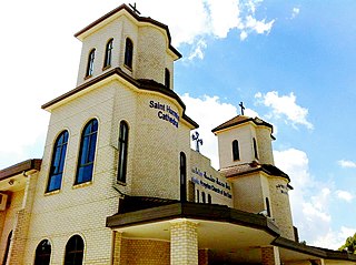
Greenfield Park is a suburb of Sydney, in the state of New South Wales, Australia. Greenfield Park is located 36 kilometres west of the Sydney central business district in the local government area of the City of Fairfield. The suburb has one of the most highest proportion of Assyrian people in the Sydney area and Australia per se.
Cambridge Gardens is a suburb of Sydney, in the state of New South Wales, Australia. Cambridge Gardens is located 54 kilometres west of the Sydney central business district, in the local government area of the City of Penrith and is part of the Greater Western Sydney region.
Colyton is a suburb of Sydney, in the state of New South Wales, Australia 43 kilometres west of the Sydney central business district, in the local government area of the City of Penrith. It is part of the Greater Western Sydney region.

Glenmore Park is a suburb of Sydney, in the state of New South Wales, Australia. Glenmore Park is located 54 kilometres (34 mi) west of the Sydney central business district, in the local government area of the City of Penrith and is part of the Greater Western Sydney region.

North St Marys is a suburb in western Sydney, in the state of New South Wales Australia. North St Marys is located 47 kilometres west of the Sydney central business district, in the local government area of the City of Penrith. North St Marys is an extension of the adjoining suburb of St Marys.
Caddens is a suburb of Sydney, in the state of New South Wales in Australia. It is a new masterplanned residential neighborhood located 48 kilometres west of the Sydney central business district, in the local government area of the City of Penrith featuring views of the scenic Blue Mountains. The suburb's postcode is 2747.
References
- 1 2 Australian Bureau of Statistics (27 June 2017). "Claremont Meadows (State Suburb)". 2016 Census QuickStats. Retrieved 15 June 2020.