Coutts is a village in Alberta and a port of entry into the U.S. state of Montana. It is one of the busiest ports of entry on the Canada–United States border in western Canada. It connects Highway 4 to Interstate 15, an important trade route between Alberta, American states along I-15, and Mexico.

Whiskey Gap is a ghost town in southern Alberta, Canada. It is located approximately 80 km (50 mi) south of Lethbridge on Highway 501.

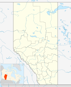
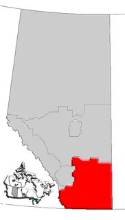
Division No. 7 is a census division in Alberta, Canada. It is located in the southeast corner of central Alberta and its largest urban community is the Town of Wainwright.
Burdett is a hamlet in Alberta, Canada within the County of Forty Mile No. 8. It is located approximately 71 kilometres (44 mi) west of Medicine Hat and 97 kilometres (60 mi) east of Lethbridge on Highway 3. Also, Burdett is regarded as the site of Canada's first irrigation pivot.
Skagit Valley Provincial Park is a provincial park in British Columbia, Canada, centred on the Skagit River and its tributaries. The park borders E. C. Manning Provincial Park in Canada and Ross Lake National Recreation Area and North Cascades National Park in the United States. It includes part of Ross Lake, a reservoir formed by a hydroelectric dam in Whatcom County, Washington.

Etzikom is a hamlet in Alberta, Canada within the County of Forty Mile No. 8. It is approximately 20 kilometres (12 mi) east of Foremost on Highway 61.

Skiff is a hamlet in southern Alberta, Canada within the County of Forty Mile No. 8. It is located on Highway 61, also known as the historic Red Coat Trail, approximately 75 km (47 mi) southeast of Lethbridge.
Woolford is a hamlet in southern Alberta, Canada within Cardston County. It is located on Highway 503, approximately 16 kilometres (9.9 mi) southeast of Cardston between the St. Mary River and the Milk River Ridge. It is named after Thomas Woolford who came to the area in 1900.
Beauvallon is a hamlet in central Alberta, Canada within the County of Two Hills No. 21. It is located on Highway 45, approximately 139 kilometres (86 mi) east of Edmonton.
Brownfield is a hamlet in central Alberta, Canada within the County of Paintearth No. 18. It is located approximately 25 km (16 mi) north of Highway 12 and 122 km (76 mi) southeast of Camrose. It is only a few miles south from the Battle River and positioned along Highway 872.
Duvernay is a hamlet in central Alberta, Canada within the County of Two Hills No. 21. It is located 1.6 km (1.0 mi) north of the intersection of Highway 36 and Highway 29 along the south bank of the North Saskatchewan River, approximately 53 km (33 mi) southwest of St. Paul. The hamlet of Brosseau is located immediately across the river along the north bank.
Iddesleigh is a hamlet in southern Alberta, Canada within Special Area No. 2. It is located approximately 37 kilometres (23 mi) northeast of Highway 1 and 46 kilometres (29 mi) northeast of Brooks.
St. Vincent is a hamlet in northern Alberta, Canada within the County of St. Paul No. 19. It is located 3 kilometres (1.9 mi) south of Highway 28, approximately 79 kilometres (49 mi) southwest of Cold Lake.
Clearwater 175 is an Indian reserve in Alberta. It is part of the Fort McMurray First Nation, located 11 kilometres (6.8 mi) southeast of Fort McMurray. It had a population of 0 in the 2011 census.
Fairview is a hamlet in southern Alberta, Canada, within Lethbridge County. It is adjacent to the eastern boundary of Lethbridge, approximately 0.3 kilometres (0.19 mi) south of Highway 3. More specifically, it is located on southeast corner of Highway 4 and Highway 512.
Conquerville is an unincorporated community in the County of Forty Mile No. 8, Alberta, Canada. Located 30 miles (48 km) north of Highway 61, in southeast Alberta, Canada. It is one of many ghost towns along the historic Red Coat Trail route.
The Leq' a: mel First Nation, formerly known as the Lakahahmen First Nation, is a First Nations band government whose community and offices are located in the area near Deroche, British Columbia, Canada, about 12 kilometres east of the District of Mission. They are a member government of the Sto:lo Nation tribal council, which is one of two tribal councils of the Sto:lo.
Legend is an unincorporated community in Alberta, Canada within the County of Forty Mile No. 8. It is located along Highway 61 between Range Road 125 and Range Road 130, in southeast Alberta. It is one of many ghost towns along the historic Red Coat Trail route.
St. Kilda is a former unincorporated community in southern Alberta, Canada within the County of Warner No. 5. It is located south of Highway 500 on township road 12-1A, southeast of the Town of Milk River, and east of the Village of Coutts. It is approximately 65 km (40 mi) southeast of the City of Lethbridge.
Atchelitz is a rural community within the City of Chilliwack in the Eastern Fraser Valley region of British Columbia, Canada. It is located southwest of the city core, to the north of the Vedder Canal.