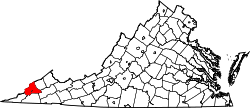
Clear Creek, Virginia

Last updated
Clear Creek, Virginia
Unincorporated community
USA Virginia location map.svg
Red pog.svg
Clear Creek, Virginia
Usa edcp location map.svg
Red pog.svg
Clear Creek, Virginia
Coordinates: 36°56′21″N82°35′52″W / 36.93917°N 82.59778°W / 36.93917; -82.59778 Coordinates: 36°56′21″N82°35′52″W / 36.93917°N 82.59778°W / 36.93917; -82.59778
Country United States
State Virginia
County Wise
Elevation 2,070 ft (630 m)
Time zone Eastern (EST) (UTC-5)
  Summer (DST) EDT (UTC-4)
GNIS feature ID 1496599 [1]

Clear Creek was an unincorporated community and coal town located in Wise County, Virginia, United States.

A coal town, also known as a coal camp or patch is typically situated in a remote place and provides residences for a population of miners to reside near a coal mine. A coal town is a type of company town or mining community established by the employer, a mining company, which imports workers to work the mineral find. The 'town founding' process is not limited to coal mining, nor mining, but is generally found where mineral wealth is located in a remote or undeveloped area, which is then opened for exploitation, normally first by having some transportation infrastructure brought into being first. Often, such minerals were the result of logging operations by pushing into a wilderness forest, which clear-cutting operations then allowed geologists and cartographers, to chart and plot the lands, allowing efficient discovery of natural resources and their exploitation.

Wise County, Virginia County in the United States

Wise County is a county located in the U.S. state of Virginia. As of the 2010 census, the population was 41,452. Its county seat is Wise. The county was formed in 1856 from Lee, Scott, and Russell Counties and named for Henry A. Wise, who was the Governor of Virginia at the time.

Related Research Articles

Clear Creek County, Colorado County in the United States

Clear Creek County is one of the 64 counties of the U.S. state of Colorado. As of the 2010 census, the population was 9,088. The county seat is Georgetown.

<i>The Virginian</i> (novel) The Virginian: A Horseman of the Plains, a 1902 novel set in the Wild West, by American author Owen Wister

The Virginian is a 1902 novel set in the Wild West by the American author Owen Wister, (1860-1938). It describes the life of a cowboy on a cattle ranch in Wyoming and was the first true fictional western ever written, aside from short stories and pulp dime novels. The Virginian paved the way for many more westerns by such authors as Zane Grey, Louis L'Amour, and several others. The novel was adapted from several short stories published in Harper's Magazine and the Saturday Evening Post between Nov 1893 and May 1902.

Clear Creek may refer to:

Clear Creek Independent School District

Clear Creek Independent School District (CCISD) is a school district based in League City, Texas (USA). The district serves most of the Clear Lake Area and some other neighboring parts of the Houston metropolitan area. CCISD is the 29th largest school district in Texas, spanning 103 square miles and serving over 41,000 students. The district operates 44 distinct campuses, consisting of 5 composite high schools, 10 intermediate schools, 26 elementary schools, and 3 alternative campuses.

Sleepy Creek river in the United States of America

Sleepy Creek is a 44.0-mile-long (70.8 km) tributary of the Potomac River in the United States, belonging to the Chesapeake Bay's watershed. The stream rises in Frederick County, Virginia, and flows through Morgan County, West Virginia before joining the Potomac near the community of Sleepy Creek.

Quantico Creek

Quantico Creek is a 13.7-mile-long (22.0 km) partially tidal tributary of the Potomac River in eastern Prince William County, Virginia. Quantico Creek rises southeast of Independent Hill, flows through Prince William Forest Park and Dumfries and empties into the Potomac at Possum Point.

Gerrardstown, West Virginia unincorporated community in West Virginia, United States

Gerrardstown is an unincorporated community village located along W.Va. Route 51 in Berkeley County in West Virginia's Eastern Panhandle region in the lower Shenandoah Valley.

Landgraff, West Virginia Unincorporated community in West Virginia, United States

Landgraff is an unincorporated community in McDowell County, West Virginia. It is located along U.S. Route 52 and Elkhorn Creek approximately 6.4 miles (10.3 km) east of the county seat of Welch.

Virginia State Route 61 highway in Virginia

State Route 61 is a primary state highway in the U.S. state of Virginia. The state highway runs 48.16 miles (77.51 km) from SR 16 in Tazewell east to U.S. Route 460 in Narrows. SR 61 passes through several narrow creek valleys as it parallels the West Virginia state line through Tazewell, Bland, and Giles counties. The only sizeable community between the highway's endpoints is Rocky Gap, where the highway meets US 52 and Interstate 77 (I-77).

John Potts was a physician and Colonial Governor of Virginia at the Jamestown settlement in the Virginia Colony in the early 17th century.

King Bridge Company

The King Iron Bridge & Manufacturing Company was a late-19th-century bridge building company located in Cleveland, Ohio. It was founded by Zenas King (1818–1892) in 1858 and subsequently managed by his sons, James A. King and Harry W. King and then his grandson, Norman C. King, until the mid-1920s. Many of the bridges built by the company were used during America's expansion west in the late 19th century and early 20th century, and some of these bridges are still standing today.

Briery Creek Wildlife Management Area

Briery Creek Wildlife Management Area is a 3,164-acre (12.80 km2) Wildlife Management Area in Prince Edward County, Virginia. With terrain typical of Virginia's south-central Piedmont, it encompasses the 845-acre (3.42 km2) Briery Creek Lake, a reservoir formed by the damming of Briery Creek and Little Briery Creek. Much of the area was historically used for tobacco farming, and more recently, timber production; today the land contains a mixture of hardwoods and loblolly pine.

Hidden Valley Wildlife Management Area

Hidden Valley Wildlife Management Area is a 6,400-acre (26 km2) Wildlife Management Area in Washington County, Virginia, along its border with Russell County. The area is typified by mountainous mature hardwood forests that have regenerated on land logged in the early twentieth century; a number of small openings which are also maintained as habitat for local wildlife. Its elevation ranges from 2,000 to 4,000 feet above sea level. At the head of the valley is the 60-acre (24 ha) Hidden Valley Lake, which serves as the source of Brumley Creek.

USS <i>Kirwin</i> (APD-90)

USS Kirwin (APD-90), ex-DE-229, later LPR-90, was a United States Navy high-speed transport in commission from 1945 to 1946 and from 1965 to 1969.

Clearco, West Virginia Unincorporated community in West Virginia, United States

Clearco is an unincorporated community and coal town in Greenbrier County, West Virginia, United States. Clearco is 8 miles (13 km) east-northeast of Quinwood.

Clear Creek, West Virginia Unincorporated community in West Virginia, United States

Clear Creek is an unincorporated community in Raleigh County, West Virginia, United States. Clear Creek is 4.5 miles (7.2 km) west of Pax. Clear Creek has a post office with ZIP code 25044.

Toney Fork, West Virginia Unincorporated community in West Virginia, United States

Toney Fork is an unincorporated community in Wyoming County, West Virginia, United States. Toney Fork is located on West Virginia Route 85 at the confluence of the Clear Fork and the Toney Fork, 2 miles (3.2 km) northeast of Oceana.

References