Clydach | |
---|---|
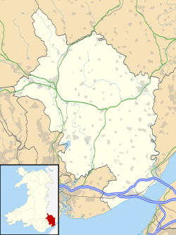
Location within Monmouthshire | |
Population | <2000 |
OS grid reference | SO225128 |
Principal area | |
Ceremonial county | |
Country | Wales |
Sovereign state | United Kingdom |
Post town | Abergavenny |
Postcode district | NP7 |
Dialling code | 01873 |
Police | Gwent |
Fire | South Wales |
Ambulance | Welsh |
UK Parliament | |
Senedd Cymru – Welsh Parliament | |
Clydach is a village in Monmouthshire, Wales. Its nearest neighbours are the village of Gilwern and town of Abergavenny.
It is split by the A465 road (the 'Heads of the Valleys') into North Clydach and South Clydach.
Historically its main industry was based around the ironworks on the south side of the valley which have long since closed.
Clydach County primary school was closed in July 2006 by Monmouthshire County Council because of there were less than 30 pupils and none in years 5 and 6. The children now attend schools in Gilwern and Brynmawr and the school buildings are unused.
The area around the village is popular for hillwalking with many routes tracing the beauty of the nearby Clydach Gorge or Cwm Clydach, and the old trackbed of the Merthyr, Tredegar and Abergavenny Railway is a cycleway and walkway and the Monmouthshire and Brecon Canal can be walked or travelled by narrow boat.
There is a picnic site and caravan park alongside the River Clydach, easily reached from the A465 Heads of the Valleys road. The ironworks are some 300 metres away, across the river. The ironworks were built during the late 18th century and are a Scheduled Ancient Monument. There are also limeworks.
The area is within the Brecon Beacons National Park close to the Blaenavon Industrial Landscape, a World Heritage Site, and not far from Big Pit National Coal Museum. Clydach Gorge or Cwm Clydach has been designated a SSSI.
Abergavenny is a market town and community in Monmouthshire, Wales. Abergavenny is promoted as a Gateway to Wales; it is approximately 6 miles (10 km) from the border with England and is located where the A40 trunk road and the A465 Heads of the Valleys road meet.
Abersychan is a settlement and community north of Pontypool in Torfaen, Wales, and lies within the boundaries of the historic county of Monmouthshire and the preserved county of Gwent.
Monmouthshire is a principal area in Wales. The name derives from the historic county of Monmouthshire of which it covers the eastern three-fifths. The largest town is Abergavenny. Other towns and large villages are Caldicot, Chepstow, Monmouth, Magor and Usk. It borders Torfaen, Newport and Blaenau Gwent to the west; Herefordshire and Gloucestershire to the east; and Powys to the north.
The A465, the Neath to Abergavenny Trunk Road, is in Wales. The section westwards from Abergavenny is more commonly known as the Heads of the Valleys Road because it links the northern heads of the South Wales Valleys. Approximately following the southern boundary of the Brecon Beacons National Park, the Ordnance Survey Pathfinder guide describes it as the unofficial border between rural and industrial South Wales. The A465 provides an alternative route between England and the counties in South West Wales and to the ferries to Ireland.
Llanelly is the name of a parish and coterminous community in the principal area of Monmouthshire, within the historic boundaries of Brecknockshire, south-east Wales. It roughly covers the area of the Clydach Gorge. The population of the parish and ward at the 2011 census was 3,899.
Thomas Dadford Jr. was an English canal engineer, who came from a family of canal engineers. He first worked with his father in the north of Britain on the Stour and the Trent, but later independently, contributing to a number of canal schemes, mainly in Monmouthshire and Glamorganshire but also in Montgomeryshire and Ellesmere, before dying at the young age of 40.
John Dadford was an English canal engineer, as were his father Thomas Dadford and brothers Thomas Dadford, Jr. and James Dadford. He lived from approximately 1769 to 1800, although neither date is known for certain.
Blorenge, also called The Blorenge, is a prominent mountain overlooking the valley of the River Usk near Abergavenny, Monmouthshire, southeast Wales. It is situated in the southeastern corner of the Brecon Beacons National Park. The summit plateau reaches a height of 1,841 feet (561 m).
The Monmouthshire and Brecon Canal is a small network of canals in South Wales. For most of its currently (2018) navigable 35-mile (56 km) length it runs through the Brecon Beacons National Park, and its present rural character and tranquillity belies its original purpose as an industrial corridor for coal and iron, which were brought to the canal by a network of tramways and/or railroads, many of which were built and owned by the canal company.
Gilwern is a village within the Brecon Beacons National Park in Monmouthshire, Wales. Historically in Brecknockshire, it extends to either side of the River Clydach on the south side of the Usk valley. Its position beside the Monmouthshire and Brecon Canal led to it being an important industrial centre at one time.
Govilon is a small Welsh village located between Llanfoist and Gilwern near Abergavenny in north Monmouthshire. It is part of the community of Llanfoist Fawr. the population was 1,447 in 2011.
The Merthyr, Tredegar and Abergavenny Railway, also known as the Heads of the Valleys line, was a railway line which operated between 1860 and 1958 between the Monmouthshire town of Abergavenny and the Glamorgan town of Merthyr Tydfil in South East Wales.
Llanvihangel Crucorney is a small village in the community (parish) of Crucorney, Monmouthshire, Wales. It is located 5 miles (8.0 km) north of Abergavenny and 18 miles (29 km) south-west of Hereford, England on the A465 road.
Llantilio Pertholey is a small village and community (parish) in Monmouthshire, south east Wales. It is located 1.5 miles (2.4 km) to the north-east of the market town of Abergavenny, which it is part of, just off the A465 road to Hereford. The parish covers a large area beneath the Skirrid, an outlier of the Black Mountains; much of the parish lies within the easternmost part of the Brecon Beacons National Park.
The Clydach Gorge is a steep-sided valley in south-east Wales down which the River Clydach flows to the River Usk. It runs for 5.6 kilometres (3.5 mi) from the vicinity of Brynmawr in Blaenau Gwent eastwards and northeastwards to Gilwern in Monmouthshire. The Gorge was one of the first locations in the region to be industrialised though it still retains its natural environment. It has long been an important transport corridor between Abergavenny and the lowlands of Monmouthshire and the northeastern quarter of the South Wales Coalfield. It is now exploited by the A465 Heads of the Valleys trunk road which runs between Abergavenny and Swansea and which serves the Heads of the Valleys sub-region.
The River Clydach is a short, steep and fast-flowing river in Monmouthshire and the county borough of Blaenau Gwent in south Wales. It lies within the Brecon Beacons National Park. It is around 10 kilometres (6 mi) in length.
Mynydd Llangatwg or Llangattock Mountain is a hill in the Brecon Beacons National Park in the county of Powys, south Wales. It is named from the village of Llangatwg which sits in the valley of the River Usk to the north of it. It is essentially an undulating plateau rising in the west to a height of 530 metres (1,740 ft) at grid reference SO171157 and in the east to a height of 529 metres (1,736 ft) at Hen Dy-aderyn / Twr Pen-cyrn. This spot is marked by a trig point. The shallow pool of Pwll Gwy-rhoc sits in a broad depression towards the northern edge of the plateau whilst a smaller pool frequently occupies a large shakehole a few hundred metres to its west. The hill forms an impressive northern scarp overlooking the Usk valley and commonly referred to as the Llangattock Escarpment. Its southern margins are more subdued. Its eastern end is defined by the drops into the Clydach Gorge. Beyond the B4560 to the west the hill merges with Mynydd Llangynidr which has a similar character.
The geology of Monmouthshire in southeast Wales largely consists of a thick series of sedimentary rocks of different types originating in the Silurian, Devonian, Carboniferous, Triassic and Jurassic periods.
Smart's Bridge, Llanelly, Monmouthshire, is a cast-iron bridge situated in Clydach Gorge. Constructed in 1824, it gave access to the Clydach Ironworks, the most significant industrial enterprise in the gorge. The bridge was designated a Grade II* listed structure in 2000.