North Yorkshire is the largest non-metropolitan county and lieutenancy area in England, covering an area of 8,654 square kilometres (3,341 sq mi). Around 40% of the county is covered by national parks, including most of the Yorkshire Dales and the North York Moors. It is one of four counties in England to hold the name Yorkshire; the three other counties are the East Riding of Yorkshire, South Yorkshire and West Yorkshire.

Daresbury is a village and civil parish in the unitary authority of Halton and the ceremonial county of Cheshire, England. At the 2001 census it had a population of 216, increasing to 246 by the 2011 census.

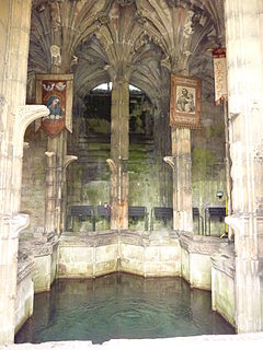
Holywell is a market town and community in Flintshire, Wales. It lies to the west of the estuary of the River Dee. The community includes Greenfield.

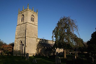
Clayton is a village in the Metropolitan Borough of Doncaster, on the border with West Yorkshire. It lies to the north of Thurnscoe at an elevation of around 80 metres above sea level.

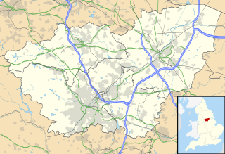
A civil parish is a country subdivision, forming the lowest unit of local government in England. There are 94 civil parishes in the ceremonial county of South Yorkshire, most of the county being unparished. At the 2001 census, there were 360,191 people living in the parishes, increasing to 369,220 in 2011, accounting for 27.5 per cent of the county's population.

Backford is a village and civil parish in the unitary authority of Cheshire West and Chester and ceremonial county of Cheshire, England. It is situated between Chester and Ellesmere Port on the A41 trunk road, to the north of the Shropshire Union Canal. Backford Cross is located about 2.5 km (1.6 mi) to the north, the village of Mollington is approximately 2.5 km (1.6 mi) to the west and the hamlet of Croughton is about 3 km (1.9 mi) to the east.

Barwick in Elmet and Scholes is a civil parish in the City of Leeds metropolitan borough in West Yorkshire, England. According to the 2001 census it had a population of 5,120, decreasing to 4,902 at the 2011 Census. The parish includes Barwick-in-Elmet and Scholes, situated in the north-eastern part of the borough.

Braithwell is a village and civil parish in the Metropolitan Borough of Doncaster in South Yorkshire, England. It is about 1 mile (1.6 km) north from Maltby and 3 miles (5 km) south-east from Conisbrough. According to the 2001 Census the civil parish had a population of 1,056, increasing slightly to 1,060 at the 2011 Census.

Mollington is a village and civil parish in the unitary authority of Cheshire West and Chester and the ceremonial county of Cheshire, England. It is located two miles north of the city of Chester, with approximate boundaries formed by the A41 Liverpool-Chester trunk road and Shropshire Union Canal to the east and southeast, the A540 Wirral Peninsula trunk road to the south and west and the A5117 Dunkirk link road to the north.

Lowther is a civil parish in Eden District, Cumbria. Within the parish are the settlements of Lowther Village, Newtown or Lowther Newtown, Hackthorpe, Whale, and Melkinthorpe. At the 2001 census the parish had a population of 402, increasing to 465 at the 2011 Census.

Higher Kinnerton is a village and community within rural Flintshire, Wales, close to the Wales-England border. Its sister village, Lower Kinnerton, is across the border in Cheshire, England.

Ulpha is a small village and civil parish in the Duddon Valley in the Lake District National Park in Cumbria, England. Historically in Cumberland, it forms part of the borough of Copeland. At Ulpha a road leaves the Duddon Valley to cross Birker Fell to the valley of Eskdale. In the 2001 census the parish had a population of 159, reducing at the 2011 Census to 128.

Norwood is a civil parish in the Harrogate district of North Yorkshire, England. According to the 2001 UK census, Norwood parish had a population of 200, increasing to 216 at the 2011 Census. The parish lies on the eastern side of the Washburn Valley, and includes the eastern side of Swinsty Reservoir.

Seaton is a village and civil parish in the East Riding of Yorkshire, England. It is situated approximately 2.5 miles (4 km) west of Hornsea on the A1035 road.

Clifton is a small village to the south-west of Doncaster, within the boundary of the civil parish of Conisbrough Parks, which had a population of 385 at the 2001 Census, reducing to 374 at the 2011 Census.

Moston is a small village and civil parish in the unitary authority of Cheshire West and Chester and the ceremonial county of Cheshire, England. It is in the north east of Chester, close to the Shropshire Union Canal and the A41 trunk road between Chester and Birkenhead. Moston combines with Bache and Upton-by-Chester to form a joint parish council.

The Milton Keynes urban area or Milton Keynes Built-up Area is a designation established by the United Kingdom's Office for National Statistics. As with other urban areas, it includes settlements that are physically contiguous with the rest of the built up area but, for historical reasons, regard themselves as being outside of the principal settlement: this urban area includes Newport Pagnell and Woburn Sands.

Chorlton is a civil parish in the Borough of Cheshire West and Chester and ceremonial county of Cheshire, England. Situated to the west of the market town of Malpas, the main settlement in the parish is Chorlton Lane. Local landmarks Chorlton Hall and Chorlton Old Hall are both Grade II listed buildings.

Chorlton-by-Backford is a former civil parish in the Borough of Cheshire West and Chester and ceremonial county of Cheshire, England, approximately 3 mi (4.8 km) to the north of Chester. It was abolished in 2015 and merged into the civil parish of Backford. Chorlton Hall is a Grade II listed building within the area.

Rowton is a village and civil parish on the outskirts of Chester, in the unitary authority of Cheshire West and Chester and ceremonial county of Cheshire, England. It is located between Christleton and Waverton, near the A41 road. The Rowton Hall hotel is the most prominent landmark in the village. At the 2001 census Rowton had a population of 497, decreasing to 441 in the 2011 census.


