
Aydon is a village and former civil parish, now in the parish of Corbridge, in Northumberland, England. It is about 2 miles (3 km) northeast of Corbridge on the B6321 road. The village is about 18 miles (29 km) from Newcastle upon Tyne along the main A69 road. The A68 road is close by, leading to Jedburgh and Darlington. Aydon lies near the course of the ancient Roman monument, Hadrian's Wall. In 1951 the parish had a population of 90.

Beanley is a village and former civil parish, now in the parish of Hedgeley in the county of Northumberland, England. It is situated to the north-west of Alnwick, near Eglingham. In 1951 the parish had a population of 53.

Bebside is a village and former civil parish, now in the parish of Blyth, in Northumberland, England. It is situated to the west of Blyth. It was formerly a mining village, the mine associated with the village operated between 1858 and 1926. It was served by Bebside railway station, from 1850 to 1964. In 1911 the parish had a population of 58.

Berwick Hill is a village and former civil parish, now in the parish of Ponteland, in the county of Northumberland, England. It is situated to the north of Newcastle upon Tyne, near Ponteland. In 1951 the parish had a population of 41.

Broomhaugh is a village and former civil parish, now in the parish of Broomhaugh and Riding, in Northumberland, England. It is situated between Hexham and Newcastle upon Tyne, to the south of the River Tyne near Riding Mill, and adjacent to the A695 road. In 1951 the parish had a population of 228.

Burradon is a village and former civil parish, now in the parish of Netherton, in Northumberland, England. It is about 14 miles (23 km) to the south-west of Alnwick. In 1951 the parish had a population of 53.

Branton is a village and former civil parish, now in the parish of Ingram, in Northumberland, England. It is about 9 miles (14 km) west of Alnwick. In 1951 the parish had a population of 50.

Cambo is a village and former civil parish, now in the parish of Wallington Demesne, in Northumberland, England. It is about 11 miles (18 km) to the west of the county town of Morpeth at the junction of the B6342 and B6343 roads. The village was gifted along with the Wallington Estate to the National Trust by Sir Charles Philips Trevelyan in 1942, the first donation of its kind. It remains a National Trust village. In 1951 the parish had a population of 60.

Clennell is a small village and as Clennel, a former civil parish, now in the parish of Alwinton, in Northumberland, England. It is about 1 mile (1.6 km) north-east of Alwinton. In 1951 the parish had a population of 37.
Cowpen is an area of Blyth and former civil parish, now in the parish of Blyth in the county of Northumberland, England. It is just east of the A189 road. The Ward population taken at the 2011 census was 4,466. In 1911 the parish had a population of 21,295.

Hexhamshire Low Quarter is a former civil parish, now in the parish of Hexhamshire, in Northumberland, England. It was situated to the south of Hexham and to the north of Hexhamshire civil parish proper. The largest settlement in the parish was Juniper. In 1961, the parish had a population of 223.

Bassington is a former civil parish, now in the parish of Eglingham, in the county of Northumberland, England. It is located about 3 miles (5 km) northwest of Alnwick. Bassington is traversed by the River Aln. In 1951 the parish had a population of 2.

Sharperton is a small settlement and former civil parish, now in the parish of Harbottle, in Northumberland, England. Sharperton is the site of a deserted medieval village, which was documented as having 14 taxpayers in 1296, and described as having two short rows of dwellings in 1632. There was also a bastle here. In 1951 the parish had a population of 36.

Halton is a village and former civil parish, now in the parish of Whittington, in the southern part of Northumberland, England. It is situated 3 miles (4.8 km) north of Corbridge just south of Hadrian's Wall. In 1951 the parish had a population of 24.

Great Whittington is a village and former civil parish, now in the parish of Whittington, in Northumberland, England, 7 miles NE of Hexham. In 1951 the parish had a population of 158.

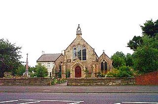
Rochester is a small village and civil parish in north Northumberland, England. It is 5 miles (8 km) north-west of Otterburn on the A68 road between Corbridge and Jedburgh. The village is the site of the Roman fort of Bremenium, built there to protect the important Roman road of Dere Street, which passes through the village.
Ouston is a village and former civil parish, now in the parish of Stamfordham, in the county of Northumberland, England. In 1951 the parish had a population of 13.

The Portgate was a fortified gateway, constructed as part of Hadrian's Wall where it crossed the Roman road now known as Dere Street, which preceded Hadrian's Wall by around 50 years. It was built to control traffic along Dere Street as it passed north through Hadrian's Wall. The gate's remains exist beneath the old B6318 Military Road to the south-west of the Stagshaw Roundabout.

Harlow Hill is a small village and former civil parish, now in the parish of Stamfordham, in Northumberland, England. In 1951 the parish had a population of 61.

Eachwick is a hamlet and former civil parish 11 miles (18 km) from Morpeth, now in the parish of Stamfordham, in the county of Northumberland, England. In 1951 the parish had a population of 69.

