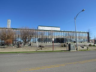
Kittitas County is a county located in the U.S. state of Washington. At the 2010 census, its population was 40,915. Its county seat and largest city is Ellensburg. The county was created in November 1883 when it was carved out of Yakima County. Kittitas County comprises the Ellensburg, Washington, Micropolitan Statistical Area.

The Yakama are a Native American tribe with nearly 10,851 members, based primarily in eastern Washington state.
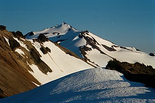
Gifford Pinchot National Forest is a National Forest located in southern Washington, USA, managed by the United States Forest Service. With an area of 1.32 million acres (5300 km2), it extends 116 km along the western slopes of Cascade Range from Mount Rainier National Park to the Columbia River. The forest straddles the crest of the South Cascades of Washington State, spread out over broad, old growth forests, high mountain meadows, several glaciers, and numerous volcanic peaks. The forest's highest point is at 12,276 ft. at the top of Mount Adams, the second tallest volcano in the state after Rainier. Often found abbreviated GPNF on maps and in texts, it includes the 110,000-acre (450 km2) Mount St. Helens National Volcanic Monument, established by Congress in 1982.

The sockeye salmon, also called red salmon, kokanee salmon, or blueback salmon, is an anadromous species of salmon found in the Northern Pacific Ocean and rivers discharging into it. This species is a Pacific salmon that is primarily red in hue during spawning. They can grow up to 84 cm in length and weigh 2.3 to 7 kg (5–15 lb). Juveniles remain in freshwater until they are ready to migrate to the ocean, over distances of up to 1,600 km (1,000 mi). Their diet consists primarily of zooplankton. Sockeye salmon are semelparous, dying after they spawn. Some populations, referred to as kokanee, do not migrate to the ocean and live their entire lives in freshwater.

Oncorhynchus is a genus of fish in the family Salmonidae; it contains the Pacific salmon and Pacific trout. The name of the genus is derived from the Greek ὄγκος + ῥύγχος, in reference to the hooked jaws of males in the mating season.

The Cle Elum River is a tributary of the Yakima River, approximately 28 miles (45 km) long in the U.S. state of Washington. A Northern Pacific Railway station at the future site of the city of Cle Elum, Washington was named Clealum after the Kittitas name Tie-el-Lum, meaning "swift water", referring to the Cle Elum River. In 1908, Clealum was altered to Cle Elum. This spelling came to be used for the river as well. Some maps in the 1850s also have the river labeled as Samahma River.
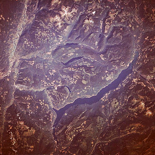
Adams Lake is a large, deep, coldwater lake in British Columbia, Canada; its average depth ranks 6th in the world. The southern end of the lake is approximately 30 km (19 mi) north of the town of Chase in the Shuswap Country region of British Columbia. The lake's upper reaches lie in the northern Monashee Mountains, while its lower end penetrates the Shuswap Highland. The lake supports Chinook, Sockeye and Coho salmon, Kokanee, mountain whitefish and rainbow trout.

Trinity Lake, previously called Clair Engle Lake, is an artificial lake on the Trinity River formed by the Trinity Dam and located in Trinity County, California, United States. The dam was built by the U.S. Bureau of Reclamation. The lake's capacity is 2,447,650 acre⋅ft (3,019.13 GL), making it one of the largest reservoirs in California. The lake's surface is at 2,370 ft (720 m) above MSL. Trinity Lake captures and stores water for the Central Valley Project, which provides the Central Valley with water for irrigation and produces hydroelectric power. This lake is known for its many small arms, glassy inlets, and good water-skiing conditions.

Wenatchee National Forest is a U.S. National Forest located in Washington. With an area of 1,735,394 acres, it extends about 137 miles along the eastern slopes of the Cascade Range of Washington, USA from Okanogan National Forest to Gifford Pinchot National Forest. The forest is located in Chelan, Kittitas and Yakima counties.

The Alpine Lakes Wilderness is a large wilderness area spanning the Central Cascades of Washington state in the United States. The wilderness is located in parts of Wenatchee National Forest and Snoqualmie National Forest, and is approximately bounded by Interstate 90 and Snoqualmie Pass to the south and U.S. Route 2 and Stevens Pass to the north. The Alpine Lakes is the largest wilderness area near the population centers of Puget Sound, counted at 414,161 acres (167,605 ha) following the 2014 expansion.
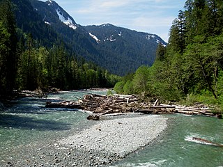
The Baker River is an approximately 30-mile (48 km), southward-flowing tributary of the Skagit River in northwestern Washington in the United States. It drains an area of the high North Cascades in the watershed of Puget Sound north of Seattle, and east of Mount Baker. With a watershed of approximately 270 square miles (700 km2) in a complex of deep valleys partially inside North Cascades National Park, it is the last major tributary of the Skagit before the larger river reaches its mouth on Skagit Bay. The river flows through Concrete, Washington, near its mouth and has two hydroelectric dams owned by Puget Sound Energy.

Keechelus Lake is a lake and reservoir in the northwest United States, near Hyak in Kittitas County, Washington. Approximately fifty miles (80 km) southeast of Seattle and a few miles southeast of Snoqualmie Pass, it is the source of the Yakima River.

Lake Cascade (formerly Cascade Reservoir, is a reservoir in the western United States, on the North Fork of the Payette River in Valley County, Idaho. Located in the Boise National Forest, it has a surface area of 47 square miles, and is the fourth largest lake or reservoir in the state. The closest cities are Cascade, Donnelly, and McCall, all in the Long Valley of Valley County.

Lake Shannon is a long, narrow reservoir on the Baker River in Skagit County, Washington in the United States. Formed in the 1920s by the construction of an arch dam just above the town of Concrete, the lake is approximately 7.5 miles (12 km) long and averages 0.6 miles (1 km) wide when full. Located just outside the western boundary of North Cascades National Park, Lake Shannon serves as the lower reservoir for Puget Sound Energy's Baker River Hydroelectric Project.

Rachel Lake is located on the eastern side of Rampart Ridge in Kittitas County, Washington. The lake is a popular area for hiking, swimming, and fishing cutthroat trout.
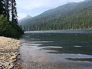
Waptus Lake is an alpine freshwater lake located on the southern stretch of the Okanogan National Forest in Kittitas County, Washington. Because of its proximity to Cooper Lake and the Pacific Crest Trail, Waptus Lake is a popular area for hiking, camping and fishing. Waptus Lake is surrounded by trails that lead to other Alpine lakes in the vicinity, including the Pete Lake and Spectacle Lake at the base of Chikamin Peak.
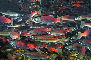
The kokanee salmon, also known as the kokanee trout, little redfish, silver trout, kikanning, Kennerly's salmon, Kennerly's trout, or Walla, is the non-anadromous form of the sockeye salmon. There is some debate as to whether the kokanee and its sea-going relative are separate species; geographic isolation, failure to interbreed, and genetic distinction point toward a recent divergence in the history of the two groups. The divergence most likely occurred around 15,000 years ago when a large ice melt created a series of freshwater lakes and rivers across the northern part of North America. While some members of the salmon family (salmonids) went out to sea (anadromous), others stayed behind in fresh water (non-anadromous). The separation of the sockeye and the kokanee created a unique example of sympatric speciation that is relatively new in evolutionary terms. While they occupy the same areas and habitats during the breeding season, when ocean-going sockeye salmon return to freshwater to spawn, the two populations do not mate with each other in some regions, suggesting speciation.

Spectacle Lake is an alpine freshwater lake located on the northern skirt of Chikamin Peak and Lemah Mountain in Kittitas County on its western border with King County, Washington. Because of its proximity to surrounding peaks and mountains at the heart of the Alpine Lakes Wilderness, the lake is a popular area for hiking, camping and fishing cutthroat trout. Other Alpine lakes are in the vicinity, including the Chikamin Lake, a short distance North, at the base of Chikamin Peak. To the South is Hibox Mountain.

Glacier Lake is a small alpine freshwater lake located on the northern skirt of Chikamin Peak and Lemah Mountain in Kittitas County, Washington. Because of its proximity to surrounding peaks and mountains at the heart of the Alpine Lakes Wilderness, the lake is a popular area for hiking, camping, and fishing golden trout. Glacier Lake is a short distance between Chikamin Lake and Spectacle Lake at the base of Chikamin Ridge. The Pacific Crest Trail is a short distance from Glacier Lake as well as other Alpine lakes located in the vicinity. To the North is Avalanche Lake and Iceberg Lake at the base of Lemah Mountain.

Pete Lake is a small alpine freshwater lake located on the southern stretch of the Alpine Lakes Wilderness in Kittitas County, Washington. Because of its proximity to the Pacific Crest Trail and Cle Elum Lake and Kachess Lake, Pete Lake is a popular area for hiking, camping, and fishing. Pete Lake is a short distance and along the trails that lead to Spectacle Lake at the base of Chikamin Peak and Cooper Lake to the South. Trails for backpacking are well-trafficked and originally designed in some areas for enough buffer that allows mountain biking.


