Okanogan County is a county located in the U.S. state of Washington along the Canada–US border. As of the 2010 census, the population was 41,120. The county seat is Okanogan, while the largest city is Omak. Its area is the largest in the state.

Chelan County is a county in the U.S. state of Washington. As of the 2010 census, its population was 72,453. The county seat and largest city is Wenatchee. The county was created out of Okanogan and Kittitas Counties on March 13, 1899. It derives its name from a Chelan Indian word meaning "deep water," likely a reference to 55-mile (89 km)-long Lake Chelan, which reaches a maximum depth of 1,486 feet.

The Mount Baker–Snoqualmie National Forest in Washington is a National Forest extending more than 140 miles (230 km) along the western slopes of the Cascade Range from the Canada–US border to the northern boundary of Mount Rainier National Park. Administered by the United States Forest Service, the forest is headquartered in Everett. There are local ranger district offices in North Bend and Skykomish.
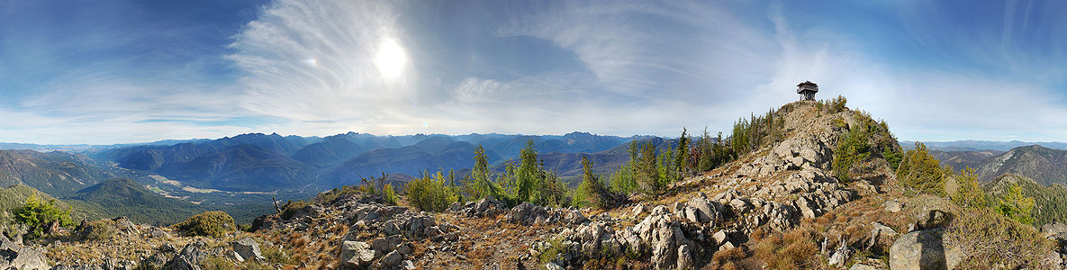
The Henry M. Jackson Wilderness is a 103,297-acre (41,803 ha) designated wilderness area in the state of Washington, United States. The area lies adjacent to the southwest corner of the Glacier Peak Wilderness, northwest of Stevens Pass on U.S. Highway 2 and northeast of the town of Skykomish, Washington. Wild Sky Wilderness is located immediately southwest of the Henry M. Jackson Wilderness. While the wilderness straddles the Cascade Mountain Range, most of it is in the westside ecotype. The wilderness lies in parts of Snoqualmie, Mount Baker, and Wenatchee national forests.

The Colville National Forest is a U.S. National Forest located in northeastern Washington state. It is bordered on the west by the Okanogan National Forest and the Kaniksu National Forest to the east. The forest also borders Little Pend Oreille National Wildlife Refuge and the Lake Roosevelt National Recreation Area.

Wenatchee National Forest is a U.S. National Forest located in Washington. With an area of 1,735,394 acres, it extends about 137 miles along the eastern slopes of the Cascade Range of Washington, USA from Okanogan National Forest to Gifford Pinchot National Forest. The forest is located in Chelan, Kittitas and Yakima counties.

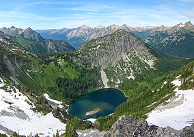
The Alpine Lakes Wilderness is a large wilderness area spanning the Central Cascades of Washington state in the United States. The wilderness is located in parts of Wenatchee National Forest and Snoqualmie National Forest, and is approximately bounded by Interstate 90 and Snoqualmie Pass to the south and U.S. Route 2 and Stevens Pass to the north. The Alpine Lakes is the largest wilderness area near the population centers of Puget Sound, counted at 414,161 acres (167,605 ha) following the 2014 expansion.

The Methow River is a tributary of the Columbia River in northern Washington in the United States. The river's 1,890-square-mile (4,900 km2) watershed drains the eastern North Cascades, with a population of about 5,000 people. The Methow's watershed is characterized by relatively pristine habitats, as much of the river basin is located in national forests and wildernesses. Many tributaries drain the large Pasayten Wilderness. An earlier economy based on agriculture is giving way to one based on recreation and tourism.

The Lake Chelan-Sawtooth Wilderness is a 153,057-acre (61,940 ha) protected wilderness area located within the Okanogan and Wenatchee national forests in Washington State. The wilderness borders Lake Chelan National Recreation Area and North Cascades National Park and the Stephen Mather Wilderness to the northwest. It was designated with the passage of the Washington Wilderness Act of 1984, on lands occupied by the old Chelan Division of the Washington Forest Reserve, now part of both the Okanogan and Wenatchee national forests.

The Pasayten Wilderness is a 531,539 acres (215,106 ha) protected area located within Okanogan National Forest and Mount Baker National Forest in Washington state, centered on the Three Forks of the Pasayten River, a tributary of the Similkameen River. Although part of the wilderness lies in Mount Baker-Snoqualmie National Forest, the largest section falls within the boundaries of Okanogan National Forest, which has responsibility for the wilderness's management. The wilderness is bordered by the Stephen Mather Wilderness to the west. The northern boundary of the wilderness is the Canada–US border. Across the border are Manning Provincial Park and Cathedral Provincial Park. The wilderness area is adjacent to the Ross Lake National Recreation Area to the west, and North Cascades National Park beyond that. The Pacific Crest National Scenic Trail has its northernmost section in this wilderness. The western part of the wilderness features dramatic views and peaks of the northern Washington Cascade Mountains while the eastern section is known for its grasslands and Alpine tundra. The tallest point in the Pasayten is Jack Mountain.

Glacier Peak Wilderness is a 566,057-acre (229,075 ha), 35-mile-long (56 km), 20-mile-wide (32 km) wilderness area located within portions of Chelan, Snohomish, and Skagit counties in the North Cascades of Washington. The area lies within parts of Wenatchee National Forest and Mount Baker National Forest and is characterized by heavily forested stream courses, steep-sided valleys, and dramatic glacier-crowned peaks. The dominant geologic feature of the area is 10,541-foot (3,213 m) Glacier Peak. It is the most remote major volcanic peak in the Cascade Range and has more active glaciers than any other place in the lower forty-eight states. Glacier Peak is a volcanic cone of basalt, pumice, and ash which erupted during periods of heavy glaciation.
U.S. Route 97 Alternate is an alternate route of US 97 within the state of Washington. It runs for 40 miles (64 km) from Wenatchee to Chelan, following the west bank of the Columbia River opposite from US 2 and US 97. The highway travels through sparsely-populated areas along the river and passes near the Rocky Reach Dam and through the town of Entiat.

The Entiat River is a tributary of the Columbia River, joining the Columbia near Entiat. The United States Geological Survey (USGS) lists two variant names for the Entiat River: En-ti-at-kwa River and Entiatqua River. The river's name is derived from the Columbia-Moses (Salishan) term /nt'yátkw/ [nt'iátkw], meaning "place of grassy water"; another source states that it was called Enteatqua which means "Rapid Water" or "Rushing Water." The name, spelled "Entiat", was selected for the river in 1958 by the Chelan County Public Utility District.

State Route 153 is a 30.78-mile (49.54 km) long state highway in the U.S. state of Washington, serving as part of the Cascade Loop in Okanogan County. The Methow Valley Highway begins at an intersection with U.S. Route 97 (US 97) in Pateros at the confluence of the Methow River and the Columbia River. SR 153 travels northwest, parallel to the Methow River, to end at SR 20 south of Twisp. The highway was first established in 1897 as the Methow-Barron Road and was designated as various highways, including State Road 12 from 1905 to 1919, the Roosevelt Highway from 1919 to 1923, and Primary State Highway 16 (PSH 16) until the 1964 highway renumbering, when it became SR 153.
NCW Libraries is an inter-county rural library district in northern Washington state. It was founded as the North Central Regional Library (NCRL) in 1960 and is headquartered in Wenatchee, Washington. NCW Libraries provides library services to 14,947-square-mile (38,710 km2) of the state, including Chelan, Douglas, Ferry, Grant, and Okanogan counties. The system has 30 branches.

The Entiat Mountains, or Entiat Range is a mountain range in the U.S. state of Washington. Located west of the Columbia River, north of the Wenatchee River, and south of the Entiat River, the range is part of the North Cascades section of the Cascade Range. The Entiat Range is relatively narrow east to west and long north to south. The Entiat River valley separates the Entiat Mountains from the Chelan Mountains to the northeast. To the west and south, across the Wenatchee River and tributaries such as the Chiwawa River are the Wenatchee Mountains.

The 2012 Washington wildfires were a series of 1,342 wildfires that burned 259,526 acres (1,050 km2) over the course of 2012. The fires primarily occurred in the Okanogan and Wenatchee National Forests during September and October 2012. A severe lightning storm on September 8 caused hundreds of fires across the east side of Cascade Range. Smoke caused hazardous air quality conditions in the cities of Ellensburg and Wenatchee, and was noticeable in Seattle. The cost of fighting the largest four fires was estimated to be $67.5 million.

The 2014 Washington wildfires were a series of 1,480 wildfires that burned 386,972 acres (1,566 km2) over the course of 2014. The first occurred primarily on the east side of the Cascade Range in Chelan and Okanogan counties. The fires burned private land, state land, and within the Okanogan and Wenatchee National Forests, ultimately covering over 350,000 acres. The first fire began on July 8 near the Entiat River. On July 14 a lightning storm started dozens more fires across the eastern Cascade Range. Governor Jay Inslee declared a state of emergency, activating the Washington National Guard. More lightning strikes later in the summer started additional fires.

The Okanogan Complex Fire was a wildfire affecting Okanogan County in north-central Washington state. It was composed of five fires that were caused by lightning strikes on August 15, 2015, with two of the fires near Conconully merging days later on August 19. At its peak, it burned over 304,782 acres (123,341 ha) of land and forced the evacuations of numerous towns, including Conconully, Twisp and Winthrop. Over 1,250 firefighters were deployed to the Okanogan Complex. Three United States Forest Service firefighters were killed in an accident near Twisp on August 19. Traditional methods of containing such wildfires, such as creating bulldozer lines, were not readily available due to the irregular terrain and because an inversion layer trapped smoke in the valley, making it difficult to fly in water by helicopter.
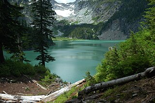
Myrtle Lake is a freshwater lake located on the northern slope of Rampart Mountain East of Cow Creek Meadows, in Chelan County, Washington. Self-issued Alpine Lake Wilderness permit required for transit within the Glacier Peak Wilderness area. Because Myrtle Lake is at the heart of the Alpine Lakes Wilderness, the lake is a popular area for hiking, swimming, and fishing brook trout.