Klickitat County is a county located in the U.S. state of Washington. As of the 2020 census, the population was 22,735. The county seat and largest city is Goldendale. The county is named after the Klickitat tribe.

Maryhill is an unincorporated community and census-designated place (CDP) in Klickitat County, Washington, United States. The population was 58 at the 2010 census, down from 98 at the 2000 census.

Samuel Hill, usually known as Sam Hill, was an American businessman, lawyer, railroad executive, and advocate of good roads. He substantially influenced the Pacific Northwest region's economic development in the early 20th century.

Fields Spring State Park is a 828-acre (3.35 km2) public recreation area in the northwest United States, located in southeastern Washington on State Route 129, four miles (6 km), south of Anatone.

Leadbetter Point State Park is a nature preserve and public recreation area located sixteen miles (26 km) north of the city of Long Beach, Washington, at the northern tip of the Long Beach Peninsula. The state park is bounded by the Pacific Ocean to the west and Willapa Bay to the east and shares a border with the Willapa National Wildlife Refuge. The park's Martha Jordan Birding Trail goes through Hines Marsh, wintering grounds for trumpeter swans. Other park activities include hiking, boating, fishing, clamming, and beachcombing.
This is a list of Stonehenge replicas and derivatives that seeks to collect all the non-ephemeral examples together. The fame of the prehistoric monument of Stonehenge in England has led to many efforts to recreate it, using a variety of different materials, around the world. Some have been carefully built as astronomically aligned models whilst others have been examples of artistic expression or tourist attractions.
Stonehenge is an ancient stone monument in England.

Lake Wenatchee State Park is a public recreation area located at the eastern end of Lake Wenatchee, a glacier- and snowmelt-fed lake in the Wenatchee National Forest on the eastern slopes of the Cascades Mountain Range in the state of Washington. The state park covers 492 acres (199 ha) split into two parts—the north shore park and the south shore park—separated by the Wenatchee River. The park is managed by the Washington State Parks and Recreation Commission.

Maryhill Museum of Art is a small museum with an eclectic collection, located near what is now the community of Maryhill in the U.S. state of Washington.
U.S. Route 97 in the U.S. state of Washington is a 322-mile (518 km) route which traverses from the Oregon state line at the northern end of the Sam Hill Memorial Bridge in Maryhill, north to the Canada–US border in Okanogan County near Oroville. The highway serves major cities such as Goldendale, Yakima, Ellensburg and Wenatchee before continuing towards the Alaska Highway at the Yukon border as British Columbia Highway 97. Along the length of the roadway, US 97 is concurrent with State Route 14 in Maryhill, Interstate 82 (I-82) and US 12 between Union Gap and Ellensburg, I-90 briefly in Ellensburg, US 2 between Peshastin and rural Douglas County and SR 20 near Omak. An alternate route connects the highway with Chelan.

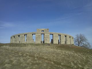
The Maryhill Stonehenge is a replica of England's Stonehenge located in Maryhill, Washington, United States. It was commissioned in the early 20th century by the wealthy entrepreneur Sam Hill, and dedicated on July 4, 1918 as a memorial to the people who had died in World War I.

Ike Kinswa State Park is a public recreation area on the northern side of Lake Mayfield, located three miles (4.8 km) northwest of Mossyrock in Lewis County, Washington. The state park covers 421 acres (170 ha) that include 46,000 feet (14,000 m) of shoreline mostly along the Tilton River including the point where the Tilton and Cowlitz rivers once merged. The park offers boating, fishing, swimming, waterskiing and windsurfing plus facilities for camping, hiking, and mountain biking, It is managed by the Washington State Parks and Recreation Commission.

Paradise Point State Park is a public recreation area on the East Fork Lewis River in Clark County, Washington. The state park is crossed by Interstate 5, which pierces the point in the river the park is named for. The park's 101 acres (41 ha) include 6,180 feet (1,880 m) of shoreline, swimming beach, campground, and hiking trails.

Pearrygin Lake State Park is a public recreation area in the Methow Valley located two miles (3.2 km) east of Winthrop in Okanogan County, Washington. The state park covers 1,186 acres (480 ha) that almost entirely surround Pearrygin Lake, giving it 11,000 feet (3,400 m) of shoreline. Park activities include camping, boating, fishing, swimming, water sports, and cross-country skiing. The park's hiking trails include the 3.1-mile (5.0 km) Rex Derr trail, which is named for a former director of the State Parks and Recreation Commission.
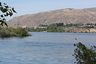
Doug's Beach State Park is a public recreation area in the Columbia River Gorge lying three miles (4.8 km) east of Lyle in Klickitat County, Washington. The state park occupies 379 acres (153 ha) along Washington State Route 14 at one of the premier windsurfing sites on the Columbia River. The park also offers picnicking, fishing, and swimming.

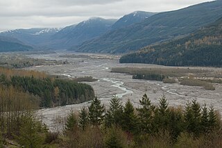
Seaquest State Park is a public recreation area located on the western flank of Silver Lake in Cowlitz County, Washington. The 505-acre (204 ha) state park is home to the Mount St. Helens Visitor Center, which offers displays on the Mount St. Helens volcanic eruption of 1980. Mount St. Helens itself is 30 miles (48 km) east of the park.

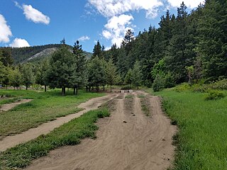
Squilchuck State Park is a public recreation area located below Mission Ridge eight miles (13 km) south of Wenatchee in Chelan County, Washington. The 249-acre (101 ha) state park offers hiking, mountain biking and cross-country ski trails, group camping, birdwatching, and wildlife viewing. The park's Squilchuck Lodge is used for group gatherings.

Wenatchee Confluence State Park is a public recreation area and nature preserve at the north end of the city of Wenatchee in Chelan County, Washington. The state park consists of 197 acres (80 ha) spanning the Wenatchee River at its confluence with the Columbia River. The park is bifurcated by the Wenatchee River into north and south sections that are connected by a footbridge. The north section, located in Sunnyslope, is suburban and recreational while the south section, located in West Wenatchee, is a man-made wetland area designated as the Horan Natural Area. The park is operated by the Washington State Parks and Recreation Commission under lease from the Chelan County Public Utility District, which owns the land. Park offerings include camping, boating, fishing, swimming, and various sports activities.

First Day Advent Christian Church is a historic church at the junction of Maryhill Hwy. and Stonehenge Avenue in Maryhill, Washington.


