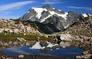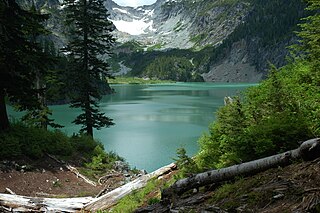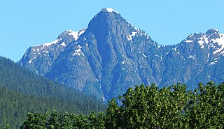
North Cascades National Park is an American national park in the state of Washington. At more than 500,000 acres (200,000 ha), it is the largest of the three National Park Service units that comprise the North Cascades National Park Complex. North Cascades National Park consists of a northern and southern section, bisected by the Skagit River that flows through the reservoirs of Ross Lake National Recreation Area. Lake Chelan National Recreation Area lies on the southern border of the south unit of the park. In addition to the two national recreation areas, other protected lands including several national forests and wilderness areas, as well as Canadian provincial parks in British Columbia, nearly surround the park. North Cascades National Park features the rugged mountain peaks of the North Cascades Range, the most expansive glacial system in the contiguous United States, the headwaters of numerous waterways, and vast forests with the highest degree of flora biodiversity of any American national park.

The Mount Baker–Snoqualmie National Forest in Washington is a National Forest extending more than 140 miles (230 km) along the western slopes of the Cascade Range from the Canada–US border to the northern boundary of Mount Rainier National Park. Administered by the United States Forest Service, the forest is headquartered in Everett. There are local ranger district offices in North Bend and Skykomish.

The North Cascades are a section of the Cascade Range of western North America. They span the border between the Canadian province of British Columbia and the U.S. state of Washington and are officially named in the U.S. and Canada as the Cascade Mountains. The portion in Canada is known to Americans as the Canadian Cascades, a designation that also includes the mountains above the east bank of the Fraser Canyon as far north as the town of Lytton, at the confluence of the Thompson and Fraser Rivers.

The Okanogan–Wenatchee National Forest is a U.S. National Forest located in Okanogan County in north-central Washington, United States.

The Henry M. Jackson Wilderness is a 103,297-acre (41,803 ha) designated wilderness area in the state of Washington, United States. The area lies adjacent to the southwest corner of the Glacier Peak Wilderness, northwest of Stevens Pass on U.S. Highway 2 and northeast of the town of Skykomish, Washington. Wild Sky Wilderness is located immediately southwest of the Henry M. Jackson Wilderness. While the wilderness straddles the Cascade Mountain Range, most of it is in the westside ecotype. The wilderness lies in parts of Snoqualmie, Mount Baker, and Wenatchee national forests.

Wenatchee National Forest is a U.S. National Forest located in Washington. With an area of 1,735,394 acres, it extends about 137 miles along the eastern slopes of the Cascade Range of Washington, USA from Okanogan National Forest to Gifford Pinchot National Forest. The forest is located in Chelan, Kittitas and Yakima counties.

The Alpine Lakes Wilderness is a large wilderness area spanning the Central Cascades of Washington state in the United States. The wilderness is located in parts of Wenatchee National Forest and Snoqualmie National Forest, and is approximately bounded by Interstate 90 and Snoqualmie Pass to the south and U.S. Route 2 and Stevens Pass to the north. The Alpine Lakes is the largest wilderness area near the population centers of Puget Sound, counted at 414,161 acres (167,605 ha) following the 2014 expansion.

The Pasayten Wilderness is a 531,539 acres (215,106 ha) protected area located within Okanogan–Wenatchee National Forest and Mount Baker National Forest in Washington state, centered on the Three Forks of the Pasayten River, a tributary of the Similkameen River. Although part of the wilderness lies in Mount Baker-Snoqualmie National Forest, the largest section falls within the boundaries of Okanogan National Forest, which has responsibility for the wilderness's management. The wilderness is bordered by the Stephen Mather Wilderness to the west. The northern boundary of the wilderness is the Canada–US border. Across the border are Manning Provincial Park and Cathedral Provincial Park. The wilderness area is adjacent to the Ross Lake National Recreation Area to the west, and North Cascades National Park beyond that. The Pacific Crest National Scenic Trail has its northernmost section in this wilderness. The western part of the wilderness features dramatic views and peaks of the northern Washington Cascade Mountains while the eastern section is known for its grasslands and Alpine tundra. The tallest point in the Pasayten is Jack Mountain.

Glacier Peak Wilderness is a 566,057-acre (229,075 ha), 35-mile-long (56 km), 20-mile-wide (32 km) wilderness area located within portions of Chelan, Snohomish, and Skagit counties in the North Cascades of Washington. The area lies within parts of Wenatchee National Forest and Mount Baker National Forest and is characterized by heavily forested stream courses, steep-sided valleys, and dramatic glacier-crowned peaks. The dominant geologic feature of the area is 10,541-foot (3,213 m) Glacier Peak. It is the most remote major volcanic peak in the Cascade Range and is the third most heavily glaciated volcano in the lower forty-eight states behind Mount Rainier and Mount Baker. Glacier Peak is a volcanic cone of basalt, pumice, and ash which erupted during periods of heavy glaciation.

Mount Baker Wilderness is a 119,989-acre (48,558 ha) wilderness area within the Mount Baker-Snoqualmie National Forest in the western Cascade Range of northern Washington state. Its eastern border is shared with the boundary of the Stephen Mather Wilderness and North Cascades National Park for a distance of 40 miles. The wilderness extends from State Route 20 north to the Canada–US border. On the west, it is bounded by the foothills of the Puget Sound lowlands.
Clearwater Wilderness is a 14,647-acre (5,927 ha) wilderness area in the North Cascades mountain range, in northern Washington state, of the Northwestern United States. It is located in the Mount Baker-Snoqualmie National Forest, southeast of Tacoma in northeastern Pierce County.

The Stephen Mather Wilderness is a 634,614 acres (256,819 ha) wilderness area honoring Stephen Mather, the first director of the National Park Service. It is located within North Cascades National Park, Lake Chelan National Recreation Area, and Ross Lake National Recreation Area in the North Cascade Range of Washington, United States.

The geography of the North Cascades describes a range of rugged mountains in British Columbia, Canada and Washington, United States. In Canada, the range is officially named the Cascade Mountains but is commonly referred to as the Canadian Cascades.

The Never Summer Wilderness is a U.S. Wilderness Area located immediately west of Rocky Mountain National Park in the Never Summer Mountains of Arapaho National Forest in northern Colorado. It encompasses an area of 21,090 acres and includes both forest and alpine tundra, with a minimum elevation of 8,900 feet. It is part of the Sulphur Ranger District.

Helen Buttes are two prominent summits near the western edge of the North Cascades, in Skagit County of Washington state. The buttes are located four miles northwest of Marblemount, Washington, in the Noisy-Diobsud Wilderness, on land administered by the Mount Baker-Snoqualmie National Forest. The nearest higher neighbor is Diobsud Buttes, 3.11 miles (5.01 km) to the north. Precipitation runoff from Helen Buttes drains into tributaries of the Skagit River.

Diobsud Buttes are summits near the western edge of the North Cascades, in Skagit County of Washington state. Diobsud Buttes are located north of Marblemount, Washington, and Helen Buttes, along the shared boundary of North Cascades National Park and the Noisy-Diobsud Wilderness. The nearest higher neighbor is Logger Butte, 0.85 mi (1.37 km) to the north. Precipitation runoff from Diobsud Buttes drains into tributaries of the Skagit River.

Logger Butte is a 6,160-foot (1,878-metre) mountain summit near the western edge of the North Cascades, in Skagit County of Washington state. It is located north of Marblemount and Diobsud Buttes, on the shared boundary of North Cascades National Park and the Noisy-Diobsud Wilderness. The nearest higher peak is Electric Butte, 1.0 mi (1.6 km) to the north. Precipitation runoff from Logger Butte drains into tributaries of the Skagit River.
The Big Branch Wilderness is one of eight wilderness areas in the Green Mountain National Forest in the U.S. state of Vermont. It was created by the Vermont Wilderness Act of 1984 and later expanded by the New England Wilderness Act of 2006. A total of 6,725 acres (2,722 ha) are managed by the U.S. Forest Service.


