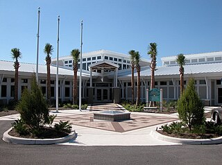
Beaufort County is a county in the U.S. state of South Carolina. As of the 2020 census, its population was 187,117. Its county seat is Beaufort and its largest town is Hilton Head Island.

Protected areas of South Australia consists of protected areas located within South Australia and its immediate onshore waters and which are managed by South Australian Government agencies. As of March 2018, South Australia contains 359 separate protected areas declared under the National Parks and Wildlife Act 1972, the Crown Land Management Act 2009 and the Wilderness Protection Act 1992 which have a total land area of 211,387.48 km2 (81,617.16 sq mi) or 21.5% of the state's area.

A nature reserve is a protected area of importance for flora, fauna, or features of geological or other special interest, which is reserved and managed for purposes of conservation and to provide special opportunities for study or research. They may be designated by government institutions in some countries, or by private landowners, such as charities and research institutions. Nature reserves fall into different IUCN categories depending on the level of protection afforded by local laws. Normally it is more strictly protected than a nature park. Various jurisdictions may use other terminology, such as ecological protection area or private protected area in legislation and in official titles of the reserves.

The protected areas of the United States are managed by an array of different federal, state, tribal and local level authorities and receive widely varying levels of protection. Some areas are managed as wilderness, while others are operated with acceptable commercial exploitation. As of 2022, the 42,826 protected areas covered 1,235,486 km2 (477,024 sq mi), or 13 percent of the land area of the United States. This is also one-tenth of the protected land area of the world. The U.S. also had a total of 871 National Marine Protected Areas, covering an additional 1,636,523 km2 (631,865 sq mi), or 19 percent of the total marine area of the United States.
The protected areas of Michigan come in an array of different types and levels of protection. Michigan has five units of the National Park Service system. There are 14 federal wilderness areas; the majority of these are also tribal-designated wildernesses. It has one of the largest state forest systems as well having four national forests. The state maintains a large state park system and there are also regional parks, and county, township and city parks. Still other parks on land and in the Great Lakes are maintained by other governmental bodies. Private protected areas also exist in the state, mainly lands owned by land conservancies.

The Monterey Bay National Marine Sanctuary (MBNMS) is a federally protected marine area offshore of California's Big Sur and central coast in the United States. It is the largest US national marine sanctuary and has a shoreline length of 276 miles (444 km) stretching from just north of the Golden Gate Bridge at San Francisco to Cambria in San Luis Obispo County. Supporting one of the world's most diverse marine ecosystems, it is home to numerous mammals, seabirds, fishes, invertebrates and plants in a remarkably productive coastal environment. The MBNMS was established in 1992 for the purpose of resource protection, research, education, and public use.

Protected areas of Canada consist of approximately 12.1 percent of the nation's landmass and freshwater are considered conservation areas, including 11.4 percent designated as protected areas. Approximately 13.8 percent of Canada's territorial waters are conserved, including 8.9 percent designated as protected areas. Terrestrial areas conserved have increased by 65 percent in the 21st century, while marine areas conserved have increased by more than 3,800 percent.

The Pacific Flyway is a major north-south flyway for migratory birds in the Americas, extending from Alaska to Patagonia. Every year, migratory birds travel some or all of this distance both in spring and in fall, following food sources, heading to breeding grounds, or travelling to overwintering sites.

In 1999, the Guana Tolomato Matanzas National Estuarine Research Reserve was designated in St. Johns and Flagler counties, Florida as a part of the National Oceanic and Atmospheric Administration (NOAA) National Estuarine Research Reserve (NERR) system. The GTM Research Reserve represents the east Florida sub-region of the Carolinian bioregion. It is one of 29 NERRs in 23 states and one territory. GTM is one of three NERRs in Florida, and is administered on behalf of the state by the Florida Department of Environmental Protection's Florida Coastal Office as part of a network that includes forty-one aquatic preserves, three NERRs, a National Marine Sanctuary, the Coral Reef Conservation Program and the Florida Oceans and Coastal Council. Additional interests are held in the research and management of the GTM and connected preserved or conserved lands including:
The Alabama Department of Conservation and Natural Resources (ADCNR) is the state agency responsible for the conservation and management of Alabama's natural resources including state parks, state lands, wildlife and aquatic resources. ADCNR also issues hunting and fishing licenses for the state. The department promotes wise stewardship and enjoyment of the state's natural resources through five divisions: Marine Resources, State Lands, State Parks and Wildlife and Freshwater Fisheries. Supporting those divisions are seven support sections: Accounting, Diversity and Recruiting, Engineering, Information and Education, Information Technology, Legal, and Personnel and Payroll.

According to the California Protected Areas Database (CPAD), in the state of California, United States, there are over 14,000 inventoried protected areas administered by public agencies and non-profits. In addition, there are private conservation areas and other easements. They include almost one-third of California's scenic coastline, including coastal wetlands, estuaries, beaches, and dune systems. The California State Parks system alone has 270 units and covers 1.3 million acres (5,300 km2), with over 280 miles (450 km) of coastline, 625 miles (1,006 km) of lake and river frontage, nearly 18,000 campsites, and 3,000 miles (5,000 km) of hiking, biking, and equestrian trails.
The environmental issues on Maury Island are linked to broader Puget Sound environmental issues, which include concerns regarding declining salmon and forage fish populations, degrading critical marine and shoreline habitats, and threatened species such as the Orca.

The Washington State Department of Natural Resources (DNR) manages over 3,000,000 acres (12,000 km2) of forest, range, agricultural, and commercial lands in the U.S. state of Washington. The DNR also manages 2,600,000 acres (11,000 km2) of aquatic areas which include shorelines, tidelands, lands under Puget Sound and the coast, and navigable lakes and rivers. Part of the DNR's management responsibility includes monitoring of mining cleanup, environmental restoration, providing scientific information about earthquakes, landslides, and ecologically sensitive areas. DNR also works towards conservation, in the form of Aquatic Reserves such as Maury Island and in the form of Natural Area Preserves like Mima Mounds or Natural Resource Conservation Areas like Woodard Bay Natural Resource Conservation Area.

The Ashepoo, Combahee and Edisto Basin is one of the largest undeveloped estuaries along the Atlantic Coast of the United States. Located primarily in Colleton, Charleston, and Beaufort counties in South Carolina, the Ashepoo, Combahee and South Edisto rivers combine into the larger St. Helena Sound and drain a significant portion of the Lowcountry region. The 350,000 acres (1,400 km2) area is known for its natural environment and the preservation of its marshes, wetlands, hardwood forests, and riverine systems and the fauna that occupy the area.


