Cottonwood River (Kansas)

Last updated
Cottonwood River
US-KS-ClementsStoneArchBridge-004.jpg
1886 Clements Stone Arch Bridge over Cottonwood River near Clements (2006)
Location
Country United States
State Kansas
Region Flint Hills
Physical characteristics
Source 
  locationWest of Marion, Kansas
  coordinates 38°21′25″N097°04′14″W / 38.35694°N 97.07056°W / 38.35694; -97.07056 [1]
  elevation1,056 ft (322 m)
Mouth Neosho River
  location
East of Emporia, Kansas
  coordinates
38°23′09″N096°03′23″W / 38.38583°N 96.05639°W / 38.38583; -96.05639 [1]
  elevation
322 ft (98 m) [1]
Basin size1,912 sq mi (4,950 km2) [2]
Discharge 
  location Neosho Rapids [3]
  average1,239 cu ft/s (35.1 m3/s) [3]
Basin features
River system Neosho River

Cottonwood River is one of the principal tributaries of the Neosho River in central Kansas of the United States. [4]

Contents

Course

The river begins near the west line of Marion County as two tributaries, the North Cottonwood River and the South Cottonwood River. They both start within 2 miles of each other, and within a few miles northwest of Lehigh. [5]

The North Cottonwood starts near the west line of Marion County, [5] crosses into McPherson County and roughly parallels the county line northward for 5 miles, then crosses back into Marion County. [6] It flows through Durham then into the Marion Reservoir. [5]

The South Cottonwood also starts near the west line of Marion County, flows southward about 1 mile west of Lehigh, then flows eastward about 2 miles south of Hillsboro, then northeast towards the lower side of the Marion Reservoir. [5]

The North and South Cottonwood join about 1 mile southeast of the Marion Reservoir to become the North Fork Cottonwood River, before flowing through the city of Marion. [5] The river flows southeast to Florence, then eastward towards Chase County. [7] In Chase County, it flows northeast through Cedar Point then near Clements and Elmdale. It then flows eastward through Strong City, Cottonwood Falls. [7]

The South Fork Cottonwood River starts south of Matfield Green, then flows northward along the east side of Matfield Green and Bazaar. It merges with the North Fork Cottonwood River about 3 miles east of Cottonwood Falls [7] then flows eastward near Saffordville and across into Lyon County near Plymouth, Kansas, then along the south edge of Emporia. It flows into the Neosho River about 5 miles east of Emporia. [8]

History

In 1806, Zebulon Pike led the Pike Expedition westward from St Louis, Missouri, of which part of their journey followed the Cottonwood River through Marion County near the current towns of Florence, Marion, Durham. [9]

Cities and towns along the river

Tributaries

Lakes

The following lakes are located in the Cottonwood River drainage basin:

Bridges

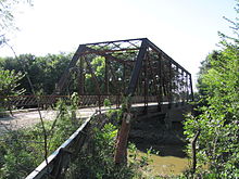
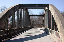
The following bridges over the Cottonwood River are on the National Register of Historic Places list:

See also

Related Research Articles

<span class="mw-page-title-main">Chase County, Kansas</span> County in Kansas, United States

Chase County is a county located in the U.S. state of Kansas. Its county seat and most populous city is Cottonwood Falls. As of the 2020 census, the county population was 2,572. The county was named for Salmon Chase, a U.S. Senator from Ohio that was a Kansas statehood advocate.

<span class="mw-page-title-main">Cedar Point, Kansas</span> City in Chase County, Kansas

Cedar Point is a city in Chase County, Kansas, United States. As of the 2020 census, the population of the city was 22. It is about 5 miles east of Florence and 0.5 miles south of U.S. Route 50 highway.

<span class="mw-page-title-main">Cottonwood Falls, Kansas</span> City in Chase County, Kansas

Cottonwood Falls is the largest city and county seat of Chase County, Kansas, United States. As of the 2020 census, the population of the city was 851. It is located south of Strong City along the south side of the Cottonwood River.

<span class="mw-page-title-main">Elmdale, Kansas</span> City in Chase County, Kansas

Elmdale is a city in Chase County, Kansas, United States. As of the 2020 census, the population of the city was 40. It is located along U.S. Route 50 highway.

<span class="mw-page-title-main">Strong City, Kansas</span> City in Chase County, Kansas

Strong City is a city in Chase County, Kansas, United States. Originally known as Cottonwood Station, in 1881 it was renamed Strong City after William Barstow Strong, then vice-president and general manager, and later president of the Atchison, Topeka and Santa Fe Railway. As of the 2020 census, the population of the city was 386. It is located along U.S. Route 50 highway.

<span class="mw-page-title-main">Neosho River</span> River in Kansas and Oklahoma, United States

The Neosho River is a tributary of the Arkansas River in eastern Kansas and northeastern Oklahoma in the United States. Its tributaries also drain portions of Missouri and Arkansas. The river is about 463 miles (745 km) long. Via the Arkansas, it is part of the Mississippi River watershed. Its name is an Osage word meaning "clear water." The lower section is also known as the Grand River.

<span class="mw-page-title-main">James Barney Marsh</span>

James Barney Marsh was an American engineer and bridge designer. He patented a new design for arch bridges. Marsh gave Archie Alexander, the first African-American to graduate as an engineer from Iowa State University, his first job. Marsh worked in the bridge building business for over 50 years, and several of his bridges are listed in the National Register of Historic Places.

<span class="mw-page-title-main">K-99 (Kansas highway)</span> State highway in Kansas, United States

K-99 is a state highway in the U.S. state of Kansas. The highway runs 234.473 miles (377.348 km) from Oklahoma State Highway 99 (SH-99) at the Oklahoma state line near Chautauqua north to Nebraska Highway 99 (N-99) at the Nebraska state line in Summerfield. K-99 connects Emporia with several smaller county seats to the south and north, including Sedan, Howard, Eureka, Alma, and Westmoreland while passing through the Flint Hills of eastern Kansas.

<span class="mw-page-title-main">K-177 (Kansas highway)</span> State highway in Kansas, United States

K-177 is a 102.871-mile-long (165.555 km) south–north state highway in central Kansas. It runs from U.S. Route 54 (US-54) near El Dorado northward to US-24 in Manhattan, passing through the Flint Hills. It is part of the Flint Hills Scenic Byway and the Prairie Parkway.

<span class="mw-page-title-main">Cottonwood Township, Chase County, Kansas</span> Township in Kansas, United States

Cottonwood Township is a township in Chase County, Kansas, United States. As of the 2000 census, its population was 184.

<span class="mw-page-title-main">Diamond Creek Township, Chase County, Kansas</span> Township in Kansas, United States

Diamond Creek Township is a township in Chase County, Kansas, United States. As of the 2000 census, its population was 237.

<span class="mw-page-title-main">Emporia, Kansas micropolitan area</span>

The Emporia Micropolitan Statistical Area, as defined by the United States Census Bureau, is an area consisting of two counties in Kansas, anchored by the city of Emporia.

<span class="mw-page-title-main">Clements, Kansas</span> Unincorporated community in Chase County, Kansas

Clements is an unincorporated community in Chase County, Kansas, United States. It is located about half way between Strong City and Florence near the intersection of U.S. Route 50 highway and G Rd.

<span class="mw-page-title-main">Saffordville, Kansas</span> Unincorporated community in Chase County, Kansas

Saffordville is an unincorporated community in Chase County, Kansas, United States. It is located about half way between Strong City and Emporia near the intersection of U.S. Route 50 highway and Zz Rd. BNSF Railway passes through it.

<span class="mw-page-title-main">Canton Bridge Company</span>

Canton Bridge Company was a firm that was later incorporated into the American Bridge Company. The firm was established in Canton, Ohio in 1892 and became one of the nation's biggest bridge-builders during the early 20th century. It designed and/or built many bridges that later became listed on the U.S. National Register of Historic Places (NRHP).

<span class="mw-page-title-main">Missouri Valley Bridge & Iron Co.</span>

The Missouri Valley Bridge & Iron Co., also known as Missouri Valley Bridge Company, was a engineering, construction, and steel fabrication firm that operated through the late nineteenth and most of the twentieth centuries. It was based in Leavenworth, Kansas, with a WWII facility in Evansville, Indiana.

<span class="mw-page-title-main">Council Grove Lake</span> Reservoir in Morris County, Kansas

Council Grove Lake is a reservoir on the Neosho River in east-central Kansas. Built and managed by the U.S. Army Corps of Engineers, it is used for flood control, recreation, and water supply.

<span class="mw-page-title-main">K-57 (Kansas highway)</span> State highway in Kansas

K-57 is a 31.2-mile-long (50.2 km) north–south state highway in the U.S. state of Kansas. K-57's southern terminus is at K-4 in Dwight. The northern terminus is at U.S. Route 77 (US-77) north of Junction City. The highway intersects Interstate 70 (I-70) in Grandview Plaza; at the intersection, I-70 is also the route of US-40 and K-18. K-57 overlaps US-40 Business from I-70 northbound to North Washington Street in Junction City. North of Junction City, the highway passes through Milford State Park where it crosses the Milford Lake Dam. The majority of the highway is two-lanes except for the section from J Hill Road in Grandview Plaza to the junction with K-244 which is four-lanes.

Cedar Creek, also called Brush Creek, is a stream in Chase County, Kansas. It is a tributary to the Cottonwood River.

References

  1. 1 2 3 "Cottonwood River". Geographic Names Information System . United States Geological Survey, United States Department of the Interior. 1978-10-13. Retrieved 2013-08-17.
  2. http://wdr.water.usgs.gov/wy2012/pdfs/07182280.2012.pdf [ bare URL PDF ]
  3. 1 2 "USGS Current Conditions for USGS 07182280 COTTONWOOD R NR NEOSHO RAPIDS, KS".
  4. Kansas : A Cyclopedia of State History, Embracing Events, Institutions, Industries, Counties, Cities, Towns, Prominent Persons, Etc; Frank W. Blackmar; Standard Publishing Co; 1912. Archived 2012-05-11 at the Wayback Machine
  5. 1 2 3 4 5 Marion County Map; KDOT.
  6. McPherson County Map; KDOT.
  7. 1 2 3 Chase County Map; KDOT.
  8. Lyon County Map; KDOT.
  9. "1806 Pike Expedition map through Marion County" (PDF). Archived from the original (PDF) on 2012-03-17. Retrieved 2012-04-13.
  10. Cottonwood River Pratt Truss Bridge - NRHP Application
  11. Cottonwood River Pratt Truss Bridge - NRHP Photos
  12. Clements Stone Arch Bridge - NRHP Application
  13. Clements Stone Arch Bridge - NRHP Photos
  14. Cottonwood River Bridge - NRHP Application
  15. Cottonwood River Bridge - NRHP Photos
  16. Soden's Grove Bridge - NRHP Application
  17. Soden's Grove Bridge - NRHP Photos
Cottonwood River current depth and history