Coulston

Last updated

Coulston
Coulston.JPG
Village hall
Wiltshire UK location map.svg
Red pog.svg
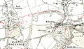
Coulston
Location within Wiltshire
Population158 (in 2011) [1]
OS grid reference ST951541
Unitary authority
Ceremonial county
Region
Country England
Sovereign state United Kingdom
Post town WESTBURY
Postcode district BA13
Dialling code 01380
Police Wiltshire
Fire Dorset and Wiltshire
Ambulance South Western
UK Parliament
Website Parish Council
List of places
UK
England
Wiltshire
51°17′10″N2°04′16″W / 51.286°N 2.071°W / 51.286; -2.071

Coulston (until 1934 called East Coulston) is a village and civil parish in Wiltshire, England, five miles northeast of the town of Westbury, just north of the B3098 road. The village lies under the north slope of Salisbury Plain and the parish extends south onto the Plain.

Contents

The parish has an elected parish council called Coulston Parish Council.

Coulston has a mix of old and new houses, about sixty-five in all. The number of buildings listed as of architectural or historic importance is thirteen (all listed Grade II). [2] There is no shop or surviving public house.

History

The parish was originally called East Coulston, and until 1934 the theoretical hamlet of West Coulston (immediately adjacent to East Coulston and including the village school) was a part of a tithing of Edington parish, known as Baynton and Coulston. In that year East and West Coulston were united into a parish called simply Coulston. [3]

A small school was built c. 1855 at West Coulston but was closed by 1899. The schoolroom is now the village hall, while the attached schoolmaster's house is a private residence. [3]

The Stert and Westbury Railway was built by the Great Western Railway Company, running to the north of the village and opening in 1900. The nearest station was Edington and Bratton. The track continues in use as part of the Reading to Taunton Line but the station closed to passengers in 1952 and to goods in 1963. [4]

Notable buildings

Baynton House is an exquisite Georgian manor house rebuilt in the 1780s, set in extensive gardens. [5] The house is next to the Coulston Deer Park, which has a herd of deer and is owned together with Baynton House.

Coulston House, a smaller manor house near the main settlement of the village, built in the late 18th century, was previously a farmhouse. [6] A substantial farm courtyard close to Coulston House was converted into several houses in the late 20th century. One of these houses is called The Granary and was once a grain barn.

Church

The parish church has 12th-century Norman origins. In the Middle Ages, its dedication was to Saint Andrew, but since the early 19th century it has been to Saint Thomas of Canterbury. [3] The chancel was built in the 14th century and rebuilt during restoration in 1868; the south side of the nave has a blocked 12th-century doorway, while the windows are from the 17th century. [7]

The Wiltshire and Swindon Archives, in Chippenham, holds the parish registers of East Coulston for the following periods.

The churchyard has the grave of Francis Savill Kent, murdered in 1860 when almost four years old at Road Hill (now in Somerset, then in Wiltshire). His half-sister Constance Kent confessed to the crime and was imprisoned; the case aroused press interest and inspired books and television dramatizations. [8]

The parish is now part of the benefice of Bratton, Edington and Imber, Erlestoke, and Coulston. [9]

Population

The population was 103 in 1831, 155 in 1951.

Pronunciation

The name of the village has been pronounced Cohlst'n at least since the late 19th century, and this is used by all long-term residents. The pronunciation Coolst'n is sometimes used by outsiders but locally is deemed to be incorrect.

Notable people

Images

See also

Related Research Articles

<span class="mw-page-title-main">Edington, Wiltshire</span> Village in England

Edington is a village and civil parish in Wiltshire, England, about 4 miles (6 km) east-northeast of Westbury. The village lies under the north slope of Salisbury Plain and the parish extends south onto the Plain. Its Grade I listed parish church was built for Edington Priory in the 14th century.

<span class="mw-page-title-main">Great Cheverell</span> Human settlement in England

Great Cheverell is a village and civil parish in Wiltshire, England, 5 miles (8.0 km) south of Devizes. In some sources the Latinized name of Cheverell Magna is used, especially when referring to the ecclesiastical parish.

<span class="mw-page-title-main">Little Cheverell</span> Human settlement in England

Little Cheverell is a small village and civil parish in Wiltshire, England. In some sources the Latinized name of Cheverell Parva is used, especially when referring to the parish. The village lies on the B3098 Westbury–West Lavington road, which skirts the northern edge of Salisbury Plain, and is about 7+12 miles (12 km) east of Westbury and 5 miles (8 km) south of Devizes.

<span class="mw-page-title-main">Erlestoke</span> Human settlement in England

Erlestoke is a village and civil parish in Wiltshire, England, on the northern edge of Salisbury Plain. The village lies about 6 miles (10 km) east of Westbury and the same distance southwest of Devizes.

<span class="mw-page-title-main">Westbury, Wiltshire</span> Human settlement in England

Westbury is a market town and civil parish in west Wiltshire, England. The town lies below the northwestern edge of Salisbury Plain, about 4 miles (6 km) south of Trowbridge and a similar distance north of Warminster.

<span class="mw-page-title-main">Dilton Marsh</span> Human settlement in England

Dilton Marsh is a village and civil parish in the far west of the county of Wiltshire, in the southwest of England. The village is about 1.5 miles (2.4 km) southwest of the centre of the town of Westbury; Dilton Marsh remains a distinct settlement with its own character and community, bounded and separated from Westbury Leigh by the Biss Brook.

<span class="mw-page-title-main">West Lavington, Wiltshire</span> Human settlement in England

West Lavington is a village and civil parish in Wiltshire, England, on the north edge of Salisbury Plain, on the A360 road between Devizes and Salisbury, about 5 miles (8 km) south of Devizes. The parish includes the hamlet of Littleton Panell.

<span class="mw-page-title-main">Bratton, Wiltshire</span> Human settlement in England

Bratton is a village and civil parish in the English county of Wiltshire, about 2.5 miles (4 km) east of Westbury. The village lies under the northern slope of Salisbury Plain, on the B3098 Westbury – Market Lavington road.

<span class="mw-page-title-main">Bishopstone, Salisbury</span> Human settlement in England

Bishopstone is a village and civil parish in Wiltshire, England, in the Ebble valley about 5.5 miles (9 km) south-west of Salisbury. The parish is on the county boundary with Hampshire and includes the small village of Croucheston and the hamlet of The Pitts.

<span class="mw-page-title-main">Edington Priory</span>

Edington Priory in Wiltshire, England, was founded by William Edington, the bishop of Winchester, in 1351 in his home village of Edington, about 3+34 miles (6 km) east of the town of Westbury. The priory church was consecrated in 1361 and continues in use as the parish church of Saint Mary, Saint Katharine and All Saints.

<span class="mw-page-title-main">Bulkington, Wiltshire</span> Village and civil parish in the county of Wiltshire, England

Bulkington is a village and civil parish in the county of Wiltshire, England. The village is about 4.5 miles (7.2 km) west of Devizes and a similar distance southeast of Melksham.

<span class="mw-page-title-main">Market Lavington</span> Human settlement in England

Market Lavington is a civil parish and large village with a population of about 2,200 on the northern edge of Salisbury Plain in Wiltshire, England, 5 miles (8.0 km) south of the market town of Devizes. The village lies on the B3098 Westbury–Urchfont road which skirts the edge of the Plain. The parish includes the hamlets of Northbrook, Lavington Sands and Fiddington Sands.

Baynton House is a Grade II listed 17th-century country house at Coulston, Wiltshire, England, about 5 miles (8 km) northeast of the town of Westbury.

<span class="mw-page-title-main">Stockton, Wiltshire</span> Human settlement in England

Stockton is a small village and civil parish in the Wylye Valley in Wiltshire, England, about 8 miles (13 km) southeast of Warminster. The parish includes the hamlet of Bapton.

<span class="mw-page-title-main">Shrewton</span> Human settlement in England

Shrewton is a village and civil parish on Salisbury Plain in Wiltshire, England, around 6 miles (9.7 km) west of Amesbury and 14 miles (23 km) north of Salisbury. It lies on the A360 road between Stonehenge and Tilshead. It is close to the source of the River Till, which flows south to Stapleford.

<span class="mw-page-title-main">Tilshead</span> Village and civil parish in Wiltshire, England

Tilshead is a village and civil parish in the county of Wiltshire in Southern England, about 9 miles (14 km) northwest of the town of Amesbury. It is close to the geographical centre of Salisbury Plain, on the A360 road approximately midway between the villages of Shrewton and West_Lavington and is near the source of the River Till. Its population in 2011 was 358, down from a peak of 989 inhabitants in 1951.

Whorwellsdown was a hundred of the English county of Wiltshire, lying in the west of the county to the south of the towns of Bradford on Avon and Melksham and to the north and east of Westbury. An arm of the hundred reached several miles southwards into Salisbury Plain, with a detached portion, a tithing of Tilshead, lying high on the Plain about five miles east of the southern arm of the rest of the hundred. At its western end, it reached as far as the Somerset county boundary.

<span class="mw-page-title-main">South Newton</span> Human settlement in England

South Newton is a village and civil parish about 4 miles (6.4 km) north-west of Salisbury in Wiltshire, England. Topologically it lies between chalk downs to the north-east, and downland with Grovely Wood to the south-west. The village straddles the A36 road and is on the left bank of the River Wylye, which defines much of the western boundary of the parish; the eastern boundary follows the A360 Salisbury-Devizes road.

<span class="mw-page-title-main">All Saints' Church, Westbury</span> Church in Wiltshire, England

The Church of All Saints is the main Church of England parish church in Westbury, Wiltshire, England. There has been a church on the site since Saxon times, and the current church, largely rebuilt around 1437, is a Grade I listed building.

<span class="mw-page-title-main">Elizabeth Godolphin</span>

Elizabeth Godolphin was a British school founder and benefactor. She is buried in Westminster Abbey. Godolphin School, Salisbury, is named after her.

References

  1. "Wiltshire Community History - Census". Wiltshire Council. Retrieved 8 January 2015.
  2. "Advanced Search: Coulston parish". Historic England. Retrieved 12 May 2016.
  3. 1 2 3 "Edington". A History of the County of Wiltshire, Volume 8. Victoria County History. University of London. 1965. pp. 239–250. Retrieved 14 June 2022 via British History Online.
  4. Oakley, Mike (2004). Wiltshire Railway Stations. Wimbourne: The Dovecote Press. p. 59. ISBN   1-904349-33-1.
  5. Historic England. "Baynton House (1021482)". National Heritage List for England . Retrieved 11 May 2016.
  6. Historic England. "Coulston House with outbuildings (1021480)". National Heritage List for England. Retrieved 11 May 2016.
  7. Historic England. "Church of St Thomas à Becket (1364255)". National Heritage List for England . Retrieved 12 May 2016.
  8. Kate Summerscale (2008). The Suspicions of Mr. Whicher: or The Murder at Road Hill House. A&C Black. ISBN   978-1-4088-0158-1.
  9. "Benefice home page" . Retrieved 12 May 2016.
  10. "Godolphin, Elizabeth (bap. 1663, d. 1726), benefactor" . Oxford Dictionary of National Biography (online ed.). Oxford University Press. 2004. doi:10.1093/ref:odnb/95354. ISBN   978-0-19-861412-8 . Retrieved 4 September 2020.(Subscription or UK public library membership required.)
  11. Sainsbury, Roger (9 November 2012). "Obituary: Arthur Robert Donald Wright". Church Times. Retrieved 1 April 2019.
  12. Maddock, Stella; Mahon, Pamela (2006). "A Romano-British prone burial from Bratton, Wiltshire". Wiltshire Archaeological and Natural History Magazine . 99: 198.

Commons-logo.svg Media related to Coulston at Wikimedia Commons