
Chautauqua is a city in Chautauqua County, Kansas, United States. As of the 2020 census, the population of the city was 108.

Aurora is a city in Cloud County, Kansas, United States. As of the 2020 census, the population of the city was 56.

Cambridge is a city in Cowley County, Kansas, United States. As of the 2020 census, the population of the city was 92.

Arcadia is a city in northeast Crawford County, Kansas, United States. As of the 2020 census, the population of the city was 254.
Frontenac is the second largest city in Crawford County, Kansas, United States. As of the 2020 census, the population of the city was 3,382.
Girard is a city in and the county seat of Crawford County, Kansas, United States. As of the 2020 census, the population of the city was 2,496.
Mulberry is a city in Crawford County, Kansas, United States. As of the 2020 census, the population of the city was 409.

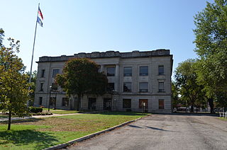
Howard is a city in and the county seat of Elk County, Kansas, United States. As of the 2020 census, the population of the city was 570.
Holton is a city in and the county seat of Jackson County, Kansas, United States. As of the 2020 census, the population of the city was 3,401.

Hoyt is a city in Jackson County, Kansas, United States. As of the 2020 census, the population of the city was 593.

Nortonville is a city in Jefferson County, Kansas, United States. As of the 2020 census, the population of the city was 601.

Osage City is a city in Osage County, Kansas, United States. As of the 2020 census, the population of the city was 2,861.

Chase is a city in Rice County, Kansas, United States. As of the 2020 census, the population of the city was 396.

Eskridge is a city in Wabaunsee County, Kansas, United States. As of the 2020 census, the population of the city was 439.
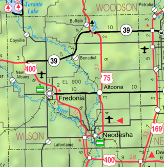
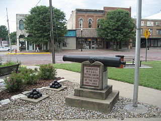
Altoona is a city in Wilson County, Kansas, United States, along the Verdigris River. As of the 2020 census, the population of the city was 354.
Chicopee is a census-designated place (CDP) in Crawford County, Kansas, United States. As of the 2020 census, the population was 422.

Baileyville is a census-designated place (CDP) in western Nemaha County, Kansas, United States. As of the 2020 census, the population was 182. It is located six miles west of Seneca on U.S. Route 36.
Farlington is a census-designated place (CDP) in Crawford County, Kansas, United States. As of the 2020 census, the population was 68. Farlington is located near K-7, 8 miles (13 km) north of Girard.
Franklin is a census-designated place (CDP) in Crawford County, Kansas, United States. As of the 2020 census, the population was 473. Franklin is located along U.S. Route 69, 1 mile (1.6 km) south of Arma, or 5.9 miles (9.5 km) north of Frontenac.
Radley is a census-designated place (CDP) in Crawford County, Kansas, United States. As of the 2020 census, the population was 105.


