The Arawak are a group of Indigenous peoples of northern South America and of the Caribbean. The term "Arawak" has been applied at various times to different Indigenous groups, from the Lokono of South America to the Taíno, who lived in the Greater Antilles and northern Lesser Antilles in the Caribbean. All these groups spoke related Arawakan languages.

The Kalinago, also called Island Caribs or simply Caribs, are an Indigenous people of the Lesser Antilles in the Caribbean. They may have been related to the Mainland Caribs (Kalina) of South America, but they spoke an unrelated language known as Island Carib. They also spoke a pidgin language associated with the Mainland Caribs.

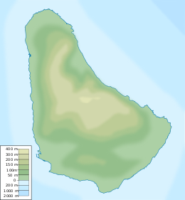
Barbados is a continental island in the North Atlantic Ocean and is located at 13°10' north of the equator, and 59°32' west of the Prime Meridian. As the easternmost isle of the Lesser Antilles in the West Indies, Barbados lies 160 kilometres (100 mi) east of the Windward Islands and Caribbean Sea. The maritime claim for Barbados is a territorial sea of 12 nmi, with an exclusive economic zone of 200 nmi which gives Barbados a total maritime area of 186,898 km2 (72,162 sq mi). Of the total EEZ area, 70,000 km2 is set aside for offshore oil exploration. A pending application to UNCLOS has placed for consideration a continental shelf 200 nmi to the east and south. To the west, most of Barbados' maritime boundaries consist of median lines with neighbours. These neighbours include: Martinique, and Saint Lucia to the northwest, Saint Vincent and the Grenadines to the west, Trinidad and Tobago and Venezuela to the southwest, and Guyana to the southeast.
South Cumberland Islands is a national park in Queensland, Australia, 831 km northwest of Brisbane. It is famous for the marine stingers which can be found in the waters of the park between October and May.

The Cariban languages are a family of languages indigenous to north-eastern South America. They are widespread across northernmost South America, from the mouth of the Amazon River to the Colombian Andes, and they are also spoken in small pockets of central Brazil. The languages of the Cariban family are relatively closely related. There are about three dozen, but most are spoken only by a few hundred people. Macushi is the only language among them with numerous speakers, estimated at 30,000. The Cariban family is well known among linguists partly because one language in the family—Hixkaryana—has a default word order of object–verb–subject. Prior to their discovery of this, linguists believed that this order did not exist in any spoken natural language.

Pelican Island was a small uninhabited island that once existed off the west coast of Bridgetown and Fontabelle, in St. Michael, Barbados.

Little Tobago is a small island off the north-eastern coast of Tobago, and part of the Republic of Trinidad and Tobago.

The Indigenous peoples of Oceania are Aboriginal Australians, Papuans, and Austronesians. These indigenous peoples have a historical continuity with pre-colonial societies that developed on their territories. With the notable exceptions of Australia, New Zealand, Hawaii, New Caledonia, Guam, and Northern Mariana Islands, indigenous peoples make up the majority of the populations of Oceania.

Arawakan, also known as Maipurean, is a language family that developed among ancient indigenous peoples in South America. Branches migrated to Central America and the Greater Antilles in the Caribbean and the Atlantic, including what is now the Bahamas. Almost all present-day South American countries are known to have been home to speakers of Arawakan languages, the exceptions being Ecuador, Uruguay, and Chile. Maipurean may be related to other language families in a hypothetical Macro-Arawakan stock.

The Kalina, also known as the Caribs or mainland Caribs and by several other names, are an Indigenous people native to the northern coastal areas of South America. Today, the Kalina live largely in villages on the rivers and coasts of Venezuela, Guyana, Suriname, French Guiana, and Brazil. They speak a Cariban language known as Carib. They may be related to the Island Caribs of the Caribbean, though their languages are unrelated.

The fauna of Barbados comprises all the animal species inhabiting the island of Barbados and its surrounding waters. Barbados has more biodiversity than the other Antilles. Human activities are responsible for the change in the composition of the fauna, in particular, the replacement of native species. Species that are able to adapt to human presence have survived.

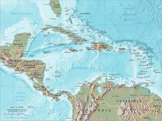
The Caribbean, is a subregion in the middle of the Americas centered around the Caribbean Sea in the North Atlantic Ocean. Bordered by North America to the north, Central America to the west, and South America to the south, it comprises numerous islands, cays, islets, reefs, and banks. It includes the Lucayan Archipelago, Greater Antilles, and Lesser Antilles of the West Indies; the Quintana Roo islands and Belizean islands of the Yucatán Peninsula; and the Bay Islands, Miskito Cays, Archipelago of San Andrés, Providencia, and Santa Catalina, and Corn Islands of Central America. It also includes the coastal areas on the continental mainland of the Americas bordering the region from the Yucatán Peninsula in North America through Central America to the Guianas in South America.

The Barbados leaf-toed gecko is a species of gecko endemic to the Caribbean island-nation of Barbados. It is the only known leaf-toed gecko in the Lesser Antilles.

The languages of the Caribbean reflect the region's diverse history and culture. There are six official languages spoken in the Caribbean:

The Kalinago language, also known as Island Carib and Igneri, was an Arawakan language historically spoken by the Kalinago of the Lesser Antilles in the Caribbean. Kalinago proper became extinct by about 1920 due to population decline and colonial period deportations resulting in language death, but an offshoot survives as Garifuna, primarily in Central America.
Caquetío is an extinct Arawakan language family. The language was spoken along the shores of Lake Maracaibo, in the coastal areas of the Venezuelan state of Falcón, and on the Dutch islands of Aruba, Bonaire and Curaçao.

Indigenous peoples in Guyana, Native Guyanese or Amerindian Guyanese are Guyanese people who are of indigenous ancestry. They comprise approximately 9.16% of Guyana's population. Amerindians are credited with the invention of the canoe, as well as Cassava-based dishes and Guyanese pepperpot, the national dish of Guyana. Amerindian languages have also been incorporated in the lexicon of Guyanese Creole.
The Lokono or Arawak are an Arawak people native to northern coastal areas of South America. Today, approximately 10,000 Lokono live primarily along the coasts and rivers of Guyana, with smaller numbers in Venezuela, Suriname, French Guiana. They speak the Arawak language, the eponymous language of the Arawakan language family, as well as various Creole languages, and English.

The Belize leaf-toed gecko is a species of gecko native to Belize. It is a small, pale, large headed gecko only found on small islands off Belize's coast and was first described by James R. Dixon in 1960. This species is currently classified as "vulnerable" by the IUCN Red List.


