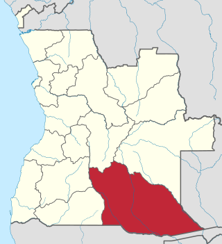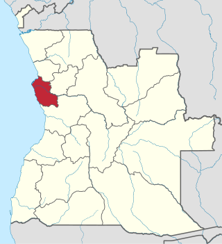
Zaire is one of the 18 provinces of Angola. It occupies 40,130 square kilometres (15,490 sq mi) in the north west of the country and had a population of 594,428 inhabitants in 2014. It is bordered on the west by the Atlantic Ocean, on the north by the Democratic Republic of Congo, on the east by the Uíge Province, and on the south by the Bengo Province.

The culture of Angola is influenced by the Portuguese. Portugal occupied the coastal enclave Luanda, and later also Benguela, since the 16th/17th centuries, and expanded into the territory of what is now Angola in the 19th/20th centuries, ruling it until 1975. Both countries share prevailing cultural aspects: the Portuguese language and Roman Catholicism. However, present-day Angolan culture is mostly native Bantu, which was mixed with Portuguese culture. The diverse ethnic communities with their own cultural traits, traditions and native languages or dialects include the Ovimbundu, Ambundu, Bakongo, Chokwe, Avambo and other peoples.

Cuando Cubango is a province of Angola and it has an area of 199,049km2 and a population of 534,002 in 2014. Menongue is the capital of the province. The governor of the province is José Martins, who was appointed governor in November 2021.

The Cuanza Norte Province is province of Angola. N'dalatando is the capital and the province has an area of 24,110 km2 and a population of 443,386. Manuel Pedro Pacavira was born here and is a former provincial governor. The 1,400 meter long Capanda Dam is located in this province. Cuanza Norte lies on the northern bank of the Cuanza River. It had been a territory of Ngola Kingdom. In 1914, Norton de Matos created District of Cuanza which was divided into Cuanza Norte and Cuanza Sul Provinces in 1917.

Huíla is a province of Angola. It has an area of 79,023 square kilometres (30,511 sq mi) and a population of 2,497,422. Lubango is the capital of the province. Basket-making is a significant industry in the province; many make baskets out of reeds.

Luanda is a province of Angola. It covers an area of 18,835 km2, and had a population of 6,945,386 at the Census of 16 May 2014. The latest official estimate is 9,079,811.

Moxico or Moshiko is the largest province of Angola. It has an area of 223,023 square kilometres (86,110 sq mi), and covers 18% of the landmass of Angola. The province has a population of 758,568 and a population density of approximately 3.4 residents per km2, making it one of the most sparsely populated areas of Angola. The population of the province is in flux; displaced residents have slowly returned to Moxico since the end of the Angolan Civil War in 2002. The war left Moxico as one of the most landmine-contaminated places in the world. The governor of the province is Gonçalves Manuel Muandumba.
Cahama is a town, with a population of 12,767, and a municipality of Cunene Province, Angola. The population of the municipality was 70,061 according to the 2014 census in an area of 9,700 km2. The municipality consists of the communes Cahama and Otchinjau. There is an airport (FN17) to the north of the town.

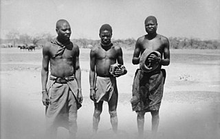
The Ovambo people, also called Aawambo, Ambo, Aawambo, or Ovawambo (Kwanyama), are a Bantu ethnic group native to Southern Africa, primarily modern Namibia. They are the single largest ethnic group in Namibia, accounting for about half of the population. Despite concerted efforts from Christian missionaries to wipe out what were believed to be 'pagan practices', they have retained many aspects of their cultural practices. They are also found in the southern Angolan province of Cunene, where they are more commonly referred to as "Ambo". The Ovambo consist of a number of kindred Bantu ethnic tribes who inhabit what was formerly called Ovamboland. In Angola, they are a minority, accounting for about two percent of the total Angolan population.
Ondjiva, formerly Vila Pereira d'Eça, is a town, with a population of 121,537 (2014), and a commune in the municipality of Cuanhama, province of Cunene, Angola. It is also the administrative capital of Cunene Province and is located at the extreme south of the country, about 42 kilometres (26 mi) from the border with Namibia. It was traditionally the seat of the Ovambo king of the Oukwanyama tribe. Ondjiva was greatly affected by the Angolan Civil War (1975-2002).

Xangongo is a town, with a population of 35,000 (2014), and a commune in the municipality of Ombadja, province of Cunene, Angola.
Naulila is a town and commune in the municipality of Ombadja, province of Cunene, Angola.

Mandume ya Ndemufayo was the last king of the Oukwanyama, a subset of the Ovambo people of southern Angola and northern Namibia. Ya Ndemufayo took over the kingdom in 1911 and his reign lasted until 1917 when he died of either suicide or machine gun fire while he was under attack from South African colonizers. Ya Ndemufayo is honoured as a national hero in both Angola and Namibia.
Cuangar is a city and municipality of the Cuando-Cubango province in Angola.
Namacunde or Namakunde is a town and municipality in Cunene Province in Angola. The municipality had a population of 142,047 in 2014.
The Mbadja or Ovambadja is an independent Bantu tribe that speaks the Oshimbadja language Fairly not Oshiwambo Speaking people but due to the way of pronouncing. The tribe consider themselves to be a distinct ethnic group, and the Namibian government formally recognised them in 2002. They originate from Ombadja in southern Angola, Cunene Province.
Lutheranism was first introduced to Angola in the late 1800s, when Finnish missionaries began working in northern Namibia and southern Angola. Following the Portuguese defeat of Mandume Ya Ndemufayo in 1917, the Lutheran church in Angola was repressed by the Roman Catholic Portuguese authorities. In 1956, Lutheranism was reestablished in Angola, and in 1991, the Evangelical Lutheran Church of Angola was organized as an independent church body. In 1997, a smaller group of conservative Lutheran missionaries helped to organize a second Angolan Lutheran church: the Confessional Lutheran Church in Angola.

Humbe is a town and commune in the municipality of Ombadja, province of Cunene, Angola.
Cuanhama, also known as Kwanhama, is a municipality in Cunene Province, Angola. Cuanhama occupies 20,255 square kilometers and has 374,529 inhabitants as of the 2014 census. It is bordered to the north by the municipality of Cuvelai, east by the municipality of Menongue, the south by the municipality of Namacunde, and west by the municipality of Ombadja. Ondjiva, the administrative capital of Cunene Province, is located in Cuanhama. Other communes in Cuanhama include Môngua, Evale, Nehone and Tchimporo-Yonde.

Ombadja is municipality in Cunene Province, Angola. Its seat is the village of Xangongo. It occupies 12,264 square kilometers and has about 304,964 inhabitants as of the 2014 Angolan census. It is bordered to the north by the municipality of Matala, in the east by the municipalities of Cuvelai, Namacunde, Cuanhama, west by the municipalities of Curoca and Cahama. It contains the communes of Xangongo, Ombala-Yo-Mungo, Naulila, Humbe and Mucope.


