
White Pine County is a largely rural, mountain county along the central eastern boundary of the U.S. state of Nevada. As of the 2020 census, the population was 9,080. Its county seat is Ely. The name "(Rocky Mountain) white pine" is an old name for the limber pine, a common tree in the county's mountains.

Nye County is a county in the U.S. state of Nevada. As of the 2020 census, the population was 51,591. Its county seat is Tonopah. At 18,159 square miles (47,030 km2), Nye is Nevada's largest county by area and the third-largest county in the contiguous United States, behind Coconino County of Arizona and San Bernardino County of California.
Beatty is an unincorporated town along the Amargosa River in Nye County, Nevada, United States. U.S. Route 95 runs through the town, which lies between Tonopah, about 90 miles (140 km) to the north and Las Vegas, about 120 miles (190 km) to the southeast. State Route 374 connects Beatty to Death Valley National Park, about 8 miles (13 km) to the west.

Gabbs is an unincorporated town in Nye County, Nevada, United States. The population was 269 at the 2010 census. Located in northern Nye County, it is part of the Greater Las Vegas, making it at 321 miles (517 km) the most distant community from Las Vegas in the Las Vegas–Henderson combined statistical area.

Ely is the largest city and county seat of White Pine County, Nevada, United States. Ely was founded as a stagecoach station along the Pony Express and Central Overland Route. In 1906 copper was discovered. Ely's mining boom came later than the other towns along US 50. The railroads connecting the transcontinental railroad to the mines in Austin, Nevada and Eureka, Nevada have long been removed, but the railroad to Ely is preserved as a heritage railway by the Nevada Northern Railway and known as the Ghost Train of Old Ely. As of the 2020 census, the population was 3,924.

The Humboldt–Toiyabe National Forest (HTNF) is the principal U.S. National Forest in the U.S. state of Nevada, and has a smaller portion in Eastern California. With an area of 6,289,821 acres (25,454.00 km2), it is the largest U.S. National Forest outside of Alaska.
Warm Springs is a former town in the Tonopah Basin in Nye County, Nevada, near the mountain pass which divides the Kawich and Hot Creek ranges. It is located at the junction of U.S. Route 6 and State Route 375, around 50 miles east of Tonopah. Only two abandoned buildings remain.

Belmont is a ghost town in Nye County, Nevada, United States along former State Route 82. The town is a historic district listed in the National Register of Historic Places. It is Nevada Historical Marker number 138.

Railroad Valley is one of the Central Nevada Desert Basins in the Tonopah Basin and is about 80 miles (130 km) long north–south and up to 20 miles (32 km) wide, with some southern areas running southwest to northeast.

The Pancake Range is located in east-central Nevada in the United States. The range extends as an irregular sinuous line for approximately 90 miles (140 km) with a roughly north-south trend in Nye and White Pine counties. The range reaches an elevation of 9,240 feet (2,820 m) at Portuguese Mountain. Neighboring ranges include the White Pine, Grant and Quinn Canyon ranges across Railroad Valley on the east-southeast; and Park and Hot Creek ranges across Big Sandy Springs and Hot Creek valleys on the west-northwest. The south end of Newark Valley lies at the extreme north end of the range. The Lunar Crater Volcanic Field lies at the southwestern end of the chain with the Reveille Range to the south.

Manhattan is an unincorporated town in Nye County, Nevada, located at the end of Nevada State Route 377, about 50 miles (80 km) north of Tonopah, the county seat.

Cherry Creek is a historic mining town located in northern White Pine County, in northeastern Nevada in the western United States. It is a census county division (CCD), with a population at the 2010 census of 72.
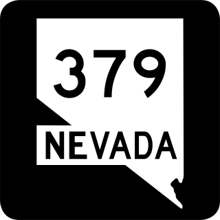
State Route 379 covers Duckwater Road, a 19.532-mile (31.434 km) state highway in Nye County, Nevada, United States. The route serves the Duckwater Indian Reservation, connecting the community of Duckwater to U.S. Route 6 at Currant. The highway was formerly a part of State Route 20 prior to the 1970s.
The Las Vegas–Henderson combined statistical area, known prior to 2013 as the Las Vegas–Paradise–Pahrump combined statistical area, is made up of two counties in southern Nevada and one in northwestern Arizona. The statistical area consists of the Las Vegas–Paradise, NV MSA, the Lake Havasu City–Kingman, AZ MSA and the Pahrump micropolitan statistical area. At the 2010 census, the CSA had a population of 2,195,401.
Silver mining in Nevada, a state of the United States, began in 1858 with the discovery of the Comstock Lode, the first major silver-mining district in the United States. Nevada calls itself the "Silver State." Nevada is the nation's second-largest producer of silver, after Alaska. In 2014 Nevada produced 10.93 million troy ounces of silver, of which 6.74 million ounces were as a byproduct of the mining of gold. The largest byproducers were the Hycroft Mine, the Phoenix Mine, the Midas Mine and Round Mountain.

Austin Creek is a 16.0-mile-long (25.7 km) southward-flowing stream in the mountains of western Sonoma County, California which empties into the Russian River about 4 miles (6 km) from the Pacific Ocean.

U.S. Route 6 (US 6) is a United States Numbered Highway, stretching from Bishop, California, in the west to Provincetown, Massachusetts, on the East Coast. The Nevada portion crosses the center of the state, serving the cities of Tonopah and Ely, en route to Utah and points further east. Like US 50, to the north, large desolate areas are traversed by the route, with few or no signs of civilization, and the highway crosses several large desert valleys separated by numerous mountain ranges towering over the valley floors, in what is known as the Basin and Range Province of the Great Basin.

Pahrump is an unincorporated town located at the southernmost tip of Nye County, Nevada, United States, about 62 miles (100 km) west of Las Vegas. Pahrump lies adjacent to the Nevada–California border and the area had a population of 44,738 as of the 2020 census.
Potts is a ghost town and abandoned ranching property in Monitor Valley, Nye County, Nevada, approximately 2 miles east of Nevada State Route 82.
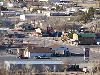
Lockes, also known as Ostorside or Ostonside, is a ghost town on U.S. Highway 6 in eastern Nye County, Nevada. The site is approximately 73 miles by road southwest by south of Ely, Nevada and 95 miles by road northeast by east of Tonopah, Nevada, with the nearest town being Currant, 24 miles to the northeast along U.S. 6.


