
Rhyolite is a ghost town in Nye County, in the U.S. state of Nevada. It is in the Bullfrog Hills, about 120 miles (190 km) northwest of Las Vegas, near the eastern boundary of Death Valley National Park. The town began in early 1905 as one of several mining camps that sprang up after a prospecting discovery in the surrounding hills. During an ensuing gold rush, thousands of gold-seekers, developers, miners and service providers flocked to the Bullfrog Mining District. Many settled in Rhyolite, which lay in a sheltered desert basin near the region's biggest producer, the Montgomery Shoshone Mine.
Genoa is an unincorporated town in Douglas County, Nevada, United States. Founded in 1851, it was the first settlement in what became the Nevada Territory. It is situated within Carson River Valley and is approximately 42 miles (68 km) south of Reno at 39.005,-119.846. The population was 939 at the 2010 census. It is home to the oldest bar in the state of Nevada which opened in 1853.

Warm Springs is a former town in the Tonopah Basin in Nye County, Nevada, near the mountain pass which divides the Kawich and Hot Creek ranges. It is located at the junction of U.S. Route 6 and State Route 375, around 50 miles east of Tonopah. Only two abandoned buildings remain.

Panamint City is a ghost town in the Panamint Range, near Death Valley, in Inyo County, California, US. It is also known by the official Board of Geographic Names as Panamint. Panamint was a boom town founded after silver and copper were found there in 1872. By 1874, the town had a population of about 2,000. Its main street was one mile (1.6 km) long. Panamint had its own newspaper, the Panamint News. Silver was the principal product mined in the area. The town is located about three miles northwest of Sentinel Peak. According to the National Geographic Names Database, NAD27 latitude and longitude for the locale are 36°07′06″N117°05′43″W, and the feature ID number is 1661185. The elevation of this location is identified as being 6,280 feet AMSL. The similar-sounding Panamint Springs, California, is located about 25.8 miles at 306.4 degrees off true north near Panamint Junction.

Belmont is a ghost town in Nye County, Nevada, United States along former State Route 82. The town is a historic district listed in the National Register of Historic Places. It is Nevada Historical Marker number 138.
Vya is a small ghost town located in Washoe County, in northwestern Nevada, United States. It is about 10 miles (16 km) to the east of the California state line, north of Forty Nine Canyon. Not much remains of the small town, which essentially died in the 1920s. Just two wooden buildings can still be seen—the Vya Post Office and Library. The Vya Post Office was in operation from September 1910 until October 1941. The settlement was named for Vya Wimer, the first European heritage baby born in the valley.

Delamar, Nevada, nicknamed The Widowmaker, is a ghost town in central eastern Nevada, USA along the east side of the Delamar Valley. During its heyday, primarily between 1895 and 1900, it produced $13.5 million in gold.

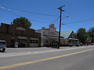
Ione, Nevada, is a ghost town in Nye County, Nevada, located approximately 23 miles east of Gabbs, Nevada.
Crystal Springs is a ghost town in the Pahranagat Valley region of Lincoln County, Nevada in the United States. The ghost town is located at the junction of State Route 318 and State Route 375, just northwest of U.S. Route 93. It is a popular destination for passersby who want to visit the towns of Hiko and Rachel. The namesake of the ghost town, the Crystal Springs, lies nearby; it is a large group of marshes and springs along the White River. Crystal Springs provides irrigation for multiple nearby ranches and farms, some of which lie over 5 miles away from the springs.

Ivanpah was a short-lived silver mining town located in San Bernardino County, California, United States. It was founded in 1869 and existed until at least the mid-1880s.

Sunnyside is a small unincorporated community in the White River Valley of eastern Nevada, near the southern terminus of the Egan Range. The site is located on State Route 318 approximately 31 miles by road south of Lund in White Pine County, the closest town, and 63 miles by road north of Hiko in Lincoln County.
Tungstonia, Nevada, is a ghost town on the Southern flank of the Kern Mountains of Eastern White Pine County, Nevada, along Tungstonia Wash.
Schellbourne, formerly known as Fort Schellbourne and Schell Creek Station is an ghost town located in White Pine County in Nevada, United States, located 43 miles (69 km) north of Ely. The town was a stopover along the Central Overland Route, Pony Express and original routing of the Lincoln Highway. It is today Nevada Historical Marker number 51. The site was listed on the National Register of Historic Places in 1972. Its boundaries were increased in 1977.
Lander is a ghost town in Lander County in Nevada in the United States.
Allred is a ghost town situated in Nye County, Nevada. A post office in the settlement opened on April 17, 1911 with Allen Oxborrow and George Kump as postmasters. The post office was closed more than a year later on October 31, 1912. There are no visible remains left of Allred.
Adaven is a former mining settlement and Ghost town in Nye County, Nevada.
Wahmonie was a mining town in Nevada. It was established as a gold mining camp in February 1928 and had a population of 500 by March. Peak population was reached that summer, with between 1000 and 1500 residents. Gold was not found in sufficient quantity to sustain the place, and the site was quickly abandoned. The post office was in operation from April 1928 until April 1929. Wahmonie was the last large mining rush in Nevada. The location was also known as Horn Silver Mine.
Willow Point is an extinct town in Humboldt County, in the U.S. state of Nevada. Willow Point is located in Paradise Valley, south of the town of Paradise Valley and about 20 miles northeast of Winnemucca.
Johnnie is a populated place in Nye County, in the U.S. state of Nevada about 15 miles north of Pahrump.
Bullionville is a ghost town in Lincoln County, Nevada, United States, 1/4 mile east of U.S. Route 93, one mile north of Panaca and 10 miles (16 km) south of Pioche. The town prospered between 1870 and 1882, and is now abandoned.

