
Lida, Nevada is a small ghost town in Esmeralda County, Nevada, near the border with California. The GNIS classifies it as a populated place. It is located on State Route 266, north of Magruder Mountain.

Belmont is a ghost town in Nye County, Nevada, United States along former State Route 82. The town is a historic district listed in the National Register of Historic Places. It is Nevada Historical Marker number 138.

Galena, Washoe County, Nevada is an abandoned town in Washoe County, Nevada, south of Reno. The portion of Reno just south of Mount Rose Highway and west of Steamboat Springs is also known as Galena.
Star City was a silver-mining boom town in Pershing County, Nevada. It was located in the Star Mining District. It is now a ghost town.

Wonder, Nevada, is a ghost town in Churchill County, Nevada, approximately 39 miles (63 km) east of Fallon.

Candelaria is a ghost town in Mineral County, Nevada. Today the site of Candelaria is dominated by the Kinross Gold Candelaria Mine on Mt. Diablo.
Broken Hills is a ghost town in Mineral County, Nevada. It was primarily the site of the mining operation of miners, Joseph Arthur and James Stratford from 1913 to 1920. The settlement reached the height of popularity during World War I.
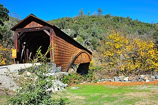
Bridgeport is a former settlement on the Yuba River in Nevada County, California, 2 mi (3.2 km) from the town of French Corral. Its elevation is 567 ft (173 m) above sea level.

Gold Run was a former mining town of the California Gold Rush, located in Placer County, California.
Poeville, also known as Peavine until 1863, is the site of a historical mining town, established in 1864. John Poe, a professional promoter from Michigan allegedly related to Edgar Allan Poe, discovered rich gold and silver veins in 1862 on the slopes of Peavine Mountain. After the discovery of ore, Poe announced that the veins comprised the next Comstock Lode; he presented extracted ore at the state fair of 1864 as rich in content. As a result, the former mining camp, called Poe City (Poeville) or Podunk (Poedunk), grew to 200 people by 1864. Ore production in the mining district and population peaked around 1873-1874 with several hundred people living in town, supported by three hotels and a post office. The post office, named "Poeville", operated between September 1, 1874, and March 24, 1878.
El Dorado Canyon is a canyon in southern Clark County, Nevada famed for its rich silver and gold mines. The canyon was named in 1857 by steamboat entrepreneur Captain George Alonzo Johnson when gold and silver was discovered here. It drains into the Colorado River at the former site of Nelson's Landing.

Fairview is a ghost town in Churchill County, Nevada, in the United States of America.
Lander is a ghost town in Lander County in Nevada in the United States.
Potosi or Potosi Camp, was called Crystal City in the 1870s, a mining ghost town in Clark County, Nevada. It lies at an elevation of 5705 feet.
Eagleville is a former populated place in Mineral County, Nevada that is now a ghost town.

Cortez is a ghost town in Lander County, in the U.S. state of Nevada. The GNIS classifies it as a populated place.
Johnnie is a populated place in Nye County, in the U.S. state of Nevada about 15 miles north of Pahrump.
Lodi is an extinct town in Nye County, in the U.S. state of Nevada. The GNIS classifies it as a populated place.

Tenabo is a ghost town in Lander County, Nevada United States.

Grantsville is a former town in Nye County, Nevada.


