Cuyamaca Peak

Last updated
Cuyamaca Peak
CuyamacaPeakFromSE.jpeg
Cuyamaca Peak from the South
Highest point
Elevation 6,515 ft (1,986 m)  NAVD 88 [1]
Prominence 2,855 ft (870 m) [2]
Listing
Coordinates 32°56′48″N116°36′24″W / 32.946743453°N 116.606723761°W / 32.946743453; -116.606723761 [1]
Geography
Relief map of California.png
Red triangle with thick white border.svg
Cuyamaca Peak
Location San Diego County, California, U.S.
Parent range Cuyamaca Mountains
Topo map USGS Cuyamaca Peak
Climbing
Easiest route Hike, class 1 [3]

Cuyamaca Peak is a mountain peak of the Cuyamaca Mountains range, in San Diego County, Southern California.

Contents

Geography

At 6,512 feet (1,985 m), its summit is the second highest point in San Diego County.

Cuyamaca Peak is located roughly 40 miles (64 km) from the Pacific Ocean, within Cuyamaca Rancho State Park. It is east of the city of San Diego and southwest of Julian.
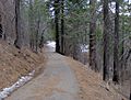
A popular 3.5-mile (5.6 km) year round hike to the summit of Cuyamaca leads from the Paso Picacho Campground, starting at about 5,000 feet (1,500 m).

Ecology

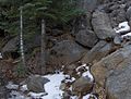
Snow in winter is common above 5,000 feet (1,500 m) and surrounding regions in Cuyamaca Rancho State Park. During summer, Bracken Ferns, a variety of wildflowers and native bunchgrasses dominate mountain meadows and the forest floor. Prior to the Cedar Fire, Black oaks once lit up the mountain.

Cedar Fire

In October 2003, the Cedar Fire burned the once abundant White Fir (Abies concolor), Incense Cedar (Calocedrus decurrens), Jeffrey Pine, Coulter Pine, Sugar Pine, and Black oak (Quercus kelloggii) that once lined the mountain.

Small seedlings of new White fir, Sugar Pine, Coulter Pine, Jeffrey Pine, and Incense Cedar were seen within a year of the Cedar Fire, and were thriving as saplings by 2007, an example of fire ecology.

Precipitation

The significant elevation of Cuyamaca relative to its surrounding landscape catches Pacific moisture easily, forming clouds which are forced to release their moisture in order to pass East, resulting in average annual precipitation between 20 and 32 inches. Fall and Winter storms account for 70%, summer thunderstorms largely accounting for the balance. During the winter snow may fall and hoar frost is common upon the highest elevations.

Views

View from the end of Lookout Road atop Cuyamaca Peak. Cuyamaca Peak Panorama.jpg
View from the end of Lookout Road atop Cuyamaca Peak.

On clear days visibility from the summit of Cuyamaca Peak can range from 60–100 miles (97–161 km) in nearly every direction.

To the west, the Pacific Ocean, the Coronado Islands of Mexico, the coast line of San Diego County, Viejas Mountain, and El Cajon Mountain can be seen.

Looking north, one can see 6,140-foot (1,870 m) Palomar Mountain among the ridge of Palomar Mountains. On very clear days 8,716-foot (2,657 m) Toro Peak in the Santa Rosas and the San Jacintos are visible. Closer yet is Volcan Mountain slightly to the northeast, the former gold rush town of Julian lying in front. Directly north are the closest summits, Middle and North Peaks.

Directly east is the Anza Borrego Desert and the Laguna Mountains, including Whale Peak. Far beyond is the Salton Sea. To the south are Lyons Peak and Lawson Peak; further yet and to the southeast are Mexican border mountains such as Table Top Mountain and the Sierra de Juárez.

See also

Related Research Articles

<span class="mw-page-title-main">Sierra de San Pedro Mártir</span> Mountain range in northwestern Mexico

Sierra de San Pedro Mártir is a mountain range located within southern Ensenada Municipality and southern Baja California state, of northwestern Mexico.

<span class="mw-page-title-main">Peninsular Ranges</span> Group of mountain ranges in Southern California and northern Mexico

The Peninsular Ranges are a group of mountain ranges that stretch 1,500 km (930 mi) from Southern California to the southern tip of the Baja California peninsula; they are part of the North American Pacific Coast Ranges, which run along the Pacific Coast from Alaska to Mexico. Elevations range from 150 to 3,300 m.

<span class="mw-page-title-main">Tehachapi Mountains</span> Mountain range of the Transverse Ranges in California

The Tehachapi Mountains are a mountain range in the Transverse Ranges system of California in the Western United States. The range extends for approximately 40 miles (64 km) in southern Kern County and northwestern Los Angeles County and form part of the boundary between the San Joaquin Valley and the Mojave Desert.

<span class="mw-page-title-main">Santa Ana Mountains</span> Mountain range in California, United States

The Santa Ana Mountains are a short peninsular mountain range along the coast of Southern California in the United States. They extend for approximately 61 miles (98 km) southeast of the Los Angeles Basin largely along the border between Orange and Riverside counties.

<span class="mw-page-title-main">San Jacinto Mountains</span> Mountain range in Riverside County, in southern California

The San Jacinto Mountains are a mountain range in Riverside County, located east of Los Angeles in southern California in the United States. The mountains are named for one of the first Black Friars, Saint Hyacinth, who is a popular patron in Latin America.

<span class="mw-page-title-main">San Rafael Mountains</span> Mountain range of the Transverse Ranges in California, United States

The San Rafael Mountains are a mountain range in central Santa Barbara County, California, U.S., separating the drainages of the Santa Ynez River and the Santa Maria River. They are part of the Transverse Ranges system of Southern California which in turn are part of the Pacific Coast Ranges system of western North America.

<span class="mw-page-title-main">Cuyamaca, California</span>

Cuyamaca is a region of eastern San Diego County. It lies east of the Capitan Grande Indian Reservation in the western Laguna Mountains, north of Descanso and south of Julian. Named for the 1845 Rancho Cuyamaca Mexican land grant, the region is now dominated by the 26,000-acre (110 km2) Cuyamaca Rancho State Park. Within the park is the prominent Cuyamaca Peak, the second-highest mountain in San Diego County at 6,512 feet (1,984.9 m).

<span class="mw-page-title-main">Palomar Mountain</span> Mountain in San Diego County, California, United States

Palomar Mountain is a mountain ridge in the Peninsular Ranges in northern San Diego County. It is famous as the location of the Palomar Observatory and Hale Telescope, and known for the Palomar Mountain State Park.

<span class="mw-page-title-main">Foothills of the San Gabriel Valley</span>

The foothills of the San Gabriel Valley are the foothills and hills in the San Gabriel Valley of eastern Los Angeles County, California. They include the foothills of the San Gabriel Mountains, and independent low mountain ranges of hills, in the east Greater Los Angeles region. The landforms are part of the Transverse Ranges System of Southern California and Baja California.

<span class="mw-page-title-main">Cleveland National Forest</span> Southernmost National forest of California

The Cleveland National Forest encompasses 460,000 acres/720 sq mi (1,900 km2) of inland montane regions—approx. 60 miles from the Pacific Ocean—within the counties of San Diego, Riverside, and Orange, California. The landscape varies somewhat, with mostly chaparral canyons, arroyos and high desert, but dotted with meadows and oak and conifer forests. Near water sources, riparian environments and perennial aquatic plants attract native and migratory wildlife, such as at San Diego’s man-made Lake Cuyamaca. A generally warm and dry, inland-Mediterranean climate prevails over the forest, with the cooler months producing morning frost and snowfall. It is the southernmost U.S. National Forest of California. The area is administered by the U.S. Forest Service, a government agency within the United States Department of Agriculture, and is locally overseen by the Descanso, Palomar and Trabuco Ranger Districts.

<span class="mw-page-title-main">San Bernardino National Forest</span> National forest in California, United States

The San Bernardino National Forest is a United States National Forest in Southern California encompassing 823,816 acres (3,333.87 km2) of which 677,982 acres (2,743.70 km2) are federal. The forest is made up of two main divisions, the eastern portion of the San Gabriel Mountains and the San Bernardino Mountains on the easternmost of the Transverse Ranges, and the San Jacinto and Santa Rosa Mountains on the northernmost of the Peninsular Ranges. Elevations range from 2,000 to 11,499 feet. The forest includes seven wilderness areas: San Gorgonio, Cucamonga, San Jacinto, South Fork, Santa Rosa, Cahuilla Mountain and Bighorn Mountain. Forest headquarters are located in the city of San Bernardino. There are district offices in Lytle Creek, Idyllwild, and Fawnskin.

<span class="mw-page-title-main">Cuyamaca Rancho State Park</span> State park in California, United States

Cuyamaca Rancho State Park is a state park in inland San Diego County, Southern California, United States, located 40 miles (64 km) east of the metropolitan are of San Diego. The park is situated near the southernmost reaches of the vast Cleveland National Forest, as well as the Cuyamaca and Laguna Mountains of the Peninsular Ranges. The park's 26,000 acres (11,000 ha) of land features pine, fir, and oak forests, interspersed with meadows, creeks and streams that exist due to the relatively high elevation of the area when compared to its surroundings. The park includes the 6,512-foot (1,985 m) Cuyamaca Peak, the second-highest point in San Diego County.

<span class="mw-page-title-main">California mixed evergreen forest</span>

California mixed evergreen forest is a plant community found in the mountain ranges of California and southwestern Oregon.

Palomar Mountain is an unincorporated community in San Diego County, California, United States.

Hot Springs Mountain is a peak located in the Peninsular Ranges in California. The mountain rises to an elevation of 6,533 feet (1,991 m) and is the highest point in San Diego County. Some snow falls on the mountain peak during winter. It is located in a remote region of the county, 4 miles from the community of Warner Springs, 12 miles from Borrego Springs, and 50 miles from San Diego. The mountain and its immediate surroundings belong to the Los Coyotes Band of Cahuilla and Cupeno Indians. The summit and fire tower can be hiked via the Sukat Road route from the campground. Hikers and campers must pay an entry fee to access the area.

<span class="mw-page-title-main">Mount Shasta Wilderness</span> Protected wilderness area in California, United States

The Mount Shasta Wilderness is a 38,200-acre (155 km2) federally designated wilderness area located 5 miles (8.0 km) east of Mount Shasta City in northern California. The US Congress passed the 1984 California Wilderness Act that set aside the Mount Shasta Wilderness. The US Forest Service is the managing agency as the wilderness is within the Shasta-Trinity National Forest. The area is named for and is dominated by the Mount Shasta volcano which reaches a traditionally quoted height of 14,162 feet (4,317 m) above sea level, but official sources give values ranging from 14,104 feet (4,299 m) from one USGS project, to 14,179 feet (4,322 m) via the NOAA. Mount Shasta is one of only two peaks in the state over 14,000 feet (4,300 m) outside the Sierra Nevada Mountain Range. The other summit is White Mountain Peak in the Great Basin of east-central California.

<span class="mw-page-title-main">Cuyamaca Mountains</span> Mountain range of the Peninsular Ranges System, in San Diego County, southern California

The Cuyamaca Mountains, locally the Cuyamacas, are a mountain range of the Peninsular Ranges System, in San Diego County, southern California. The mountain range runs roughly northwest to southeast. The Laguna Mountains are directly adjacent to the east, with Palomar Mountain and Hot Springs Mountain more distant to the north.

<span class="mw-page-title-main">Sierra Nevada lower montane forest</span>

The Sierra Nevada lower montane forest is a plant community along a strip along the western and eastern edges of the Sierra Nevada mountain range in California. This zone is also known as a yellow pine forest.

<span class="mw-page-title-main">Toro Peak</span> Mountain in California, United States

Toro Peak, in Southern California, is the highest mountain in the Santa Rosa Mountain Range. It is located 15 mi (24 km) south of Palm Springs, 12 mi (19 km) west of the Salton Sea, and 31 mi (50 km) east of Temecula, in the County of Riverside, California.

<span class="mw-page-title-main">California interior chaparral and woodlands</span> Mediterranean forests, woodlands, and scrub ecoregion in California, United States

The California interior chaparral and woodlands ecoregion covers 24,900 square miles (64,000 km2) in an elliptical ring around the California Central Valley. It occurs on hills and mountains ranging from 300 feet (91 m) to 3,000 feet (910 m). It is part of the Mediterranean forests, woodlands, and scrub biome, with cool, wet winters and hot, dry summers. Temperatures within the coast can range from 53° to 65 °F and 32° to 60 °F within the mountains. Many plant and animal species in this ecoregion are adapted to periodic fire.

References

  1. 1 2 "Cuyamaca reset". NGS Data Sheet. National Geodetic Survey, National Oceanic and Atmospheric Administration, United States Department of Commerce . Retrieved 2021-09-17.
  2. "Cuyamaca Peak, California". Peakbagger.com. Retrieved 2009-01-25.
  3. 1 2 "Cuyamaca Peak". Hundred Peaks Section List. Angeles Chapter, Sierra Club . Retrieved 2011-05-08.
  4. "Sand Diego peaks list". San Diego Chapter, Sierra Club . Retrieved 2021-09-17.