Related Research Articles

Madison is a town located in Rockingham County, North Carolina. At the 2010 census, the town had a total population of 2,246. It is home to the corporate headquarters of Remington Arms.

The Chattahoochee River forms the southern half of the Alabama and Georgia border, as well as a portion of the Florida - Georgia border. It is a tributary of the Apalachicola River, a relatively short river formed by the confluence of the Chattahoochee and Flint rivers and emptying from Florida into Apalachicola Bay in the Gulf of Mexico. The Chattahoochee River is about 430 miles (690 km) long. The Chattahoochee, Flint, and Apalachicola rivers together make up the Apalachicola–Chattahoochee–Flint River Basin. The Chattahoochee makes up the largest part of the ACF's drainage basin.

Wheeler Dam is a hydroelectric dam on the Tennessee River between Lauderdale County and Lawrence County in Alabama. It is one of nine dams on the river owned and operated by the Tennessee Valley Authority, which built the dam in the mid-1930s as part of a New Deal-era initiative to improve navigation on the river and bring flood control and economic development to the region. The dam impounds the Wheeler Lake of 67,070 acres (27,140 ha) and its tailwaters feed into Wilson Lake.

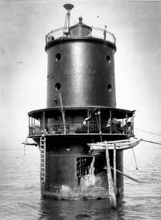
The Thomas Point Shoal Light, also known as Thomas Point Shoal Light Station, is a historic lighthouse in the Chesapeake Bay on the east coast of the United States, and the most recognized lighthouse in Maryland. It is the only screw-pile lighthouse in the bay which stands at its original site. The current structure is a 1½ story hexagonal wooden cottage, equipped with a foghorn as well as the light.

Mountain Island is a neighborhood of Charlotte, North Carolina. Located in the extreme northwestern part of Mecklenburg County and Charlotte, it is an affluent home to many private schools and lakes. It is approximately 3 miles (4.8 km) north of Mount Holly. Like Steele Creek, Mountain Island was once largely its own township but nowadays has largely either been annexed or closely integrated to Charlotte.

Wilson Dam is a dam spanning the Tennessee River between Lauderdale County and Colbert County in the U.S. state of Alabama. Completed in 1924 by the United States Army Corps of Engineers, it impounds Wilson Lake, and is one of nine Tennessee Valley Authority (TVA) dams on the Tennessee River. The dam was declared a National Historic Landmark on November 13, 1966, for its role as the first dam to come under the TVA's administration. The dam is named for former President of the United States Woodrow Wilson.

The Sycamore Shoals of the Watauga River, usually shortened to Sycamore Shoals, is a rocky stretch of river rapids along the Watauga River in Elizabethton, Tennessee. Archeological excavations have found Native Americans lived near the shoals since prehistoric times, and Cherokees gathered there. As Europeans began settling the Trans-Appalachian frontier, the shoals proved strategic militarily, as well as shaped the economies of Tennessee and Kentucky. Today, the shoals are protected as a National Historic Landmark and are maintained as part of Sycamore Shoals State Historic Park.

Hales Bar Dam was a hydroelectric dam once located on the Tennessee River in Marion County, Tennessee, United States. The Chattanooga and Tennessee River Power Company began building the dam on October 17, 1905 and completed it on November 11t, 1913, making Hales Bar one of the first major multipurpose dams and one of the first major dams to be built across a navigable channel in the United States. It began operation on November 13, 1913.

Stratford Shoal Light, officially Stratford Shoal Light, is a lighthouse on a shoal in the middle of Long Island Sound approximately halfway between Port Jefferson, New York and Bridgeport, Connecticut.

Sandy Point Shoal Light is a brick three story lighthouse on a caisson foundation that was erected in 1883. It lies about 0.6 mi (0.97 km) off Sandy Point, north of the Chesapeake Bay Bridge, from whose westbound span it is readily visible.

Wolf Trap Light is a caisson lighthouse in the Virginia portion of the Chesapeake Bay, about seven and a half miles northeast of New Point Comfort Light. It is listed on the National Register of Historic Places.
Thimble Shoal Light is a sparkplug lighthouse in the Virginia portion of Chesapeake Bay, north of the Hampton Roads channel. The third light at this location, it is listed on the National Register of Historic Places.

The Columbia Canal is the surviving canal of a series of canals built by the State of South Carolina in 1824 using the labor of indentured Irishmen to provide direct water routes between the upstate settlements and the towns on the Fall Line. It is on the Congaree and Broad rivers in Columbia, South Carolina. It is the focal point of the Riverfront Park in Columbia. The canal is now used to generate hydroelectric power by the South Carolina Electric & Gas Co.

The Rapidan Dam Canal of the Rappahannock Navigation is a canal intended to safely carry Batteaus, sturdy flat-bottomed boats used primarily for transporting cargo, around the rapids at the confluence of the Rappahannock and Rapidan Rivers. The Rapidan Canal, funded and constructed by The Rappahannock Company, consists of two different canals built at different times. All of the Rappahannock Navigation, of which the Rapidan Canal is a part, is located in the Piedmont region of Virginia. The Confluence, the name used on maps of the day and sometimes maps of today to denote where the two rivers meet, is located where the borders of the Virginia Counties of Spotsylvania, Stafford and Culpeper meet but is owned by the City of Fredericksburg, Virginia. The Rapidan Canal was listed on the Virginia Landmarks Register (VLR) on June 19, 1973, and on the National Register of Historic Places on July 26, 1973.

The Allegheny River Lock and Dam No. 4 in Harrison Township, Allegheny County, Pennsylvania, is a lock that was built 1920-1927, and opened in 1927, 24.2 miles upstream from the mouth of the river in Pittsburgh. The lock and dam were built by the U.S. Army Corps of Engineers as a part of an extensive system of locks and dams to improve navigation along the Allegheny River.
Allegheny River Lock and Dam No. 6 is a historic lock and fixed-crest dam complex located at Bethel Township and South Buffalo Township in Armstrong County, Pennsylvania. It was built between 1927 and 1928 by the United States Army Corps of Engineers, and consists of the lock, dam, esplanade, Operations Building, and two locktenders' houses. The lock measures 56 feet by 360 feet, and has a lift of 12.4 feet. The dam measures approximately 20 feet high and 992 feet long. The Operations Building, or powerhouse, is a utilitarian two-story building in a vernacular early-20th century revival style. The locktenders' houses are identical two-story, brick dwellings on concrete foundations. The lock and dam were built by the U.S. Army Corps of Engineers as a part of an extensive system of locks and dams to improve navigation along the Allegheny River.
Allegheny River Lock and Dam No. 7 is a historic lock and fixed-crest dam complex located at East Franklin Township, Pennsylvania and Kittanning in Armstrong County, Pennsylvania. It was built between 1928 and 1930 by the United States Army Corps of Engineers, and consists of the lock, dam, esplanade, and Operations Building. The lock measures 56 feet by 360 feet, and has a lift of 13.0 feet. The dam measures approximately 20 feet high and 916 feet long. The Operations Building, or powerhouse, is a utilitarian two-story building in a vernacular early-20th century revival style. The lock and dam were built by the U.S. Army Corps of Engineers as a part of an extensive system of locks and dams to improve navigation along the Allegheny River.

Allegheny River Lock and Dam No. 8 is a historic lock and fixed-crest dam complex located at Boggs Township and Washington Township in Armstrong County, Pennsylvania. It was built between 1929 and 1931 by the United States Army Corps of Engineers, and consists of the lock, dam, esplanade, and Operations Building. The lock measures 56 feet by 360 feet, and has a lift of 17.8 feet. The dam measures approximately 50 feet high and 916 feet long; a three-foot addition was built on top of the dam in 1937. The Operations Building, or powerhouse, is a utilitarian two-story building in a vernacular early-20th century revival style. The lock and dam were built by the U.S. Army Corps of Engineers as a part of an extensive system of locks and dams to improve navigation along the Allegheny River.

Allegheny River Lock and Dam No. 9 is a historic lock and fixed-crest dam complex located at Madison Township and Washington Township in Armstrong County, Pennsylvania. It was built between 1935 and 1938 by the United States Army Corps of Engineers, and includes the lock, dam, steel miter gates, and Operations Building. The lock measures 56 feet by 360 feet, and has a lift of 22 feet. The dam measures approximately 60 feet high and 918 feet long. The Operations Building, or powerhouse, is a utilitarian two-story building in a vernacular early-20th century revival style. The lock and dam were built by the U.S. Army Corps of Engineers as a part of an extensive system of locks and dams to improve navigation along the Allegheny River.

Cat Rock Sluice of the Roanoke Navigation is a historic sluice located near Brookneal, Campbell County, Virginia. Cat Rock Sluice is at Staunton Scenic River Mile 9.85. It consists of a deep cut about 10 feet wide, blasted through the south end of a wide rock ledge and extending across the main river channel. Associated with it is a "towing wall" measuring about 6 feet thick and at least 5 feet high. The wall was probably originally continuous, from about 50 feet above the cut to 300 feet below it. The 11-mile network of sluices and associated wing dams and towing walls was constructed by Samuel Pannill of Green Hill in 1827. It was built for the Roanoke Navigation Company to permit the passage of poled river boats, called batteaux, through the falls of the Staunton River.
