The 1967 CFL season was the tenth Canadian Football League season, and the 14th season in modern-day Canadian football.
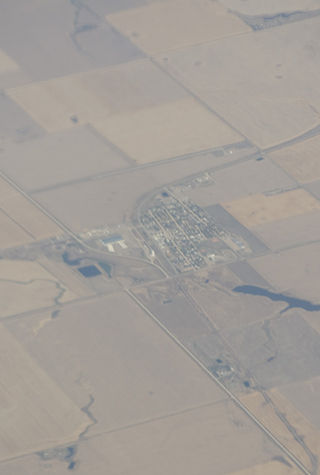
Christopher Lake is a village in the Canadian province of Saskatchewan within the District of Lakeland No. 521 and Census Division No. 15. The village lies in the boreal forest of central Saskatchewan, 2 km south and east of a large lake of the same name. The village is approximately 40 km north of the City of Prince Albert and about 5 km east of its partner resort area of Emma Lake, west of the junction of Highway 2 and 263. Christopher Lake is home to the Little Red River Cree First Nation band government.
Highway 995, also known as Welcome Street, is a provincial highway in the far north region of the Canadian province of Saskatchewan. It is one of the few highways in Saskatchewan that is completely isolated from the other highways. Seasonal access is provided to Highway 905 by way of the Wollaston Lake Barge.
Highway 945 is a provincial highway in the Canadian province of Saskatchewan. It runs from Highway 24 near Chitek Lake to Highway 943 near Island Lake. It is about 25 kilometres (16 mi) long. The highway provides access to several provincial recreational sites.
Highway 263 is a provincial highway in the Canadian province of Saskatchewan. Saskatchewan's 200-series highways primarily service its recreational areas. The highway runs from Highway 2 to Highway 264 in Prince Albert National Park at Waskesiu Lake. It is about 63 kilometres (39 mi) long.
Highway 264 is a provincial highway in the Canadian province of Saskatchewan. Saskatchewan's 200-series highways primarily service its recreational areas. The highway runs from Highway 2 to Highway 263 in the Prince Albert National Park at Waskesiu Lake. It is about 14 kilometres (8.7 mi) long.
Highway 265 is a provincial highway in the north-east region of Canadian province of Saskatchewan. Saskatchewan's 200-series highways primarily service its recreational areas. The highway runs from Highway 120 to Highway 926 and is about 29 kilometres (18 mi) long.
Highway 931 is a provincial highway in the north-east region of the Canadian province of Saskatchewan. It runs from Highway 926 until it becomes a local road near the Snowfield Lakes. It is about 5 kilometres (3.1 mi) long.
Highway 970 is a provincial highway in the north-easteen region of the Canadian province of Saskatchewan. It runs from the Highway 265 / Highway 926 intersection near Clearsand Lake north to a dead end near Gaire Lake. It is about 15 kilometres (9.3 mi) long.
Highway 983 is a provincial highway in the east-central region of the Canadian province of Saskatchewan.
Highway 982, also known as Little Swan Road, is a provincial highway in the east central region of the Canadian province of Saskatchewan. It runs from Highway 8 to Highway 9 and is about 57 kilometres (35 mi) long.
Highway 923 is a provincial highway in the Canadian province of Saskatchewan. It runs from Highway 922 to a dead end near Listen Lake. It is about 17 kilometres (11 mi) long.
Highway 316 is a provincial highway in the Canadian province of Saskatchewan. The highway is in the RM of Blucher No. 343 and runs from Highway 16 near Clavet north to Highway 5. It is a primary weight highway and the land around it is an industrial and commercial area. The highway intersects with Highway 394 and the Canadian National and Canadian Pacific Railways. It is about 17 kilometres (11 mi) long.
Highway 24 is a provincial highway in the Canadian province of Saskatchewan. It runs from Highway 3 at Spiritwood north to the community of Chitek Lake on Chitek Lake. Highway 24 is about 56 kilometres (35 mi) long.
Lake Lenore is a village in the Canadian province of Saskatchewan within the Rural Municipality of St. Peter No. 369 and Census Division No. 15. The village is about 144 kilometres (89 mi) northeast of the city of Saskatoon. To the north of the village is Lenore Lake, which is designated as a migratory bird sanctuary, an Important Bird Area (IBA) of Canada, and has a National Wildlife Area on Raven Island. Services in Lake Lenore include a school, Co-op Grocery and Agro Service Station, a Credit Union, and Public Library.
Lucky Lake is a village in the Canadian province of Saskatchewan within the Rural Municipality of Canaan No. 225 and Census Division No. 7. The Village is located at the junction of Highway 42, Highway 45 and Highway 646 approximately 90 km northeast of Swift Current, Saskatchewan.
The Meadow Lake Tribal Council (MLTC) is a tribal council representing nine First Nation band governments in the province of Saskatchewan. The council is based in Meadow Lake, Saskatchewan.

The Onion Lake Cree Nation is a Plains Cree First Nations band government in Canada, straddling the Alberta/Saskatchewan provincial border approximately 50 km (31 mi) north of the City of Lloydminster.

