
Fairburn Ings Nature Reserve is a protected area in West Yorkshire, England, noted for its avian biodiversity. The reserve has recorded around 280 bird species, remarkable for an inland site in the United Kingdom. This is explained by the site being on migration routes as well as the diversity of habitats.

Airedale is a geographic area in Yorkshire, England, corresponding to the river valley or dale of the River Aire.

The River Dearne South Yorkshire, England flows roughly east for more than 30 kilometres (19 mi), from its source just inside West Yorkshire. It flows through Denby Dale, Clayton West, Darton, Barnsley, Darfield, Wath upon Dearne, Bolton on Dearne, Adwick upon Dearne and Mexborough to its confluence with the River Don at Denaby Main. Its main tributary is the River Dove, which joins it at Darfield. The river was one of those affected by the 2007 United Kingdom floods.
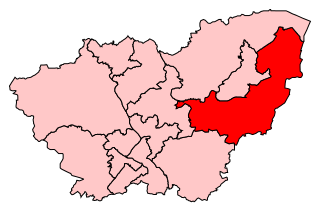
Don Valley is a constituency in South Yorkshire represented in the House of Commons of the UK Parliament since 2019 by Nick Fletcher of the Conservative Party.

The Yorkshire Wildlife Trust is a wildlife trust that covers the Yorkshire and the Humber region of England. When it was founded, it covered the traditional county of Yorkshire, England, but under the 1974 county boundary changes, some of the trust's boundaries were amended to reflect those changes. The Trust is part of the UK-wide partnership of 46 Wildlife Trusts. It was formed in 1946, as the Yorkshire Naturalists’ Trust, essentially to preserve its first nature reserve Askham Bog on the outskirts of York. It now manages more than ninety reserves across the county, including some of the best wildlife sites in the UK. These nature reserves cover the diversity of Yorkshire's landscape, from woodland to grassland, wetland and moorland, fen and bog, and river and coast. One of the flagship reserves is Potteric Carr, a mixed wetland habitat to the south of Doncaster.

RSPB Dearne Valley Old Moor is an 89-hectare (220-acre) wetlands nature reserve in the Dearne Valley near Barnsley, South Yorkshire, run by the Royal Society for the Protection of Birds (RSPB). It lies on the junction of the A633 and A6195 roads and is bordered by the Trans Pennine Trail long-distance path. Following the end of coal mining locally, the Dearne Valley had become a derelict post-industrial area, and the removal of soil to cover an adjacent polluted site enabled the creation of the wetlands at Old Moor.

Clifton Without is a suburb and civil parish in the unitary authority of the City of York, North Yorkshire, England. It consists of those parts of Clifton that lie outside, i.e. Without, the (pre-1996) city boundaries and Clifton Moor. It lies on the A19 about two miles north-west of central York.

The Maltby Main Colliery was a coal mine located 7 miles (11 km) east of Rotherham on the eastern edge of Maltby, South Yorkshire, England. The mine was closed in 2013.

Denaby United Football Club is a football club based in Denaby, Doncaster, South Yorkshire, England. They are currently members of the Doncaster & District Senior League Premier Division.

Ings is an old word of Norse origin referring to water meadows and marshes, including those that were part of the Humber flood plain.

Derwent Ings is a Site of Special Scientific Interest (SSSI) divided between North Yorkshire and the East Riding of Yorkshire, England. Derwent Ings is of international significance and has been designated a Wetland of International Importance under the Ramsar Convention and as a Special Protection Area under the terms of the European Community Directive. Part of the site is owned by the Yorkshire Wildlife Trust and is managed in conjunction with English Nature. It lies adjacent to the River Derwent between Sutton upon Derwent and Menthorpe. The site, which was designated a SSSI in 1975, consists of a series of neutral alluvial flood meadows, fen and swamp communities and freshwater habitats. It is one of the most important examples of agriculturally unimproved species-rich alluvial flood meadow habitat remaining in the UK.
Dinnington Main Colliery was a coal mine situated in the village of Dinnington, near Rotherham, South Yorkshire, England.
The 1965–66 Yorkshire Football League was the 40th season in the history of the Yorkshire Football League, a football competition in England.
The 1967–68 Yorkshire Football League was the 42nd season in the history of the Yorkshire Football League, a football competition in England.
The 1980–81 Yorkshire Football League was the 55th season in the history of the Yorkshire Football League, a football competition in England.

A Flash is a body of water that forms where the land below it has subsided. Whilst these are mostly found in areas where mining has taken place, some can occur naturally. Collectively they are known as Flashes

Bishop Monkton Ings is a Site of Special Scientific Interest, or SSSI, situated east of Bishop Monkton village in North Yorkshire, England. It consists mostly of marshy, calcareous grassland, with some broadleaved woodland, and some fen alongside the two watercourses which run through the site. This varied wetland forms a habitat for a variety of plants, including the semi-parasitic marsh lousewort (Pedicularis palustris).

Mar Field Fen is a Site of Special Scientific Interest, or SSSI, north of Masham, North Yorkshire, England, in a rural area known as Marfield. It is situated on land containing woodland carr, fen, spring-fed marshy grassland and drier calcareous grassland, between the River Ure to the east and Marfield Wetland nature reserve to the west. As "one of the best examples of fen habitat in the Vale of York," it is a protected habitat for a variety of plants, including the common butterwort, a carnivorous plant. There is no public access to this site.

Wyke Beck is a stream that runs from Roundhay Park to the River Aire in east Leeds, West Yorkshire, England. Described as an Urban Beck, the stream flows through housing estates and then an industrial landscape in its lower reaches. Wyke Beck has been prone to flooding so often, that remediation of its course and flood storage schemes have been initiated by Leeds City Council.

