
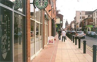
Alhambra Shopping Centre, also known by its former name The Mall Barnsley, is Barnsley's main shopping complex, housing 41 shops and adjacent to Barnsley Market. The centre was opened in 1991. A number of chains have been in the centre in the past, most notable was Woolworths which ceased trading in December 2008. It was owned and operated by shopping centre operator The Mall Fund until its sale to F&C REIT in September 2011. The centre was in receivership since 2021. On 29 September 2023, Barnsley Council completed its takeover of The Alhambra Shopping Centre. In the centre there are a number of small retail stalls which encourage independent businesses to start.

Southey ward—which includes the districts of Fox Hill, New Parson Cross, Southey, Wadsley Bridge, and part of Old Parson Cross—is one of the 28 electoral wards in City of Sheffield, England. It is located in the northern part of the city and covers an area of 1.8 square miles. The population of this ward in 2011 was 19,086 people in 8,295 households. It is one of the wards that make up the Sheffield Brightside and Hillsborough constituency.

City ward — which includes the districts of Highfield, Kelham Island and the city centre — is one of the 28 electoral wards in City of Sheffield, England. It covers the central area of the city. The ward was created following the 2015 local government boundary review out of part of the old Central ward, which, with a population of 36,412, was the largest ward in the UK. City is one of the wards that make up the Sheffield Central constituency.

Castle Market was an indoor market in Sheffield city centre, England. The building lay in the north-east of the present city centre, by the River Don, and was built on top of the remains of Sheffield Castle, which could still be seen via guided tours. The market closed in 2013 when the Moor Market opened on The Moor, further south in Sheffield city centre, and demolition began in 2015.

Fargate is a pedestrian precinct and shopping area in Sheffield, England. It runs between Barker's Pool and High Street opposite the cathedral. It was pedestrianised in 1973. Fargate also holds a Continental Market approximately 4 times a year, which includes European stalls selling cheeses, confectionery, clothing, plants and crafts including jewellery and ornaments.
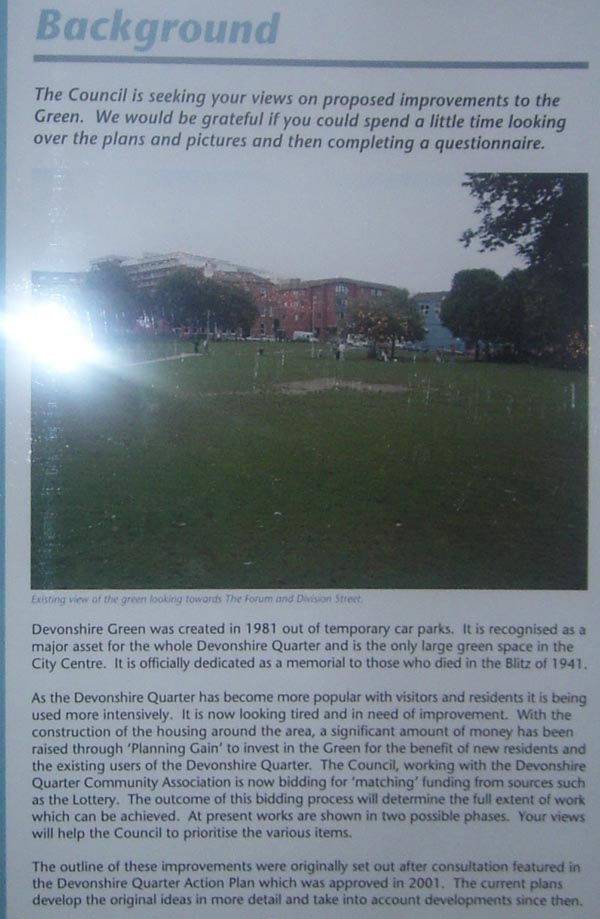
The Devonshire Quarter is an area in the centre of Sheffield, England. Its heart is the Division Street and Devonshire Street shopping areas, known for their small independent shops and variety of pubs and bars. The district also has The Forum shopping centre and Devonshire Green, one of the largest open areas in central Sheffield.

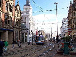
Fitzalan Square is a municipal square situated in the city centre of Sheffield in South Yorkshire, England. The present day square is one of the busiest areas of the city centre, with traffic and pedestrians continually moving through the area. It has a Sheffield Supertram stop and a taxi rank.

Sheaf Square is a municipal square lying immediately east of the city centre of Sheffield, England.
Buildings and structures in Sheffield have been constructed over a time-span ranging from the 13th century to the present day. The majority of Sheffield's older buildings were built during the Industrial Revolution, with many medieval buildings demolished in the 19th century; some older buildings were lost during the Sheffield Blitz. Sheffield can only lay claim to five Grade I listed buildings, two of which are in the city centre.

Sheffield City Centre is a district of the City of Sheffield and is covered partly by the City ward of the City of Sheffield. It includes the area that is within a radius of roughly 0.75 miles (1.2 km) of Sheffield Cathedral and is encircled by the Inner Ring Road, a circular route started in the late 1960s and completed in 2007. As well as the cathedral, buildings in the city centre include the Grade I listed Town Hall, the City Hall and the Winter Gardens. Several areas of the city centre have been designated as quarters. It is home to the city's major business, transport, leisure and cultural attractions.
Heart of the City II is a mixed-use development under construction in Sheffield city centre, England between the Devonshire Quarter and The Moor Gateway. The project was previously given the marketing name Sevenstone, prior to Hammerson, the developer, being dropped from the project in December 2013 with Sheffield City Council seeking new developers.
High Street is one of the main thoroughfares and shopping areas in the city centre of Sheffield in South Yorkshire, England, located at the approximate grid reference of SK356874. High Street starts at the Commercial Street, Fitzalan Square and Haymarket junction and runs for approximately 400 metres west to conclude near the Sheffield Cathedral where it forms a Y-junction with Fargate and Church Street. High Street has the traditional wide variety of shops, financial institutions and eating places which are associated with any British town centre.

Tudor Square is a city square in the city of Sheffield, England. The square is home to the largest concentration of theatres in the UK outside London and has thus become known as Sheffield's ‘Theatre Land’. The Square lies at the heart of the city centre, only metres away from the town hall, major attractions such as the Winter Gardens and is only 5 minutes away from Sheffield railway station.

Millennium Square is a modern city square in Sheffield, England. It was created as part of the Heart of the City project that began in 1998 and has become a central feature in Sheffield's redeveloped city centre. It contains fountains in the shape of steel spheres, recalling Sheffield's past as a centre of the steel making industry, whilst linking with the fountains of the Peace Gardens, as well as Sheaf Square, Hallam Square and Barkers Pool. The square forms part of the 'Gold Route', designed by Sheffield City Council to guide visitors through the city centre from Sheffield Station to Devonshire Green.

West One is a mixed-use development at the centre of the Devonshire Quarter in the city centre of Sheffield, South Yorkshire, England. It comprises bars, restaurants and shops at ground-level and apartments housing over 1,000 people above, including a penthouse. It faces onto Devonshire Green, and provides easy access to the Moor and Division Street.
Victoria Hall is a Methodist place of worship situated on Norfolk Street in Sheffield city centre. It is the most important Methodist building in Sheffield and it is a Grade II listed building. It is a large many roomed building which stands between the side streets of Chapel Walk and George Street. Although the main entrance to the church is on Norfolk Street, there is a separate administration entrance on Chapel Walk.
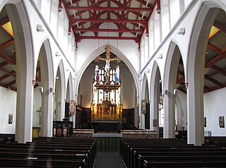
St Matthew's Church, more usually known as St Matthew's Carver Street, is situated on Carver Street in the centre of Sheffield, South Yorkshire, England. It is a Grade II listed building located at grid reference SK351871. The church is part of the Anglo-Catholic movement.

Redvers House is an office block situated on Union Street in the centre of the city of Sheffield in South Yorkshire, England.

Longley Park is a public park within the City of Sheffield, South Yorkshire, England. The park lies between the suburbs of Longley and Firth Park, four km north of the city centre. It covers an area of just under 52 acres and is the third largest public park in Sheffield.

Ringway Centre is a Grade B locally listed building located on Smallbrook Queensway in the city centre of Birmingham, England. The six-storey, 230 metres (750 ft) long building was designed by architect James Roberts as part of the Inner Ring Road scheme in the 1950s and is notable for its gentle sweeping curved frontal elevation.

