Dexter, Texas

Last updated

Dexter, Texas
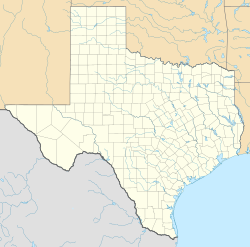
USA Texas location map.svg
Red pog.svg
Dexter
Usa edcp location map.svg
Red pog.svg
Dexter
Coordinates: 33°49′7″N96°57′49″W / 33.81861°N 96.96361°W / 33.81861; -96.96361
Country United States
State Texas
County Cooke
Elevation
778 ft (237 m)
Time zone UTC-6 (Central (CST))
 • Summer (DST) UTC-5 (CDT)
Area code 940
GNIS feature ID1355990 [1]

Dexter is an unincorporated community in Cooke County, Texas, United States. [1] According to the Handbook of Texas, the community had a population of 18 in 2000. It is located within the Dallas-Fort Worth Metroplex.

Contents

History

On September 8, 1986, an Amoco gas condensate pipeline leaked.14 people were injured. [2] [3]

The Washington House on Sycamore Creek Ranch in the community was listed on the National Register of Historic Places. [4]

Geography

Dexter is located on Farm to Market Road 678 near the Red River, 25 mi (40 km) northeast of Gainesville, 8.7 mi (14.0 km) east-northeast of Callisburg, and 11.5 mi (18.5 km) west-northwest of Whitesboro in extreme northeastern Cooke County. [5]

Education

Dexter had its own school in the early 1880s. [6] Today, Dexter is served by the Whitesboro Independent School District.

Notable people

References

  1. 1 2 U.S. Geological Survey Geographic Names Information System: Dexter, Texas
  2. ↑ "The Bonham Daily Favorite - Google News Archive Search". google.com. Archived from the original on June 8, 2020. Retrieved January 18, 2016.
  3. ↑ "Leak in Pipeline Blamed for Fumes". NewsOK.com. Archived from the original on March 3, 2016. Retrieved January 18, 2016.
  4. ↑ https://atlas.thc.texas.gov/Details/5097005722
  5. ↑ "Dexter, Texas". Texas Escapes Online Magazine. Retrieved July 4, 2024.
  6. ↑ Dexter, TX from the Handbook of Texas Online
  7. ↑ Texas Legislative Reference Library-Texas Legislators Past and Present-William H. Bourland
  8. ↑ Coffey, Michael (2004). 27 Men Out: Baseball's Perfect Games . Atria Books. pp. 36–51.