
Spurr Township is a civil township of Baraga County in the U.S. state of Michigan. The population was 262 at the 2020 census.

Lake Fenton is a census-designated place (CDP) in Fenton Charter Township, Genesee County in the U.S. state of Michigan. As of the 2010 census the population was 5,559, up from 4,876 at the 2000 census. The CDP includes the unincorporated communities of Bayport Park and Lakeside.

Portage Charter Township is a charter township of Houghton County in the U.S. state of Michigan. As of the 2010 census, the township population was 3,221. The city of Houghton is adjacent to the north side of the township. Portage Lake is the eastern boundary in the north, and the township extends well south of Houghton to the Baraga County line.

Allouez Township is a civil township of Keweenaw County in the U.S. state of Michigan. The population was 1,428 at the 2020 census.

Eagle Harbor Township is a civil township of Keweenaw County in the U.S. state of Michigan. The population was 217 at the 2020 census. The township is located on the Keweenaw Peninsula and also includes the southwestern portion of Isle Royale National Park.

Prudenville is an unincorporated community and census-designated place (CDP) in Roscommon County in the U.S. state of Michigan. The population was 1,643 at the 2020 census. Prudenville is located within Denton Township.
Hurontown is an unincorporated community and census-designated place (CDP) in Houghton County in the U.S. state of Michigan. The community is located immediately south of the city of Houghton. The CDP had a population of 244 at the 2020 census.
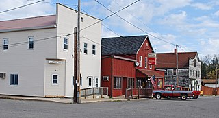
Amasa is an unincorporated community and census-designated place (CDP) in Iron County in the U.S. state of Michigan. The population of the CDP was 195 at the 2020 census. The community is located within Hematite Township.
Atlantic Mine is an unincorporated community and census-designated place (CDP) in Houghton County in the U.S. state of Michigan. The CDP had a population of 565 at the 2020 census. The community is located just southwest of the city of Houghton in Adams Township. Atlantic Mine is located in the Copper Country region of Michigan's Upper Peninsula. The community is named for the eponymous Atlantic Mine.

Brimley is an unincorporated community and census-designated place (CDP) in Chippewa County in the U.S. state of Michigan. The CDP had a population of 504 at the 2020 census. Brimley is located in Michigan's Upper Peninsula, and is located along the southern shore of Lake Superior. The community is located within Superior Township.

Elm Hall is an unincorporated community and census-designated place (CDP) in Gratiot County in the U.S. state of Michigan. The CDP had a population of 279 at the 2020 census. The community is located within Sumner Township.

Eagle River is an unincorporated community and census-designated place (CDP) in the U.S. state of Michigan. It is the county seat of Keweenaw County. Its population was 65 at the 2020 census, which makes it by far the least-populated county seat in the state of Michigan. As an unincorporated community, Eagle River has no legal autonomy and is part of Allouez Township and Houghton Township.
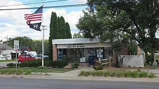
Rapid City is an unincorporated community and census-designated place (CDP) in Kalkaska County in the U.S. state of Michigan. At the 2020 census, the CDP had a population of 1,357. Rapid City is located within Clearwater Township, and is about 8 miles (13 km) northwest of Kalkaska.

Three Lakes is an unincorporated community and census-designated place (CDP) in Baraga County in the U.S. state of Michigan. The CDP had a population of 167 at the 2020 census. Three Lakes is located within Spurr Township.

Skanee is an unincorporated community and census-designated place (CDP) in Baraga County in the U.S. state of Michigan. The CDP had a population of 102 at the 2020 census. Skanee is located in Arvon Township on the shore of Huron Bay, a bay of Lake Superior.

Cambria is an unincorporated community and census-designated place (CDP) in Hillsdale County in the U.S. state of Michigan. The population of the CDP was 258 at the 2020 census. The community is located within Cambria Township.

Chassell is an unincorporated community and census-designated place (CDP) in Houghton County in the U.S. state of Michigan. The CDP had a population of 876 at the 2020 census. Chassell is located within Chassell Township, and is located on the shore of Portage Lake in the Upper Peninsula. As an unincorporated community, Chassell has no legal autonomy of its own, however it does have a post office with the ZIP code 49916.

Ponshewaing is an unincorporated community and census-designated place (CDP) in Emmet County in the U.S. state of Michigan. As of the 2010 census, the CDP had a population of 69. It is located within Littlefield Township.
Fulton is an unincorporated community and census-designated place (CDP) in Keweenaw County in the U.S. state of Michigan. The CDP had a population of 149 at the 2020 census. The community is located in Allouez Township, immediately southeast of the community of Mohawk. Fulton is located in the Copper Country region of Michigan's Upper Peninsula.

Lakes of the North is an unincorporated community and census-designated place (CDP) in Antrim County in the U.S. state of Michigan. The CDP is located in Mancelona Township to the south and Star Township to the north. The population of the CDP was 1,044 at the 2020 census.


