Dolls Point, New South Wales

Last updated

Dolls Point
Sydney,  New South Wales
Dolls Point, New South Wales
Population1,661 (2016 census) [1]
Postcode(s) 2219
Location17 km (11 mi) south of Sydney CBD
LGA(s) Bayside Council
State electorate(s) Rockdale
Federal division(s) Cook
Suburbs around Dolls Point:
Sans Souci Sans Souci
Sans Souci Dolls Point Botany Bay
Sans Souci Sandringham

Dolls Point is a small suburb in southern Sydney, in the state of New South Wales, Australia. Dolls Point is located 17 km south of the Sydney central business district and is part of the St George area. Dolls Point is in the local government area of the Bayside Council.

Contents

History

Dolls Point was originally a deserted landscape, which was considered uninhabitable. The origins of the name are unclear but legend has it that it was named for an escaped convict who took shelter in the dire landscape to hide from the authorities. [2]

The area between Cooks River and Georges River was originally known as Seven Mile Beach. It was changed to Lady Robinsons Beach in 1874 to honour the wife of Governor Sir Hercules Robinson. Cook Park is named after Samuel Cook who advocated it as a public pleasure area.

Historic Primrose House became the Royal South Sydney Community Health Centre.

Geography

Dolls Point takes its name from the geographical formation on Botany Bay. Cook Park runs along the eastern border and the beach stretches from Dolls Point to Sandringham Bay. Dolls Point is a quiet residential suburb that has managed to maintain an uncluttered landscape. Its village feel makes it a family friendly neighbourhood. It is home to fine sailing, water views and abundant parkland.

Dolls Point beach

One of the main attractions is Doll Point Beach, which has the whitest sand in Sydney. Fishing and kite surfing are popular activities in the beach. [3] The beach sets out at the rock groyne and continues to the southwest for 550 metres past a seawall and a small tidal pool to a western deviation in the sandy shore at a groyne in front of a sailing club in Georges River. The beach is fairly precipitous and reflective, which is opposite of the deep 1 km wide river mouth to Towra Point. [4]

Commercial area

A small group of shops, along with the Sans Souci Library, are located at the intersection of Clareville Avenue and Russell Avenue, on the border with Sans Souci and Sandringham.

Population

According to the 2016 census of Population, there were 1,661 residents in Dolls Point. 62.3% of people were born in Australia. 56.3% of people spoke only English at home. Other languages spoken at home included Greek at 12.6%. The most common responses for religious affiliation were Catholic 26.1%, Eastern Orthodox 20.0%, No Religion 17.1% and Anglican 10.3%. [1]

Related Research Articles

<span class="mw-page-title-main">Brighton-Le-Sands, New South Wales</span> Suburb of Sydney, New South Wales, Australia

Brighton Le Sands, is a suburb in southern Sydney, in the state of New South Wales, Australia. Brighton Le Sands is located 13 kilometres south of the Sydney central business district, on the western shore of Botany Bay. Brighton Le Sands is in the local government area of the Bayside Council and is part of the St George area.

<span class="mw-page-title-main">Division of Cook</span> Australian federal electoral division

The Division of Cook is an Australian electoral division in the State of New South Wales.

<span class="mw-page-title-main">Zetland, New South Wales</span> Suburb of Sydney, New South Wales, Australia

Zetland is an inner southern suburb of Sydney, New South Wales, Australia 4 kilometres south of the Sydney central business district, in the local government area of the City of Sydney.

<span class="mw-page-title-main">Sans Souci, New South Wales</span> Suburb of Sydney, New South Wales, Australia

Sans Souci is a Southern Sydney suburb in the state of New South Wales, Australia. Sans Souci is 17 kilometres south of the Sydney central business district and lies across the local government areas of the Bayside Council and the Georges River Council. It is part of the St George area.

<span class="mw-page-title-main">Sandringham, New South Wales</span> Suburb of Sydney, New South Wales, Australia

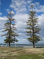
Sandringham is a suburb in southern Sydney, in the state of New South Wales, Australia. Sandringham is located 18 kilometres south of the Sydney central business district and is part of the St George area. Sandringham is in the local government area of the Bayside Council.

<span class="mw-page-title-main">Roselands, New South Wales</span> Suburb of Sydney, New South Wales, Australia

Roselands is a suburb to the south-west of the Sydney CBD, in the state of New South Wales, Australia. Roselands is located 16 kilometres south-west of the Sydney central business district in the City of Canterbury-Bankstown. It is one of the easternmost suburbs in the Western Sydney area and is one of the major suburbs in Sydney without a train station.

<span class="mw-page-title-main">Ramsgate, New South Wales</span> Suburb of Sydney, New South Wales, Australia

Ramsgate is a suburb in southern Sydney, in the state of New South Wales, Australia 16 km south of the Sydney central business district. It is part of the St George area. Divided by Rocky Point Road, part of Ramsgate to the east of Rocky Point Road is in the local government area of the Bayside Council, whilst properties to the west of Rocky Point Road are in the Georges River Council. Ramsgate Beach is a separate suburb, to the east.

<span class="mw-page-title-main">Monterey, New South Wales</span> Suburb of Sydney, New South Wales, Australia

Monterey is a suburb in southern Sydney, in the state of New South Wales, Australia 15 km south of the Sydney central business district and is part of the St George area. Monterey is in the local government area of the Bayside Council.

<span class="mw-page-title-main">Kogarah Bay</span> Suburb of Sydney, New South Wales, Australia

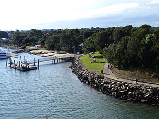
Kogarah Bay is a suburb in southern Sydney, in the state of New South Wales, Australia 16 kilometres south of the Sydney central business district. It is part of the St George area. Kogarah Bay is in the local government area of the Georges River Council.

<span class="mw-page-title-main">Kyeemagh</span> Suburb of Sydney, New South Wales, Australia

Kyeemagh is a suburb in southern Sydney, in the state of New South Wales, Australia. It is 12 kilometres south of the Sydney central business district, on the western shore of Botany Bay. Kyeemagh is in the local government area of the Bayside Council and is part of the St George area.

<span class="mw-page-title-main">Belfield, New South Wales</span> Suburb of Sydney, New South Wales, Australia

Belfield is a suburb of Sydney, in the state of New South Wales, Australia. It is 8 miles (13 km) southwest of the Sydney central business district, in the local government area of the City of Canterbury-Bankstown and partly in the Municipality of Strathfield.

<span class="mw-page-title-main">Banksmeadow</span> Suburb of Sydney, New South Wales, Australia

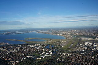
Banksmeadow is a suburb located in the Eastern Suburbs of Sydney, within the state of New South Wales, Australia. Situated 11 kilometres south of the Sydney central business district, it falls under the jurisdiction of the Bayside Council. Banksmeadow is positioned on the northern shores of Botany Bay.

<span class="mw-page-title-main">Beverley Park, New South Wales</span> Suburb of Sydney, New South Wales, Australia

Beverley Park is a suburb in southern Sydney, in the state of New South Wales, Australia. Beverley Park is located 15 kilometres south of the Sydney central business district, in the Georges River Council and is part of the St George area.

<span class="mw-page-title-main">Bilgola Beach, New South Wales</span> Suburb of Sydney, New South Wales, Australia

Bilgola Beach is a suburb in northern Sydney, in the state of New South Wales, Australia 33 kilometres north-east of the Sydney central business district, in the local government area of Northern Beaches Council. It is part of the Northern Beaches region. It and Bilgola Plateau were gazetted as suburbs in 2012 dividing the previous suburb of Bilgola.

<span class="mw-page-title-main">Clareville, New South Wales</span> Suburb of Sydney, New South Wales, Australia

Clareville is a suburb in northern Sydney, in the state of New South Wales, Australia. Clareville is 36 kilometres north-east of the Sydney central business district, in the local government area of Northern Beaches Council. Clareville is part of the Northern Beaches region.

<span class="mw-page-title-main">Ramsgate Beach, New South Wales</span> Suburb of Sydney, New South Wales, Australia

Ramsgate Beach is a suburb in southern Sydney, in the state of New South Wales, Australia. Ramsgate Beach is located 16 kilometres south of the Sydney central business district, in the Bayside Council and is part of the St George area. The postcode is 2217. Ramsgate is a separate suburb, to the west.

<span class="mw-page-title-main">Lady Robinsons Beach</span>

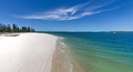
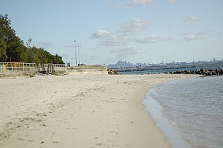
Lady Robinsons Beach is the stretch of beach between the mouth of the Cooks River and the mouth of Georges River on the western shore of Botany Bay in Sydney, New South Wales, Australia. Originally known as Seven Mile Beach, it was renamed after the wife of the then Governor, Sir Hercules Robinson. Isolated settlements separated from the beach by sand dunes were also given the name of Lady Robinson's Beach as their postal address.

<span class="mw-page-title-main">Elvina Bay</span> Suburb of Sydney, New South Wales, Australia

Elvina Bay is a bay and adjacent suburb in northern Sydney, in the state of New South Wales, Australia. It is located 35 kilometres north of the Sydney central business district, in the local government area of Northern Beaches Council.

<span class="mw-page-title-main">Trolleybuses in Sydney</span> Trolleybus system in Sydney, New South Wales

The Sydney trolleybus system in New South Wales consisted of two unconnected lines in the Eastern Suburbs and St George areas of Sydney.

References

  1. 1 2 Australian Bureau of Statistics (27 June 2017). "Dolls Point (State Suburb)". 2016 Census QuickStats. Retrieved 11 April 2018. OOjs UI icon edit-ltr-progressive.svg
  2. The Book of Sydney Suburbs, Compiled by Frances Pollon, Angus & Robertson Publishers, 1990, Published in Australia ISBN   0-207-14495-8, page 240
  3. Dolls Point Beach
  4. Dolls Point

33°59′38″S151°08′35″E / 33.99386°S 151.14301°E / -33.99386; 151.14301