Lingewaard is a municipality in the eastern Netherlands. It is located in the province of Gelderland, in the most eastern part of the Betuwe. The municipality is situated in the lowlands between the major cities of Arnhem and Nijmegen, where most inhabitants work. Lingewaard was part of the Arnhem–Nijmegen metropolitan area until 2015.

IJzevoorde is a hamlet in the municipalities of Doetinchem and Bronckhorst in the province of Gelderland in the east part of the Netherlands.

Wordragen is a Dutch hamlet, north of Ammerzoden in the Maasdriel municipality of Gelderland province.

Aalst is a hamlet in the Dutch province of Gelderland. It is a part of the municipality of Buren, and lies about 10 km southwest of Wageningen.

Asch is a village in the Dutch province of Gelderland. It is a part of the municipality of Buren, and lies about 9 km northwest of Tiel.

Eck en Wiel is a village in the Dutch province of Gelderland. It is a part of the municipality of Buren, and lies about 9 km southwest of Veenendaal.

Hoogmeien is a hamlet in the Dutch province of Gelderland. It is a part of the municipality of Buren, and lies about 8 km northeast of Tiel.

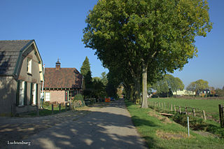
Luchtenburg is a hamlet in the Dutch province of Gelderland. It is a part of the municipality of Buren, and is located in about 8 km southwest of Veenendaal.

Lutterveld is a hamlet in the Dutch province of Gelderland. It is a part of the municipality of Buren, and lies about 4 km west of Tiel.

Ravenswaaij is a village in the Dutch province of Gelderland. It is a part of the municipality of Buren, and lies about 10 km northwest of Tiel.

Zandberg is a hamlet in the Dutch province of Gelderland. It is a part of the municipality of Buren, and lies about 9 km northwest of Tiel.
Zwarte Paard is a hamlet in the Dutch province of Gelderland. It is a part of the municipality of Buren, and lies about 7 km north of Tiel.
Kapel is a hamlet in the Dutch province of Gelderland. It is located in the municipality of Lingewaard, about 1 km north of the town of Gendt.

Californië is a hamlet in the Dutch province of Gelderland. It is located in the municipality of Maasdriel, between the villages Ammerzoden and Hedel.

Almen is a village in the Dutch province of Gelderland. It is in the municipality Lochem, about 7 km east of the city of Zutphen.

Baal is a hamlet in the Dutch province of Gelderland. It is located in the municipality of Lingewaard, about 1 km northeast of Bemmel, and located 1 kilometer north of Haalderen and is therefore part of Haalderen.

Hierden is a farming village in the centre-east of Netherlands. It is located in the municipality of Harderwijk, Gelderland.

Ooij is a village in the eastern Netherlands. It is located in the municipality of Berg en Dal, Gelderland.

Persingen is a village situated in the municipality of Berg en Dal in the province of Gelderland. In 2021, Persingen had 105 inhabitants. The village claims to be the smallest village of the Netherlands for tourist reasons, however there are many more contestants who are much smaller; the former island of Schokland and the former squatter village of Ruigoord have the best credentials.

Hulhuizen is a hamlet near Gendt in the municipality of Lingewaard in the province of Gelderland, the Netherlands. Hulhuizen became Dutch in 1817 together with Huissen.


