Dorstone

Last updated

Dorstone
Triangular village green, Dorstone - geograph.org.uk - 3136307.jpg
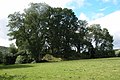
The village green, Dorstone
Herefordshire UK location map.svg
Red pog.svg
Dorstone
Location within Herefordshire
Population401 (2011) [1]
OS grid reference SO313418
Unitary authority
Ceremonial county
Region
Country England
Sovereign state United Kingdom
Post town HEREFORD
Postcode district HR3
Dialling code 01981
Police West Mercia
Fire Hereford and Worcester
Ambulance West Midlands
UK Parliament
List of places
UK
England
Herefordshire
52°04′13″N3°00′06″W / 52.0703°N 3.0016°W / 52.0703; -3.0016

Dorstone is a village within the Golden Valley, Herefordshire, England. There is a church [2] and public house [3] with restaurant. The Golden Valley area offers hillwalking and horseback riding countryside and is noted for its scenery. It is within the catchment area of Fairfield secondary school.

Contents

Dorstone was once the location of Dorstone Castle. [4] A mile to the south the fragmentary remains of Snodhill Castle can still be seen. [5] [6] From 2014 to 2018, the Historic Buildings and Monuments Commission for England (Historic England) put £150,000 into scientific and historical study of the Snodhill Castle site, plus an additional £500,000 grant to the Snodhill Castle Preservation Trust to complete clearing and restoration of the remains of Snodhill Castle, with the site opening to the public as of May 2018. [7] [8]

St. Faith's parish church in Dorstone was reputedly built by Richard de Brito, one of the knights who murdered Thomas Becket, as penance for the murder. He also built the Pandy Inn in Dorstone to house the workmen who built the church. During Victorian era rebuilding of the church in the 1890s a tomb to another de Brito was found which contained a pewter chalice. This was housed in the church for many years, but was stolen in 2006.

The Dorstone History Society seeks to study the church and the village – which stretches back to Neolithic times as suggested by the local Arthur's Stone, an ancient monument. This is said to be the spot where King Arthur slew a giant who left the impression of his elbows on one of the stones as he fell. [9]

An annual sloe gin competition is held in Dorstone. [10] Each year the winner is crowned the "Grand Master of the Sloes". [11]

Railway

The Golden Valley Railway branch line to Hay-on-Wye was opened on 1 September 1881 as far as Dorstone and later extended to Hay-on-Wye. The new line involved considerable additions to the track layout and buildings where it joined an existing line at the junction station of Pontrilas.

The last passenger train from Dorstone was on 23 August 1951.

Related Research Articles

<span class="mw-page-title-main">River Monnow</span> River in Herefordshire and Monmouthshire, United Kingdom

The River Monnow marks the England–Wales border for much of its 42 miles (68 km) length. After flowing through southwest Herefordshire, England, and eastern Monmouthshire, Wales, its confluence with the River Wye is approximately 13 mile (0.54 km) south of Monmouth.

<span class="mw-page-title-main">Monmouthshire</span> County in Wales

Monmouthshire is a county in the south east of Wales. It borders Powys to the north; the English counties of Herefordshire and Gloucestershire to the north and east; the Severn Estuary to the south, and Torfaen, Newport and Blaenau Gwent to the west. The largest town is Abergavenny, and the administrative centre is Usk.

<span class="mw-page-title-main">Ross-on-Wye</span> Market town in Herefordshire, England

Ross-on-Wye is a market town and civil parish in Herefordshire, England, near the border with Wales. It had a population estimated at 10,978 in 2021. It lies in south-east of the county, on the River Wye and on the northern edge of the Forest of Dean.

<span class="mw-page-title-main">Sloe gin</span> Red liqueur made from gin and blackthorn drupes

Sloe gin is a British red liqueur made with gin and blackthorn fruits (sloes), which are the drupe fruit of the Prunus spinosa tree, which is a relative of the plum. As an alcoholic drink, sloe gin contains between 15 per cent and 30 per cent alcohol by volume (ABV); however, European Union regulations established 25 per cent ABV as the minimal alcoholic content for the blackthorn beverage to be a sloe gin. Historically, despite being a liqueur based upon gin, the EU included the colloquial name sloe gin to the legal definitions; thus, sloe gin is the only alcoholic beverage that legally uses the term gin without appending the liqueur suffix.

<span class="mw-page-title-main">Herefordshire</span> County of England

Herefordshire is a ceremonial county in the West Midlands of England. It is bordered by Gloucestershire to the south-east, Worcestershire to the east, Shropshire to the north and the Welsh counties of Monmouthshire and Powys to the west. The city of Hereford is the largest settlement and the county town.

<span class="mw-page-title-main">Goodrich, Herefordshire</span> Village in England

Goodrich is a village in south Herefordshire, England close to Gloucestershire and the Forest of Dean, situated near the River Wye at grid reference SO574193. It is known for its Norman and mediaeval castle built with Old Red Sandstone.

<span class="mw-page-title-main">Much Marcle</span> Human settlement in England

Much Marcle is a village and civil parish in Herefordshire, England, located 7 miles (11 km) north-east of Ross-on-Wye. The 2011 Census recorded the parish's population as 660. The name Marcle comes from the Anglo-Saxon word for a boundary field, mearc-leah. Much, in this case, means large or great, from the Middle English usage of the word.

Stow Hill is a community civil parish and coterminous electoral district (ward) of the City of Newport, South Wales.

<span class="mw-page-title-main">Geograph Britain and Ireland</span> Web archive of geographically located images

Geograph Britain and Ireland is a web-based project, begun in March 2005, to create a freely accessible archive of geographically located photographs of Great Britain and Ireland. Photographs in the Geograph collection are chosen to illustrate significant or typical features of each 1 km × 1 km (100 ha) grid square in the Ordnance Survey National Grid and the Irish national grid reference system. There are 332,216 such grid squares containing at least some land or permanent structure, of which 280,037 have Geographs.

<span class="mw-page-title-main">Ganarew</span> Human settlement in England

Ganarew is a village and small civil parish in south Herefordshire, England near the River Wye and the border with Wales. The village is located 0.62 miles (1.00 km) southwest of the village of Whitchurch on the main A40 road, and lies within the electoral ward of Kerne Bridge. The village is about 2 miles (3.2 km) from Monmouth and 8 miles (13 km) from Ross-on-Wye. It contains the Church of St Swithin and Ganarew Manor.

<span class="mw-page-title-main">Golden Valley (Herefordshire)</span> Valley in Herefordshire, United Kingdom

The Golden Valley is the name given to the valley of the River Dore in western Herefordshire, England. The valley is a picturesque area of gently rolling countryside. It lies in the lee of the Black Mountains, Wales.

<span class="mw-page-title-main">A606 road</span> Road in East Midlands

The A606 is an A road in England that starts in West Bridgford, on the outskirts of Nottingham, and heads southeastwards through Leicestershire and the towns of Melton Mowbray and Oakham, terminating at Stamford, Lincolnshire on the former Great North Road.

<span class="mw-page-title-main">Wilton Castle</span> Castle in Herefordshire, England

Wilton Castle is a 12th-century Norman castle located in south-eastern Herefordshire, England on the River Wye adjacent to the town of Ross-on-Wye. The castle is named after the manor associated with it.

<span class="mw-page-title-main">Bernard de Neufmarché</span> 11th-century Norman nobleman in England

Bernard de Neufmarché, also Bernard of Newmarket or Bernard of Newmarch was the first of the Norman conquerors of Wales. He was a minor Norman lord who rose to power in the Welsh Marches before successfully undertaking the invasion and conquest of the Kingdom of Brycheiniog between 1088 and 1095. Out of the ruins of the Welsh kingdom he created the Anglo-Norman lordship of Brecon.

<span class="mw-page-title-main">Arthur's Stone, Herefordshire</span> Dolmen in England

Arthur's Stone is a Neolithic chambered tomb, or dolmen, in Herefordshire, England. It is situated on the ridge line of a hill overlooking both the Golden Valley, Herefordshire and the Wye Valley. The tomb dates from 3,700 BC – 2,700 BC.

<span class="mw-page-title-main">Marches Way</span> Long-distance footpath in the United Kingdom

The Marches Way is a partially waymarked long-distance footpath in the United Kingdom. It runs for 351 kilometres (218 mi) through the Welsh–English borderlands, traditionally known as the Welsh Marches, and links the cities of Chester in the north and Cardiff in the south.

<span class="mw-page-title-main">Devauden</span> Village in Wales

Devauden is a village and community in Monmouthshire, southeast Wales. It is located between Chepstow and Monmouth near the top of the Trellech ridge on the B4293 road. The community covers an area of 3,790 hectares (14.6 sq mi). The community includes the villages of Itton and Wolvesnewton, Llanfihangel-tor-y-mynydd and Newchurch.

<span class="mw-page-title-main">Herefordshire Trail</span>

The Herefordshire Trail is a long distance footpath in Herefordshire, England.

<span class="mw-page-title-main">Llancillo</span> Human settlement in England

Llancillo is a civil parish in south-west Herefordshire, England, and is approximately 13 miles (20 km) south-west from Hereford. The parish borders Wales at the south in which is the nearest town, Abergavenny, 7 miles (11 km) to the south-southwest. In the parish is the isolated Grade II* listed 11th-century Church of St Peter.

<span class="mw-page-title-main">Snodhill Castle</span> Castle in Herefordshire, England

Snodhill Castle is a ruined motte-and-bailey castle, about 1 mi (1.6 km) south of the village of Dorstone in west Herefordshire, England. It is recognized as one of the major castles of the Welsh Marches. It was built in the 11th century to secure the border between Norman England and the Welsh Princes. Archaeological excavations have found that it was one of the first Norman castles in the country to have stone-built fortifications, with more sophisticated defences being added in later centuries.

References

  1. "Civil Parish population 2011". Archived from the original on 4 March 2016. Retrieved 29 October 2015.
  2. "Dorstone Church:: OS grid SO3141 :: Geograph Britain and Ireland – photograph every grid square!". Geograph.org.uk. Retrieved 4 July 2012.
  3. "The Pandy Inn, Dorstone:: OS grid SO3141 :: Geograph Britain and Ireland – photograph every grid square!". Geograph.org.uk. Retrieved 4 July 2012.
  4. "Dorstone Castle:: OS grid SO3141 :: Geograph Britain and Ireland – photograph every grid square!". Geograph.org.uk. Retrieved 4 July 2012.
  5. staff writers (23 October 2016). "Trust takes over Snodhill Castle in Herefordshire". BBC News . Retrieved 17 July 2018.
  6. "Snodhill Castle – 2:: OS grid SO3240 :: Geograph Britain and Ireland – photograph every grid square!". Geograph.org.uk. Retrieved 4 July 2012.
  7. staff writers (9 May 2017). "Snodhill Castle is restored by villagers after £50k (sic) grant". BBC News . Retrieved 17 July 2018.
  8. "Snodhill Castle Has Been Saved!". Historic England . Retrieved 17 July 2018.
  9. "History of Arthur's Stone". English Heritage. Retrieved 11 June 2020.
  10. "Golden Valley annual Sloe Gin Competition prepares for kick off". Hereford Times . 11 January 2011. Retrieved 24 January 2011.
  11. "Dorstone Sloe Gin Competition 2010 – judging this Friday". Hereford Times . 20 January 2010. Retrieved 24 January 2011.