Drummondville Water Aerodrome

Last updated
Drummondville Water Aerodrome
Summary
Airport type Private
Operator SDED - Aéroport de Drummondville
Location Drummondville, Quebec
Time zone EST (UTC−05:00)
  Summer (DST) EDT (UTC−04:00)
Elevation  AMSL 320 ft / 98 m
Coordinates 45°51′16″N072°23′22″W / 45.85444°N 72.38944°W / 45.85444; -72.38944 Coordinates: 45°51′16″N072°23′22″W / 45.85444°N 72.38944°W / 45.85444; -72.38944
Map
Canada Quebec location map 2.svg
Airplane silhouette.svg
CSA7
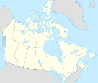
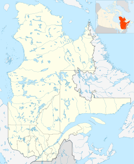
Location in Quebec
Runways
Direction Length Surface
ft m
n/a n/a n/a Water

Drummondville Water Aerodrome( TC LID : CSA7) is located 4 nautical mile s (7.4 km; 4.6 mi) east of Drummondville, Quebec, Canada.

Transport Canada

Transport Canada is the department within the Government of Canada responsible for developing regulations, policies and services of transportation in Canada. It is part of the Transportation, Infrastructure and Communities (TIC) portfolio. The current Minister of Transport is Marc Garneau. Transport Canada is headquartered in Ottawa, Ontario.

A location identifier is a symbolic representation for the name and the location of an airport, navigation aid, or weather station, and is used for manned air traffic control facilities in air traffic control, telecommunications, computer programming, weather reports, and related services.

Nautical mile unit of distance (1852 m)

A nautical mile is a unit of measurement used in both air and marine navigation, and for the definition of territorial waters. Historically, it was defined as one minute of a degree of latitude. Today it is defined as exactly 1852 metres. The derived unit of speed is the knot, one nautical mile per hour.

The airport is classified as an airport of entry by Nav Canada and is staffed by the Canada Border Services Agency (CBSA). CBSA officers at this airport can handle general aviation aircraft only, with no more than 15 passengers. [1]

Nav Canada

Nav Canada is a privately run, not-for-profit corporation that owns and operates Canada's civil air navigation system (ANS). It was established in accordance with the Civil Air Navigation Services Commercialization Act.
Canada Border Services Agency government agency

The Canada Border Services Agency is a federal agency that is responsible for border protection and surveillance, immigration enforcement and customs services in Canada. The CBSA is accountable to Parliament through the Minister of Public Safety and Emergency Preparedness

General aviation civil use of aircraft excluding commercial transportation

General Aviation (GA) represents the 'private transport' and recreational flying component of aviation.

See also

Related Research Articles

Inuvik/Shell Lake Water Aerodrome

Inuvik/Shell Lake Water Aerodrome is located 5 nautical miles south-southeast of Inuvik, Northwest Territories, Canada and is open from June until September.

Dawson City Water Aerodrome

Dawson City Water Aerodrome(TC LID: CEG7) was located adjacent to Dawson City, Yukon, Canada and was open from August to September.

Baie-Comeau Water Aerodrome

Baie-Comeau Water Aerodrome, is located on the Manicouagan River, Quebec, Canada and is open from May until October.

Drummondville Airport

Drummondville Airport,, is located 4 nautical miles east southeast of Drummondville, Quebec, Canada.

Lac-à-la-Tortue Water Aerodrome

Lac-à-la-Tortue Water Aerodrome is located on Lac-à-la-Tortue, 2.6 nautical miles east of Grand-Mère, Quebec, Canada and is open from May until October. The first aircraft to land here was in 1919 and it is Canada's first seaplane base.

Sept-Îles/Lac Rapides Water Aerodrome

Sept-Îles/Lac Rapides Water Aerodrome is located on Lac des Rapides near Sept-Îles, Quebec, Canada.

Fort Frances Water Aerodrome

Fort Frances Water Aerodrome is located 2 nautical miles northeast of Fort Frances, Ontario, Canada. The aerodrome is a private floatplane base operated by Rusty Myers Flying Service.

Kenora Water Aerodrome

Kenora Water Aerodrome is located adjacent to Kenora, Ontario, Canada.

Orillia/Lake St John (Orillia Rama Regional) Water Aerodrome

Orillia/Lake St John Water Aerodrome is located 6.5 nautical miles northeast of Orillia, Ontario, Canada.

Orillia Airport

Orillia Airport is located 6.5 nautical miles northeast of Orillia, Ontario, Canada.

Rainy River Water Aerodrome

Rainy River Water Aerodrome is located on the Rainy River, Ontario, Canada.

Sand Point Lake Water Aerodrome

Sand Point Lake Water Aerodrome is located on Sand Point Lake, Ontario, Canada.

Sault Ste. Marie/Partridge Point Water Aerodrome

Sault Ste. Marie/Partridge Point Water Aerodrome, formerly TC LID: CNV7, was adjacent to Sault Ste. Marie, Ontario, Canada.

Atlin Water Aerodrome

Atlin Water Aerodrome,, is located on Atlin Lake adjacent to Atlin, British Columbia, Canada.

Dawson Creek Water Aerodrome

Dawson Creek Water Aerodrome, TC LID: CBD3, was located 2 nautical miles southeast of Dawson Creek, British Columbia, Canada.

Kamloops Water Aerodrome

Kamloops Water Aerodrome,, is located 3 nautical miles west northwest of Kamloops, British Columbia, Canada.

Nanaimo Harbour Water Aerodrome

Nanaimo Harbour Water Aerodrome is a Seaplane Base (SPB) serving the city of Nanaimo, British Columbia, Canada.

Rykerts Water Aerodrome airport

Rykerts Water Aerodrome, formerly TC LID: CBZ8, is a defunct aerodrome that was located adjacent to Rykerts, British Columbia, Canada.

Victoria Airport Water Aerodrome

Victoria Airport Water Aerodrome,, is located 12 nautical miles north northwest of Victoria, British Columbia, Canada, and is a base for floatplanes/seaplanes.

Vancouver International Water Airport

Vancouver International Water Airport,, is located adjacent to Vancouver International Airport in Richmond, British Columbia, Canada.

References

  1. 1 2 Nav Canada's Water Aerodrome Supplement. Effective 0901Z 7 March 2013 to 0901Z 3 April 2014