
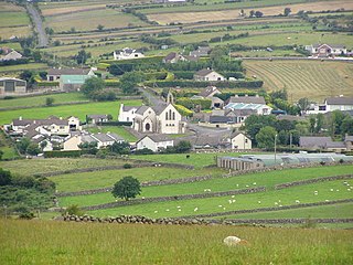
Dunseverick is a hamlet near the Giant's Causeway in County Antrim, Northern Ireland. The name is also the alias for the townland of Feigh. It is most notable for Dunseverick Castle.
A townland is a small geographical division of land, historically and currently used in Ireland and in the Western Isles in Scotland, typically covering 100–500 acres (40–202 ha). The townland system is of Gaelic origin, antedating the Norman invasion, and most have names of Irish origin. However, some townland names and boundaries come from Norman manors, plantation divisions, or later creations of the Ordnance Survey. The total number of inhabited townlands in Ireland was 60,679 in 1911. The total number recognised by the Irish Place Names database as of 2014 was 61,098, including uninhabited townlands, mainly small islands.
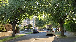
Ballyroan is a suburban area within Rathfarnham, County Dublin, Ireland. It lies at the foot of the Dublin mountains, alongside Ballyboden, Butterfield, Knocklyon, Old Orchard, and Scholarstown. The townland of Ballyroan crosses civil parish and barony boundaries with roughly 114 acres of the historical townland in the civil parish of Tallaght in the barony of Uppercross, and nearly 10 acres in the civil parish of Rathfarnham in the barony of Rathdown. The modern suburb of Ballyroan has extended somewhat beyond the traditional townland boundaries.

Claudy is a village and townland in County Londonderry, Northern Ireland. It lies in the Faughan Valley, 6 miles (9.7 km) southeast of Derry, where the River Glenrandal joins the River Faughan. It is situated in the civil parish of Cumber Upper and the historic barony of Tirkeeran. It is also part of Derry and Strabane district.

Cogry-Kilbride is a village in County Antrim, Northern Ireland, about 4 km west of Ballyclare. The village encompasses the two townlands of Cogry and Kilbride. It had a population of 1,195 people in the 2001 census. Kilbride is also a civil parish. It is situated in Antrim and Newtownabbey district.

Dervock is a small village and townland in County Antrim, Northern Ireland. It is about 3.5 miles (6 km) northeast of Ballymoney, on the banks of the River Bush. It is situated in the civil parish of Derrykeighan and the historic barony of Dunluce Lower. It had a population of 714 people in the 2011 Census.

Laurelvale is a village in County Armagh, Northern Ireland. It is beside the smaller village of Mullavilly and the two are sometimes referred to as Laurelvale-Mullavilly or Mullavilly-Laurelvale. The village is three miles south of Portadown and 1.5 miles northwest of Tandragee. It had a population of 1,288 people in the 2011 census.

Tullylish is a small village, townland and civil parish in County Down, Northern Ireland. It sits on the River Bann, along the main road between the towns of Banbridge and Portadown. In the 2001 census it had a population of 105 people. It lies within the civil parish of Tullylish and Banbridge District.

Annahugh is a small village and townland near Loughgall in County Armagh, Northern Ireland. While most of the settlement is within the townland of Annahugh, part of it extends into the neighbouring townland of Ballyhagan. Hence, the two names are sometimes used to refer to the same settlement. It is situated within the Armagh City and District Council area. It had a population of 275 people in the 2011 Census.

Ballylesson is a small village and townland in County Down, Northern Ireland. In the 2001 Census it had a population of 108 people. The village lies within the Lagan Valley Regional Park and the Lisburn City Council area.
Ballyskeagh is a small village and townland situated between Lambeg and Drumbeg in County Down, Northern Ireland. In the 2001 Census it had a population of 186 people. It lies within the Lagan Valley Regional Park and the Lisburn City Council area.
Attical or Atticall is a small village and townland in the Mourne Mountains of County Down, Northern Ireland. It is situated in the civil parish of Kilkeel and the historic barony of Mourne. In the 2001 Census it had a population of 153 people. It lies within the Newry and Mourne District Council area.
Dunnaval is a small village and townland near Kilkeel in County Down, Northern Ireland. It is situated in the civil parish of Kilkeel and the historic barony of Mourne. In the 2001 Census it had a population of 147 people. It lies within the Newry and Mourne District Council area.
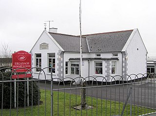
Erganagh is a small village and townland near Castlederg in County Tyrone, Northern Ireland. It is situated in the historic barony of Strabane Lower and the civil parish of Ardstraw. In the 2001 Census it had a population of 366 people. It is within the Strabane District Council area.

Agharaskilly is a townland in the civil parish of Tomregan, County Cavan, Ireland. It lies within the former barony of Loughtee Lower.

Magheracross is a townland and civil parish in County Fermanagh, Northern Ireland. It extends in area from just north of Enniskillen to the border with County Tyrone and includes a small enclave in County Tyrone. The main town in the parish is Ballinamallard.

Annaghmore is a small village and townland near Loughgall in County Armagh, Northern Ireland. It is situated in the civil parish of Loughgall and the historic barony of Oneilland West. It had a population of 265 people in the 2011 Census.
Down is a townland in County Westmeath, Ireland. It is located about 8.17 kilometres (5 mi) north of Mullingar.
Parsonstown is a townland in County Westmeath, Ireland. It is located about 7.71 kilometres (5 mi) north–north–east of Mullingar.
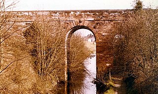
Broighter is a townland in west County Londonderry, Northern Ireland. It lies 4.4 miles (7 km) northwest of Limavady and 2.5 miles (4 km) northeast of Ballykelly. Broighter is part of Causeway Coast and Glens district.

