County Fermanagh is one of the thirty-two counties of Ireland, one of the nine counties of Ulster and one of the six counties of Northern Ireland.

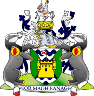
Lisnaskea is the second-biggest settlement in County Fermanagh, Northern Ireland. It is situated mainly in the townland of Lisoneill, with some areas in the townland of Castle Balfour Demesne, both in the civil parish of Aghalurcher and the historic barony of Magherastephana. It had a population of 2,956 people at the 2011 Census.
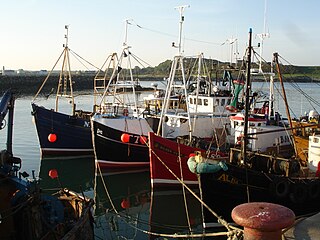
Ardglass is a coastal fishing village, townland and civil parish in County Down, Northern Ireland, in the historic barony of Lecale Lower. It is still a relatively important fishing harbour. It is situated on the B1 Ardglass to Downpatrick road, about 6 miles to the south east of Downpatrick, in the Lecale peninsula on the Irish Sea. It had a population of 1,668 in the 2001 Census, and is located within the Newry, Mourne and Down area.
Clogher is a village and civil parish in the border area of south County Tyrone, Northern Ireland. It lies on the River Blackwater, 5.8 miles from the border crossing to County Monaghan. It stands on the townlands of Clogher Demesne and Clogher Tenements. The 2011 Census recorded a population of 717. The civil parish of Clogher covers areas of County Fermanagh as well as County Tyrone.

Derrylin is a village and townland in County Fermanagh, Northern Ireland. It is on the A509 road between Enniskillen and the border with County Cavan. It had a population of 624 in the 2011 census and is situated within Fermanagh and Omagh district.

Belleek is a village and civil parish in County Fermanagh, Northern Ireland. While the greater part of the village lies within County Fermanagh, part of it crosses the border and the River Erne into County Donegal. It lies in the historic barony of Lurg. It had a population of 904 people in the 2011 Census, and is situated within Fermanagh and Omagh district.

Ederney is a village situated primarily in the townlands of Drumkeen and of Ederny in County Fermanagh, Northern Ireland.

Castle Balfour is a castle situated in Lisnaskea, County Fermanagh, Northern Ireland. It sits at the edge of the parish graveyard just west of Main Street. The castle is a State Care Historic Monument sited in the townland of Castle Balfour Demesne, in the Fermanagh and Omagh district area, at grid ref: H3622 3369.
Donagh is a small village and townland in County Fermanagh, Northern Ireland. It lies between Lisnaskea and Newtownbutler in the south-east of the county. In the 2001 Census it had a population of 255. It is situated within Fermanagh and Omagh district.

Kinawley or Kinawly is a small village, townland and civil parish straddling County Fermanagh, Northern Ireland and County Cavan Republic of Ireland. The village and townland are both in the civil parish of Kinawley in the historic barony of Clanawley, while other areas of the parish are in the baronies of Knockninny in County Fermanagh and Tullyhaw in County Cavan. In the 2011 Census it had a population of 141 people.
Tamlaght is a townland and village in County Fermanagh, Northern Ireland, 4.5 km south-east of Enniskillen. It is situated in the civil parish of Derryvullan and the historic barony of Tirkennedy. In the 2001 Census it had a population of 276 people.

Carrybridge is a hamlet in County Fermanagh, Northern Ireland, 8 km north-west of Lisnaskea and 11 km south-east of Enniskillen. It is situated in the townland of Aghnacarra in the civil parish of Derrybrusk and the historic barony of Magherastephana.
Knockmore is an upland area and townland situated in County Fermanagh, Northern Ireland outside the village of Derrygonnelly, in the historical barony of Magheraboy. This area, together with the adjacent Barrs of Boho and most of the uplands in Boho parish, are described as the Knockmore Scarplands. The focal point of the area is Knockmore summit at 277 metres (909 ft).
Moylehid is a townland in County Fermanagh, Northern Ireland. It is in the civil parish of Boho. This townland has also been variously known as Moylehide (1609), Moolet (1659), Moylehit, Mullyleet, Mul Leathaid and Mul-leithid (1834).
Aghindisert is a townland in the civil parish of Tomregan, in County Fermanagh, Northern Ireland. It is situated within the former barony of Knockninny.
Knocks is a townland to the east of Lisnaskea in County Fermanagh, Northern Ireland. It is situated in the historic barony of Magherastephana and the civil parish of Aghalurcher and covers an area of 193 acres.
Lisoneill is a townland of 145 acres in County Fermanagh, Northern Ireland. It is situated in the civil parish of Aghalurcher and the historic barony of Magherastephana. It contains the main part of the small town of Lisnaskea, with the remainder in the townland of Castle Balfour Demesne.
Derryvullan is a civil parish and townland in County Fermanagh, Northern Ireland. The civil parish is situated in the historic baronies of Tirkennedy and Lurg. Derryvullan townland is in the portion of the parish of the same name in Tirkennedy.

Rathgarve, is a civil parish, religious parish, and townland, in County Westmeath, Ireland. It is located about 19.24 kilometres (12 mi) north of Mullingar. It takes in parts of the modern town of Castlepollard, and it forms part of the religious parish of St. Michael's Parish, Castlepollard. Historically it has been linked to the 8th century monk Dicuil, according to Monasticon Hibernicum. However, he is also associated with Rathgar, in Dublin, which may indicate a misassociation with one of these sites.

The Finn River, also known as the River Finn, is a small river that flows through parts of County Fermanagh and parts of County Monaghan in the south of Ulster, the northern province in Ireland. In certain places, the river forms part of the boundary between County Fermanagh, which is part of Northern Ireland, and County Monaghan, which is part of the Republic of Ireland. Two very short stretches of the river, just north of Redhills and at Castle Saunderson, near Belturbet, also form part of the boundary between County Fermanagh and County Cavan. This means that some stretches of the river form part of the border between Northern Ireland and the Republic of Ireland, these short stretches also forming part of the external border of the European Union.

