
Attu Station is a census-designated place (CDP) located on Attu Island in the Aleutians West Census Area in the U.S. state of Alaska. The population was 21 at the 2010 census, consisting entirely of coast guard personnel who resided and worked at Casco Cove Coast Guard Station, but left the island when the station was closed in August 2010, leaving it uninhabited. LORAN Station Attu had provided a navigational signal for mariners of the North Pacific since the 1970s.

King Salmon is a census-designated place (CDP) in Bristol Bay Borough in the U.S. state of Alaska. It is 284 miles (457 km) southwest of Anchorage. As of the 2020 census the population was 307, down from 374 in 2010. It is home to Katmai National Park and Preserve. King Salmon is the borough seat of neighboring Lake and Peninsula Borough, but does not serve that purpose in its own borough, whose borough seat is in Naknek.
Salamatof is a census-designated place (CDP) in Kenai Peninsula Borough, Alaska, United States. The population was 1,078 at the 2020 census, up from 980 in 2010. Salamatof is the location for the former Wildwood Air Force Station, which operated from 1965 to 1972. Today, it is the Wildwood Correctional Complex.
Kodiak Station is a census-designated place (CDP) in Kodiak Island Borough, Alaska, United States. At the 2020 census the population was 1,673, up from 1,301 in 2010.

Gulkana is a census-designated place (CDP) in Copper River Census Area, Alaska, U.S. At the 2020 census the population was 110, down from 119 in 2010. It also has an airport.

Belle Chasse is a census-designated place (CDP) in Plaquemines Parish, Louisiana, United States, on the west bank of the Mississippi River. Belle Chasse is part of the Greater New Orleans metropolitan area. The population was 10,579 at the 2020 United States census. Belle Chasse is the largest community in Plaquemines Parish. It is home to Naval Air Station Joint Reserve Base New Orleans, a Naval Air Station for the U.S. Navy Reserve.

Forestville is an unincorporated area and census-designated place (CDP) in Prince George's County, Maryland, United States. Per the 2020 census, the population was 12,831. The community is a mixture of garden apartments, single-family homes, and shopping centers built mostly from the 1930s through 1970s, adjacent to the communities of District Heights, Suitland, Morningside, Westphalia and Camp Springs. Forestville is located close to the town of Upper Marlboro, where many Prince George's County Board Offices are located. Additionally, Forestville is located adjacent to the Joint Base Andrews/ Andrews Air Force Base. The neighborhood has a majority African-American population. It is convenient to the Capital Beltway (I-95/I-495), Maryland Route 4, including Penn Mar Shopping Center, and for employees of Andrews Air Force Base and the U.S. Census Bureau. Forestville is located within proximity to the Suitland Metro Station, served by WMATA's Green Line. A notable former resident was Steny Hoyer, now Democratic Leader of the United States House of Representatives.
Glassmanor is an unincorporated community and census-designated place in Prince George's County, Maryland, United States. As of the 2020 census, it had a population of 18,430. In the 1990 and 2000 censuses, the United States Census Bureau had placed Glassmanor and the adjacent community of Oxon Hill in the "Oxon Hill-Glassmanor" census-designated place for statistical purposes. Glassmanor was last delineated separately in 1980, when the CDP recorded a population of 7,751.
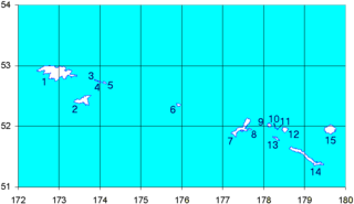
Shemya or Simiya is a small island in the Semichi Islands group of the Near Islands chain in the Aleutian Islands archipelago southwest of Alaska, at 52°43′27″N174°07′08″E. It has a land area of 5.903 sq mi (15.29 km2), and is about 1,200 miles (1,900 km) southwest of Anchorage, Alaska. It is 2.73 miles (4.39 km) wide and 4.32 miles (6.95 km) long.

Eareckson Air Station, formerly Shemya Air Force Base, is a United States Air Force military airport located on the island of Shemya, in the Alaskan Aleutian Islands.
Melwood is an unincorporated community and census-designated place (CDP) in Prince George's County, Maryland, United States. It was newly delineated for the 2010 census, at which time its population was 3,051. Per the 2020 census, the population was 3,977.

Columbus Air Force Base is a United States Air Force base located in Columbus, Mississippi. The host unit at Columbus AFB is the 14th Flying Training Wing , which is a part of Air Education and Training Command (AETC).
Manville is an unincorporated community and census-designated place (CDP) in Lee County, South Carolina, United States. It was first listed as a CDP prior to the 2020 census with a population of 471.
Andrews Air Force Base is a census-designated place (CDP) covering the residential population of Andrews Air Force Base/Joint Base Andrews, in Prince George's County, Maryland, Maryland, United States. The population at the 2020 Census was 3,025.
New Orleans Station is a census-designated place (CDP) covering the residential population of the Naval Air Station Joint Reserve Base New Orleans in Plaquemines Parish, Louisiana, United States.
New Orleans Station is a census-designated place (CDP) covering the residential population of the Kirtland Air Force Base in Bernalillo County, New Mexico. It first appeared as a CDP in the 2020 Census with a population of 3,838.
Lackland Air Force Base CDP is a census-designated place (CDP) covering the permanent residential population of the Lackland Air Force Base in Bexar County, Texas, United States. Per the 2020 census, the population was 9,467.
Randolph Air Force Base CDP is a census-designated place (CDP) covering the permanent residential population of the Randolph Air Force Base in Bexar County, Texas, United States. Per the 2020 census, the population was 1,280.

Laughlin Force Base CDP is a census-designated place (CDP) covering the permanent residential population of the Laughlin Air Force Base in Val Verde County, Texas, United States. Per the 2020 census, the population was 1,673.


