East Palatka, Florida | |
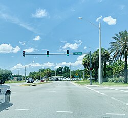
---|---|
Coordinates: 29°39′0″N81°35′58″W / 29.65000°N 81.59944°W | |
Country | United States |
State | Florida |
County | Putnam |
Area | |
• Total | 4.71 sq mi (12.20 km2) |
• Land | 3.18 sq mi (8.24 km2) |
• Water | 1.53 sq mi (3.97 km2) |
Elevation | 16 ft (5 m) |
Population (2020) | |
• Total | 1,573 |
• Density | 494.65/sq mi (191.01/km2) |
Time zone | UTC-5 (Eastern (EST)) |
• Summer (DST) | UTC-4 (EDT) |
ZIP code | 32131 |
Area code | 386 |
FIPS code | 12-19350 [2] |
GNIS feature ID | 0282007 [3] |
East Palatka is a census-designated place (CDP) in Putnam County, Florida, United States. It is located on the east side of the City of Palatka at the intersection of U.S. Route 17/State Road 20/State Road 100 and the southwestern terminus of State Road 207. The population was 1,654 at the 2010 census. [4]
East Palatka is home to the Palatka State Farmer's Market, as well as the Putnam County Fairgrounds.
East Palatka is located at 29°39′00″N81°35′58″W / 29.650024°N 81.599397°W . [5]
According to the United States Census Bureau, the CDP has a total area of 4.5 square miles (12 km2), of which 3.2 square miles (8.3 km2) is land and 1.3 square miles (3.4 km2) (28.89%) is water. East Palatka is drained by the St. Johns River.
Census | Pop. | Note | %± |
---|---|---|---|
2020 | 1,573 | — | |
U.S. Decennial Census [6] |
As of the census [2] of 2000, there were 1,707 people, 521 households, and 365 families residing in the CDP. The population density was 532.3 inhabitants per square mile (205.5/km2). There were 594 housing units at an average density of 185.2 per square mile (71.5/km2). The racial makeup of the CDP was 59.64% White, 37.26% African American, 0.29% Native American, 1.00% Asian, 0.76% from other races, and 1.05% from two or more races. Hispanic or Latino of any race were 2.40% of the population.
There were 521 households, out of which 28.6% had children under the age of 18 living with them, 50.5% were married couples living together, 15.5% had a female householder with no husband present, and 29.9% were non-families. 25.3% of all households were made up of individuals, and 12.7% had someone living alone who was 65 years of age or older. The average household size was 2.50 and the average family size was 2.98.
In the CDP, the population was spread out, with 18.5% under the age of 18, 8.7% from 18 to 24, 36.7% from 25 to 44, 21.8% from 45 to 64, and 14.3% who were 65 years of age or older. The median age was 38 years. For every 100 females, there were 158.2 males. For every 100 females age 18 and over, there were 175.6 males.
The median income for a household in the CDP was $37,857, and the median income for a family was $46,071. Males had a median income of $31,507 versus $26,250 for females. The per capita income for the CDP was $18,478. About 12.6% of families and 17.4% of the population were below the poverty line, including 41.4% of those under age 18 and 12.8% of those age 65 or over.
Putnam County is a county located in the northern part of the state of Florida. As of the 2020 census, the population was 73,321. Its county seat is Palatka.
Bellair-Meadowbrook Terrace is an unincorporated area and census-designated place (CDP) in Clay County, Florida, United States. The population was 13,343 at the 2010 census.
Pine Ridge is a census-designated place (CDP) in Collier County, Florida, United States. The population was 1,918 at the 2010 census. It is part of the Naples–Marco Island Metropolitan Statistical Area.
Altoona is an unincorporated community and census-designated place (CDP) in Lake County, Florida, United States. The population was 89 at the 2010 census. It is part of the Orlando–Kissimmee–Sanford Metropolitan Statistical Area.
Pittman is an unincorporated community and census-designated place (CDP) in Lake County, Florida, United States. The population was 180 at the 2010 census. It is part of the Orlando–Kissimmee Metropolitan Statistical Area.
Buckingham is an unincorporated community and census-designated place (CDP) in Lee County, Florida, United States. The population was 4,443 at the 2020 census, up from 4,036 at the 2010 census. It is part of the Cape Coral-Fort Myers, Florida Metropolitan Statistical Area.
Charleston Park is an unincorporated community and census-designated place (CDP) in Lee County, Florida, United States. The population was 235 at the 2020 census, up from 218 at the 2010 census. It is part of the Cape Coral-Fort Myers, Florida Metropolitan Statistical Area.
Fort Myers Shores is an unincorporated community and census-designated place (CDP) in Lee County, Florida, United States. The population was 5,774 at the 2020 census. It is part of the Cape Coral-Fort Myers, Florida Metropolitan Statistical Area.
Iona is an unincorporated community and census-designated place (CDP) in Lee County, Florida, United States. The population was 16,908 at the 2020 census, up from 15,404 at the 2010 census. It is part of the Cape Coral-Fort Myers, Florida Metropolitan Statistical Area.
North Fort Myers is an unincorporated area and census-designated place (CDP) in Lee County, Florida, United States. It is part of the Cape Coral-Fort Myers, Florida Metropolitan Statistical Area. The population was 42,719 at the 2020 census.
Olga is an unincorporated community and census-designated place (CDP) in Lee County, Florida, United States. The population was 1,952 at the 2010 census, up from 1,398 at the 2000 census. It is part of the Cape Coral-Fort Myers, Florida Metropolitan Statistical Area.
San Carlos Park is a census-designated place (CDP) in Lee County, Florida, United States. The population was 18,563 at the 2020 census. It is part of the Cape Coral-Fort Myers, Florida Metropolitan Statistical Area.
Tice is an unincorporated community and census-designated place (CDP) in Lee County, Florida, United States. As of the 2020 census, the CDP population was 4,853. It is part of the Cape Coral-Fort Myers, Florida Metropolitan Statistical Area.
Villas, Florida is an unincorporated community and census-designated place (CDP) in Lee County, Florida, United States. It is part of the Cape Coral-Fort Myers, Florida Metropolitan Statistical Area.
East Williston is a census-designated place (CDP) in Levy County, Florida, United States. The population was 694 at the 2010 census.
West Perrine is a census-designated place (CDP) in Miami-Dade County, Florida, United States. It is part of the Miami metropolitan area of South Florida. The population was 10,602 at the 2020 census, up from 9,460 in 2010.
Oak Ridge is a census-designated place and unincorporated area in Orange County, Florida, United States. The population was 22,685 at the 2010 census. It is part of the Orlando–Kissimmee–Sanford, Florida Metropolitan Statistical Area.
South Apopka is a census-designated place and an unincorporated area in Orange County, Florida, United States. Per the 2020 census, the population was 6,803. It is part of the Orlando–Kissimmee Metropolitan Statistical Area.
Crescent City is a city in Putnam County, Florida, United States. As of the 2020 Census, its population was 1,654. The city is located on two lakes and is part of the Palatka Micropolitan Statistical Area. Crescent Lake lies to the east of town and Lake Stella is located to the west.
Pomona Park is a town in Putnam County, Florida, United States. The population was 912 at the 2010 census and has gone up to 916 in the 2018 estimates. The town is part of the Palatka Micropolitan Statistical Area.