It crosses Canning Highway before a steep drop to the level of Beach Street.
Located on the western side of the street is the John Curtin College of the Arts The cutting and its edges at the southern end of the street has required maintenance over time.[2][3] The Swan River end of the street, a jetty known locally as the East Street Jetty, has been the location for a number of events.[4][5][6]
↑ "A FREMANTLE STREET". The West Australian. Vol.15, no.4, 304. Western Australia. 18 December 1899. p.6. Retrieved 18 June 2022– via National Library of Australia.
↑ "Dangerous Fencing". The Advertiser. Vol.I, no.32. Western Australia. 5 August 1921. p.6. Retrieved 18 June 2022– via National Library of Australia.
↑ "Boys Swim Close To Zephyr". The Daily News. Vol.LVIII, no.20, 268 (CITY FINALed.). Western Australia. 14 March 1940. p.6. Retrieved 15 January 2017– via National Library of Australia.
The Swan River is a river in the south west of Western Australia. The river runs through the metropolitan area of Perth, Western Australia's capital and largest city.
Fremantle is a port city in Western Australia, located at the mouth of the Swan River in the metropolitan area of Perth, the state capital. Fremantle Harbour serves as the port of Perth. The Western Australian vernacular diminutive for Fremantle is Freo. Fremantle was also ranked 7th place for "Top 10 tourism city for 2016". It was also featured in "TIME Magazine’s 50 Greatest Places of 2022". Making it one of the most popular tourist attractions in the country.
Albany is a port city in the Great Southern region in the Australian state of Western Australia, 418 kilometres (260 mi) southeast of Perth, the state capital. The city centre is at the northern edge of Princess Royal Harbour, which is a part of King George Sound. The central business district is bounded by Mount Clarence to the east and Mount Melville to the west. The city is in the local government area of the City of Albany. While it is the oldest colonial, although not European, settlement in Western Australia - predating Perth and Fremantle by over two years - it was a semi-exclave of New South Wales for over four years until it was made part of the Swan River Colony.
The Fremantle line is a suburban railway and service in Western Australia that connects the central business district (CBD) of Perth with Fremantle.
Augusta is a town on the south-west coast of Western Australia, where the Blackwood River emerges into Flinders Bay. It is the nearest town to Cape Leeuwin, on the furthest southwest corner of the Australian continent. In the 2001 census it had a population of 1,091; by 2016 the population of the town was 1,109.
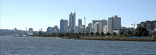
Perth Water is a section of the Swan River on the southern edge of the central business district of Perth, Western Australia. It is between the Causeway to the east, and Narrows Bridge to the west – a large wide but shallow section of river, and the northern edge of the suburb South Perth. It is considered a landmark of the City of Perth.
South Fremantle is a suburb of Perth, Western Australia, located within the City of Fremantle.
North Fremantle is a suburb of Perth, Western Australia, located within the City of Fremantle, a local government area of the state. Its postcode is 6159.
Queen Victoria Street is the main road entering the city centre of Fremantle, Western Australia from the direction of Perth. The road was originally named Cantonment Road, but was subsequently renamed Victoria Road, and a few years later Queen Victoria Street, after Queen Victoria of the United Kingdom, to avoid confusion with similarly named roads in the area.
Transport in Perth, Western Australia, is served by various means, among them an extensive highway / freeway network and a substantial system of commuter rail lines and bus routes. Public transport is managed by the Transperth agency.
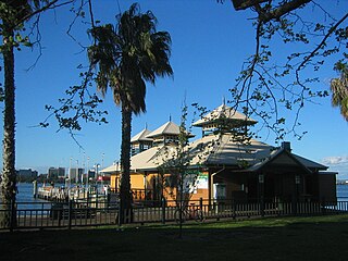
Mends Street Jetty is located in South Perth in Western Australia. The jetty is on the southern shore of the Swan River in the section known as Perth Water. The ferry service is primarily used for accessing the Perth Zoo from the Perth central business district.
Riverside Drive in Perth, Western Australia, is a road on the northern side of Perth Water. It was built on reclaimed land in the 1930s, and links The Causeway to the Narrows Bridge.
Victoria Quay is a wharf on the south bank of the Swan River mouth in the Western Australian port city of Fremantle. It is separated from the Fremantle CBD by the railway line. Originally named South Quay, it was renamed Victoria Quay on 26 July 1901 in honour of the late Queen Victoria. With North Quay it forms the Inner Harbour area of Fremantle Harbour.
Esplanade Park is a public reserve in Fremantle, Western Australia. Situated on Marine Terrace and opposite the Esplanade Hotel, the reserve features about 100 mature Norfolk Island pines and the Explorers' Monument.
Bathers Beach, also known as Whalers Beach, is a section of coastline that has a written history since the European settlement of what is now called Fremantle, Western Australia.
The Black Swan was the first bucket dredge used by the Swan River Colony to make its rivers more suitable for shipping. The dredge was operational from 1872 to 1911, when it was scuttled. Initially known as the Government Dredge, it was renamed after being repaired and modified between 1887 and 1888. The dredging carried out by the Black Swan and other vessels had a significant impact on the river fauna and flora, including the black swans for which it was named.
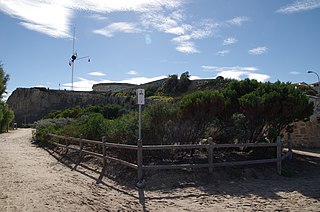
Arthur Head in Fremantle, Western Australia, is a former large limestone headland on the southern side of the mouth of the Swan River, now also the entry to Fremantle Harbour.
Beach Street in a street located in Fremantle, Western Australia. It runs along the historic southern shore of the Swan River, south-east of the inner harbour, between Parry Street and East Street.
Mill Street is a short street at the western end of the central business district (CBD) of Perth, Western Australia. It runs between St Georges Terrace and Mounts Bay Road.
This page is based on this Wikipedia article Text is available under the CC BY-SA 4.0 license; additional terms may apply. Images, videos and audio are available under their respective licenses.