East Vineland, New Jersey

Last updated

East Vineland, New Jersey
Location map of Atlantic County, New Jersey.svg
Red pog.svg
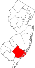
East Vineland
Location in Atlantic County
USA New Jersey relief location map.svg
Red pog.svg
East Vineland
Location in New Jersey
Usa edcp relief location map.png
Red pog.svg
East Vineland
Location in the United States
Coordinates: 39°28′51″N74°55′10″W / 39.48083°N 74.91944°W / 39.48083; -74.91944
Country Flag of the United States.svg  United States
State Flag of New Jersey.svg  New Jersey
County Atlantic
Township Buena Vista
Area
[1]
  Total5.03 sq mi (13.02 km2)
  Land5.01 sq mi (12.99 km2)
  Water0.01 sq mi (0.03 km2)
Elevation
105 ft (32 m)
Population
 (2020) [2]
  Total925
  Density184.45/sq mi (71.22/km2)
FIPS code 34-19690 [3]
GNIS feature ID876071 [4]

East Vineland is an unincorporated community and census-designated place (CDP) [5] located within Buena Vista Township in Atlantic County, in the U.S. state of New Jersey. [6]

Demographics

As of the 2020 United States census, the population of the area was 925. [2]

Historical population
CensusPop.Note
2020 925
U.S. Decennial Census [7]

Related Research Articles

<span class="mw-page-title-main">East Freehold, New Jersey</span> Populated place in Monmouth County, New Jersey, US

East Freehold is an unincorporated community and census-designated place (CDP) located within Freehold Township, in Monmouth County, in the U.S. state of New Jersey. As of the 2010 United States Census, the CDP's population was 4,894.

Deerfield is an unincorporated community and census-designated place (CDP) located within Upper Deerfield Township, Cumberland County, in the U.S. state of New Jersey. It was first listed as a CDP in the 2020 census with a population of 230.

Troy Hills is a census-designated place (CDP) in the township of Parsippany-Troy Hills, Morris County, in the U.S. state of New Jersey. It is in the southeast part of the township, bordered to the north and west by the Parsippany CDP, to the south by Whippany in Hanover Township, and to the east by Troy Meadows, the largest freshwater marsh in New Jersey.

<span class="mw-page-title-main">Cologne, New Jersey</span> Census-designated place in New Jersey, United States

Cologne is an unincorporated community and census-designated place (CDP) located within Galloway Township, in Atlantic County, in the U.S. state of New Jersey. Cologne is located on U.S. Route 30, about 2.5 miles (4.0 km) southeast of Egg Harbor City. Cologne has a post office with ZIP Code 08213.

Absecon Highlands is an unincorporated community and census-designated place (CDP) in Atlantic County, in the U.S. state of New Jersey. It is in the eastern part of the county, in southern Galloway Township. It is bordered to the south by the city of Absecon and to the east by Reeds Bay, a tidal water body the connects to the Atlantic Ocean through Broad Creek and Absecon Inlet. The CDP includes the neighborhoods of Absecon Highlands, Seaview Estates, Seaview Park, Conovertown, and Holly Brook.

Germania is a census-designated place (CDP) located in Atlantic County, in the U.S. state of New Jersey. It is in the east-central part of the county, in western Galloway Township. It is bordered to the south by the unincorporated community of Cologne, and Egg Harbor City is 3 miles (5 km) to the northwest. U.S. Route 30 touches the southern border of Germania, leading northwest through Egg Harbor City 15 miles (24 km) to Hammonton and southeast 13 miles (21 km) to Atlantic City.

Seeley is a census-designated place (CDP) in Cumberland County, in the U.S. state of New Jersey. It is in the northern part of the county, on the west side of Upper Deerfield Township. The western border of the CDP is the Cohansey River, which forms the border with Hopewell Township to the west. Seeley is 5 miles (8 km) north of Bridgeton, the county seat, and 13 miles (21 km) west of Vineland.

Carlls Corner is a census-designated place (CDP) located in Upper Deerfield Township in Cumberland County, in the U.S. state of New Jersey. It is bordered at its southwest corner by the city of Bridgeton, the county seat.

Centre Grove is a census-designated place (CDP) located in Cumberland County, in the U.S. state of New Jersey. It is in the center part of the county, on the east side of Lawrence Township. It is bordered to the east by the city of Millville. Bridgeton, the Cumberland county seat, is 9 miles (14 km) to the northwest.

Lakeside-Beebe Run is a census-designated place (CDP) in Hopewell Township, in Cumberland County, in the U.S. state of New Jersey. It is in the northern part of the county, on the eastern side of the township, on high ground overlooking Sunset Lake to the east and Mary Elmer Lake to the south. It is bordered to the south by the city of Bridgeton, the county seat.

West Park is a census-designated place (CDP) in Cumberland County, in the U.S. state of New Jersey. It is in the northwest part of the county, within Hopewell Township, and it is bordered to the east by the city of Bridgeton, the county seat. New Jersey Route 49 passes through the CDP, northwest 14 miles (23 km) to Salem.

Ampere North is a unincorporated community and census-designated place (CDP) in Bloomfield Township, Essex County, in the U.S. state of New Jersey. It is in the southern corner of the township, bordered to the north by the Watsessing CDP, to the northeast by Silver Lake, to the southwest by East Orange, and to the southeast by Newark. Ampere Parkway runs through the center of the CDP, from Bloomfield Avenue at the northeast border of the community, south into the Ampere neighborhood in East Orange.

Encore at Monroe is a gated community and census-designated place (CDP) located in Monroe Township, Middlesex County, in the U.S. state of New Jersey. It is in the western part of the township, bordered to the south by Clearbrook. It is 3 miles (5 km) southwest of Jamesburg, 15 miles (24 km) south of New Brunswick, 6 miles (10 km) northeast of Hightstown, and 18 miles (29 km) northeast of Trenton.

Forsgate is a golf course community and census-designated place (CDP) located in Monroe Township, Middlesex County, in the U.S. state of New Jersey. It consists of Forsgate Country Club and its associated housing developments. It is in the northwestern part of the township, bordered to the south across Forsgate Drive by Rossmoor, to the east by the Hightstown Industrial Track rail line, to the north by a branch rail line connecting Jamesburg and Monmouth Junction, and to the west by the New Jersey Turnpike at Exit 8A. It is 13 miles (21 km) south of New Brunswick and 19 miles (31 km) northeast of Trenton.

Renaissance at Monroe is a planned community and census-designated place (CDP) in Monroe Township, Middlesex County, in the U.S. state of New Jersey. It is in the southwest part of the township, bordered to the east by Monroe Manor and to the east by East Windsor Township in Mercer County. New Jersey Route 33 forms the northern edge of the community; it is 1.5 miles (2.4 km) west to Exit 8 on the New Jersey Turnpike and 11 miles (18 km) east to Freehold.

Bedminster is an unincorporated community and census-designated place (CDP) comprising the primary community in Bedminster Township, Somerset County, in the U.S. state of New Jersey. It was first listed as a CDP prior to the 2020 census.

Bridgewater Center is a census-designated place (CDP) located in the west-central part of Bridgewater Township, Somerset County, in the U.S. state of New Jersey. It was first listed as a CDP prior to the 2020 census with a population of 4,616.

Hillsborough is a census-designated place (CDP) located in the center of Hillsborough Township, Somerset County, in the U.S. state of New Jersey. It was first listed as a CDP prior to the 2020 census.

Cranford is a census-designated place (CDP) comprising the downtown part of Cranford Township, Union County, in the U.S. state of New Jersey. It was first listed as a CDP prior to the 2020 census with a population of population was 2,032.

Connecticut Farms is a neighborhood and census-designated place (CDP) within Union Township, Union County, in the U.S. state of New Jersey. It was first listed as a CDP prior to the 2020 census.

References

  1. "ArcGIS REST Services Directory". United States Census Bureau. Retrieved October 11, 2022.
  2. 1 2 Census Data Explorer: East Vineland CDP, New Jersey, United States Census Bureau. Accessed June 15, 2023.
  3. Geographic Codes Lookup for New Jersey, Missouri Census Data Center. Accessed June 9, 2023.
  4. U.S. Geological Survey Geographic Names Information System: East Vineland, New Jersey
  5. State of New Jersey Census Designated Places - BVP20 - Data as of January 1, 2020, United States Census Bureau. Accessed December 1, 2022.
  6. Locality Search, State of New Jersey. Accessed February 19, 2015.
  7. "Census of Population and Housing". Census.gov. Retrieved June 4, 2016.