Leeds Point, New Jersey

Last updated

Leeds Point, New Jersey
View south along Leeds Point Rd by Leeds Point Post Office, 2021-11-06.jpg
Stockton University census-designated place (2020).jpg
Neighboring communities
Location map of Atlantic County, New Jersey.svg
Red pog.svg
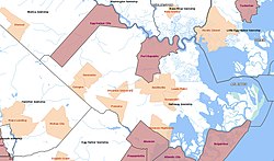
Leeds Point
Location in Atlantic County
USA New Jersey relief location map.svg
Red pog.svg
Leeds Point
Location in New Jersey
Usa edcp relief location map.png
Red pog.svg
Leeds Point
Location in the United States
Coordinates: 39°29′31″N74°25′45″W / 39.49194°N 74.42917°W / 39.49194; -74.42917
Country Flag of the United States.svg  United States
State Flag of New Jersey.svg  New Jersey
County Atlantic
Township Galloway
Area
[1]
  Total0.24 sq mi (0.63 km2)
  Land0.24 sq mi (0.63 km2)
  Water0.00 sq mi (0.00 km2)
Elevation
49 ft (15 m)
Population
 (2020) [2]
  Total205
  Density847.11/sq mi (326.83/km2)
Time zone UTC−05:00 (Eastern (EST))
  Summer (DST) UTC−04:00 (Eastern (EDT))
ZIP Code
08220 [3]
Area code(s) 609/640
FIPS code 34-39810 [4]
GNIS feature ID877726 [5]

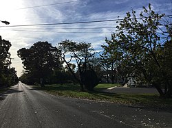
Leeds Point (also known as Leeds) is an unincorporated community and census-designated place (CDP) [6] located within Galloway Township, Atlantic County, in the U.S. state of New Jersey. [7] It is situated on the end of a promontory raised about 30-50 ft above the salt marsh on the south side of Great Bay. [8] Leeds Point is 5.7 miles (9.2 km) northeast of Absecon. Leeds Point has a post office with ZIP Code 08220, which opened on December 18, 1827. [3] [9] The town is named after the Leeds family, whose first American member, Daniel Leeds, Surveyor General of West Jersey around the beginning of the 18th century, after immigrating to New Jersey from the city of Leeds in England, claimed the land which now makes up Leeds Point; some of his descendants lived in Leeds Point from then on. (His descendants also include his son Daniel Leeds and grandson Titan Leeds, who in Philadelphia published one of America's first almanacs.) [10]

The Jersey Devil was born in Leeds Point, according to one legend about the cryptid. The legend claims that in 1735, the thirteenth child of a woman called Mrs. Leeds from the community was transformed into a demon shortly after birth due to her cursing that it would be the devil. [11]

Demographics

As of the 2020 United States census, the population was 205. [2]

Historical population
CensusPop.Note
2020 205
U.S. Decennial Census [12]

Related Research Articles

<span class="mw-page-title-main">Thorofare, New Jersey</span> Populated place in Gloucester County, New Jersey, US

Thorofare is an unincorporated community and census-designated place (CDP) located within West Deptford Township in northwestern Gloucester County, situated in the South Jersey region of the U.S. state of New Jersey. The area is served as United States Postal Service ZIP Code 08086. As of the 2020 United States census, the CDP's population was 2,806. As of the 2000 census, the population of a different geographic entity containing Thorofare, namely ZIP Code Tabulation Area 08086, was 5,424.

<span class="mw-page-title-main">Bridgeport, New Jersey</span> Populated place in Gloucester County, New Jersey, US

Bridgeport is a census-designated place (CDP) and unincorporated community that is part of Logan Township, in Gloucester County, in the U.S. state of New Jersey. At the 2020 United States census, the population of the CDP was 389. in the 2010 census, the population was 504.

Deerfield is an unincorporated community and census-designated place (CDP) located within Upper Deerfield Township, Cumberland County, in the U.S. state of New Jersey. It was first listed as a CDP in the 2020 census with a population of 230.

Martinsville is an unincorporated community and census-designated place (CDP) located within Bridgewater Township, in Somerset County, in the U.S. state of New Jersey. As of the 2010 United States Census, the CDP's population was 11,980.

Hewitt is an unincorporated community and census-designated place (CDP) located within West Milford Township in Passaic County, in the U.S. state of New Jersey. The area is served as United States Postal Service ZIP Code 07421. It is named for Abram Hewitt.

<span class="mw-page-title-main">Oak Ridge, New Jersey</span> Populated place in Morris and Passaic counties, New Jersey, US

Oak Ridge is an unincorporated community and census-designated place (CDP) located along the border of West Milford Township in Passaic County and Jefferson Township in Morris County, in the U.S. state of New Jersey. The area is served as United States Postal Service ZIP Code 07438.

<span class="mw-page-title-main">Gillette, New Jersey</span> Place in Morris County, New Jersey, United States

Gillette is an unincorporated community and census-designated place (CDP) located within Long Hill Township in Morris County, in the U.S. state of New Jersey. The area is served as United States Postal Service ZIP Code 07933.

New Gretna is an unincorporated community and census-designated place (CDP) located within Bass River Township in Burlington County, in the U.S. state of New Jersey. The area is served as United States Postal Service ZIP Code 08224.

Macopin is an unincorporated community and census-designated place (CDP) located within West Milford in Passaic County, in the U.S. state of New Jersey. The area is served as United States Postal Service ZIP Code 07480.

<span class="mw-page-title-main">Jobstown, New Jersey</span> Populated place in Burlington County, New Jersey, US

Jobstown is an unincorporated community and census-designated place (CDP) located within Springfield Township in Burlington County, in the U.S. state of New Jersey. The area is served as United States Postal Service ZIP Code 08041.

<span class="mw-page-title-main">Brookside, New Jersey</span> Place in Morris County, New Jersey, United States

Brookside is a historic unincorporated community and census-designated place (CDP) located within Mendham Township in Morris County, in the U.S. state of New Jersey. It is located approximately 6 mi (9.7 km) west of Morristown. It is close to the Washington Valley Historic District in neighboring Morris Township.

<span class="mw-page-title-main">Liberty Corner, New Jersey</span> Populated place in Somerset County, New Jersey, US

Liberty Corner is an unincorporated community and census-designated place (CDP) located in Bernards Township, in Somerset County, in the U.S. state of New Jersey. Liberty Corner is about 3+34 miles (6.0 km) south of Bernardsville. Liberty Corner has a post office with ZIP code 07938. The Liberty Corner Historic District was listed on the state and national registers of historic places in 1991.

<span class="mw-page-title-main">Harrisonville, New Jersey</span> Populated place in Gloucester County, New Jersey, US

Harrisonville is an unincorporated community and census-designated place (CDP) located within South Harrison Township, in Gloucester County, in the U.S. state of New Jersey. The area is served as United States Postal Service ZIP Code 08039.

<span class="mw-page-title-main">Ocean View, New Jersey</span> Populated place in Cape May County, New Jersey, US

Ocean View is an unincorporated community and census-designated place (CDP) located within Dennis Township in Cape May County, in the U.S. state of New Jersey. The area is served as United States Postal Service ZIP Code 08230. The post office was established in 1872, with William Doolittle as the first postmaster.

<span class="mw-page-title-main">Hancock's Bridge, New Jersey</span> Populated place in Salem County, New Jersey, US

Hancock's Bridge is an unincorporated community and census-designated place (CDP) located within Lower Alloways Creek Township, in Salem County, in the U.S. state of New Jersey. As of the 2010 United States Census, the CDP's population was 254. The area is served as United States Postal Service ZIP Code 08038.

Grenloch is an unincorporated community and census-designated place (CDP) located within Washington Township, in Gloucester County, in the U.S. state of New Jersey. Grenloch is located along New Jersey Route 168 10.25 miles (16.50 km) south-southeast of Camden. Grenloch has a post office with ZIP Code 08032.

<span class="mw-page-title-main">Cologne, New Jersey</span> Populated place in Atlantic County, New Jersey, US

Cologne is an unincorporated community and census-designated place (CDP) located within Galloway Township, in Atlantic County, in the U.S. state of New Jersey. Cologne is located on U.S. Route 30, about 2.5 miles (4.0 km) southeast of Egg Harbor City. Cologne has a post office with ZIP Code 08213.

<span class="mw-page-title-main">Dividing Creek, New Jersey</span> Populated place in Cumberland County, New Jersey, US

Dividing Creek is an unincorporated community and census-designated place (CDP) located in Downe Township in Cumberland County, in the U.S. state of New Jersey.

Milmay is an unincorporated community and census-designated place (CDP) located mostly within Buena Vista Township, in Atlantic County, in the U.S. state of New Jersey. Part of the CDP extends southwest into Maurice River Township in Cumberland County.

Newtonville is an unincorporated community and census-designated place (CDP) in Buena Vista Township in Atlantic County, in the U.S. state of New Jersey. Newtonville is located on a Conrail line 4.7 miles (7.6 km) east-northeast of Buena. Newtonville has a post office with ZIP Code 08346.

References

  1. "ArcGIS REST Services Directory". United States Census Bureau. Retrieved October 11, 2022.
  2. 1 2 Census Data Explorer: Leeds Point CDP, New Jersey, United States Census Bureau. Accessed June 15, 2023.
  3. 1 2 Zip Codes, State of New Jersey. Accessed November 18, 2013.
  4. Geographic Codes Lookup for New Jersey, Missouri Census Data Center. Accessed June 9, 2023.
  5. "Leeds Point". Geographic Names Information System . United States Geological Survey, United States Department of the Interior.
  6. State of New Jersey Census Designated Places - BVP20 - Data as of January 1, 2020, United States Census Bureau. Accessed December 1, 2022.
  7. Locality Search, State of New Jersey. Accessed June 9, 2016.
  8. "New Jersey topographic map". topographic-map.com. Archived from the original on February 14, 2024.
  9. United States Postal Service (2012). "USPS - Look Up a ZIP Code" . Retrieved February 15, 2012.
  10. Beck, Henry Charlton (1945). Jersey Genesis: The story of the Mullica River (5th ed.). Rutgers University Press. pp. 65–67. ISBN   0-8135-1015-5.
  11. Heide, Robert; John Gilman (2007). Backroads of New Jersey: Your Guide to New Jersey's Most Scenic Backroad Adventures. Voyageur Press. p. 124. ISBN   9781616731977.
  12. "Census of Population and Housing". Census.gov. Retrieved June 4, 2016.