Eastern Line (Thailand)

Last updated
Eastern Line
Sukhumvit 71 Station 20220501-2.jpg
Aranyaprathet Main Line near Sukhumvit 71 in Suan Luang district, Bangkok
Overview
StatusOperational
Owner Government of Thailand
Locale Central and Eastern Thailand
Termini
Connecting lines
  • Aranyaprathet Main Line
  • Chuk Samet Main Line
  • Phra Phutthachai Line
Service
Type
Operator(s) State Railway of Thailand
Depot(s)Makkasan
History
Opened24 January 1907;116 years ago (1907-01-24) [1]
Last extension10 November 2023;15 days ago (2023-11-10)
Completed14 July 1989;34 years ago (1989-07-14) [2]
Technical
Line length255 km (158 mi)
Number of tracks1
Track gauge 1,000 mm (3 ft 3+38 in) metre gauge
Route map

Contents

Eastern Line
km
BSicon KBHFa.svg
0.00
Bangkok (Bangkok (Hua Lamphong))
BSicon ABZgl.svg
BSicon CONTfq.svg
BSicon HST.svg
2.64
Urupong Halt
BSicon HST.svg
3.67
Phayathai Halt
BSicon eHST.svg
4.59
Ratchaprarop
0km
BSicon BHF.svg
5.17
Makkasan
Mae Nam
09.87
BSicon KBSTaq.svg
BSicon ABZq+l.svg
BSicon ABZgr.svg
Tha Ruea Mai
14.00
BSicon exKBSTaq.svg
BSicon eABZgr.svg
BSicon HST.svg
6.98
Asok Halt
Mae Nam
Bang Chak oil refinery
22.00
BSicon KDSTe.svg
BSicon BHF.svg
9.85
Khlong Tan
BSicon HST.svg
11.14
Sukhumvit 71 Halt
BSicon BHF.svg
15.18
Hua Mak
BSicon BHF.svg
20.87
Ban Thap Chang
BSicon HST.svg
23.94
Soi Wat Lan Boon
BSicon BHF.svg
26.75
Lat Krabang
BSicon HST.svg
30.33
Phra Chom Klao
BSicon ABZg+l.svg
BSicon KDSTeq.svg
33.86
Inland Container Depot
BSicon BHF.svg
30.91
Hua Takhe
BSicon BHF.svg
39.50
Khlong Luang Phaeng
BSicon HST.svg
43.43
Khlong Udom Chonlajorn
BSicon BHF.svg
46.50
Preng
BSicon HST.svg
51.02
Khlong Khwaeng Klan
BSicon BHF.svg
53.99
Khlong Bang Phra
BSicon HST.svg
57.10
Bang Toei Halt
BSicon BHF.svg
60.99
Chachoengsao Junction
BSicon STR+l.svg
BSicon ABZgr+r.svg
Paet Riu Halt
062.87
BSicon HST.svg
BSicon eHST.svg
69.00
Wat Ko Chan Halt
Don Si Non
075.97
BSicon BHF.svg
BSicon HST.svg
74.53
Phrong Akat Halt
Phan Thong
091.53
BSicon BHF.svg
BSicon BHF.svg
79.04
Bang Nam Prieo
Chon Buri
107.79
BSicon BHF.svg
BSicon BHF.svg
85.60
Khlong Sip Kao Junction
Bang Phra
121.31
BSicon BHF.svg
BSicon KRWgl.svg
BSicon KRW+r.svg
Khao Phrabat Halt
125.35
BSicon HST.svg
BSicon STR.svg
BSicon BHF.svg
115.00
Ongkharak
Si Racha Junction
130.60
BSicon BHF.svg
BSicon STR.svg
BSicon BHF.svg
138.40
Wihan Daeng
BSicon KRW+l.svg
BSicon KRWgr.svg
BSicon STR.svg
BSicon TUNNEL1.svg
Phra Phutthachai Tunnel (1.197 km)
Laem Chabang
139.85
BSicon BST.svg
BSicon STR.svg
BSicon STR.svg
BSicon BHF.svg
149.00
Bu Yai
Laem Chabang Port
BSicon KDSTe.svg
BSicon STR.svg
BSicon STR.svg
BSicon BHF.svg
162.81
Ban Phai Na Bun Junction
Bang Lamung
144.08
BSicon BHF.svg
BSicon STR.svg
BSicon ABZgl.svg
BSicon CONTfq.svg
Pattaya
155.14
BSicon BHF.svg
BSicon STR.svg
BSicon BHF.svg
168.44
Kaeng Khoi Junction
Pattaya Tai Halt
158.82
BSicon HST.svg
BSicon STR.svg
BSicon ABZgl.svg
BSicon CONTfq.svg
BSicon STR.svg
BSicon STR.svg
BSicon CONTf.svg
Pattaya Floating Market Halt
163.28
BSicon HST.svg
BSicon HST.svg
89.42
Khlong Yi Sip Et Halt
Ban Huai Khwang
168.34
BSicon BHF.svg
BSicon BHF.svg
93.73
Yothaka
Yansangwararam
171.10
BSicon BHF.svg
BSicon BHF.svg
101.53
Ban Sang
Suan Nong Nuch Halt
174.09
BSicon HST.svg
BSicon HST.svg
109.49
Nong Nam Khao Halt
Khao Chi Chan Junction
180.00
BSicon BHF.svg
BSicon BHF.svg
115.28
Ban Pak Phli
BSicon KRW+l.svg
BSicon KRWgr.svg
BSicon BHF.svg
121.78
Prachin Buri
Ban Phlu Ta Luang
184.03
BSicon BHF.svg
BSicon STR.svg
BSicon HST.svg
126.25
Nong Krachap Halt
Jamboree
BSicon eHST.svg
BSicon STR.svg
BSicon BHF.svg
131.00
Khok Makok
Sattahip Commercial Port
BSicon eKDSTe.svg
BSicon STR.svg
BSicon BHF.svg
137.65
Prachantakham
Ban Chang
192.25
BSicon BST.svg
BSicon HST.svg
143.41
Nong Saeng
Map Ta Phut
200.48
BSicon BST.svg
BSicon BHF.svg
146.73
Ban Dong Bang
Map Ta Phut Port
BSicon KDSTe.svg
BSicon HST.svg
148.91
Ban Nong Sriwichai Halt
km
BSicon HST.svg
151.85
Ban Phrom Saeng
BSicon HST.svg
156.15
Ban Ko Daeng Halt
BSicon BHF.svg
161.26
Kabin Buri
BSicon HST.svg
165.50
Kabin Kao Halt
BSicon BHF.svg
172.71
Nong Sang
BSicon HST.svg
183.76
Phra Prong Halt
BSicon BHF.svg
190.06
Ban Kaeng
BSicon HST.svg
195.87
Sala Lamduan Halt
BSicon BHF.svg
202.25
Sa Kaeo
BSicon HST.svg
212.94
Sa Kaeo Provincial Office Halt
BSicon HST.svg
216.28
Tha Kasem
BSicon HST.svg
223.40
Huai Chot Halt
BSicon BHF.svg
233.86
Watthana Nakhon
BSicon HST.svg
240.32
Ban Pong Kom Halt
BSicon HST.svg
245.03
Huai Dua Halt
BSicon BHF.svg
254.50
Aranyaprathet
BSicon HST.svg
259.00
Ban Klong Luk Border
BSicon ZOLL.svg
260.44
BSicon HST.svg
261.20
Poipet (Cambodia)
BSicon CONTf.svg
km

Eastern Line is a railway line in Thailand, built and owned by State Railway of Thailand (SRT), located in Bangkok, Chachoengsao Province, Nakhon Nayok Province, Saraburi Province, Prachinburi Province, Sa Kaeo Province, Chonburi Province, and Rayong Province. It is the most important freight transport line in Thailand because there are many freight trains on the line. It was opened on 24 January 1907. [1]

There are plans to incorporate the line as part of the eastern branch line on the Kunming–Singapore railway.

Route description

The lines are divided into three main lines:

Other branch lines:

Timeline

Aranyaprathet Main Line

In 1941, SRT built a 17-kilometer railway line into Cambodia, but five years later, that line was removed because of World War II ending. [1] In 1953, the SRT rebuilt the 6-kilometer rail line into Cambodia upon Cambodia's request and opened it on 22 April 1955, though it was closed again in 1961 due to strained Cambodia-Thailand relations. [1] The cross-border link between Aranyaprathet briefly Poipet briefly opened in April 2019, [4] but closed again in April 2020 due to the COVID-19 pandemic. [5] In 2023, the border was reopened for freight transport. [6]

Chuk Samet Main Line

In July 1989, the Eastern Line Chachoengsao JunctionSattahip Commercial Port section opened. Freight trains continued to end of the line to Sattahip Commercial Port (Chuk Samet) until the early 2000s when the port's commercial role decreased. This resulted in passenger services terminating at Ban Phlu Ta Luang railway station and freight trains stopped operating on the line entirely. In 2002–2003, some services continued down the line to Jamboree Station, built specially for the 20th World Scout Jamboree held in Sattahip. In the 2010s, Samae San railway halt was constructed with some weekend tourist rail services terminating here, but this was short-lived.

On 10 November 2023, the line between Ban Phlu Ta Luang and Chuk Samet reopened, in the hopes of boosting tourism by providing closer access to U-Tapao International Airport, as well as direct rail access to HTMS Chakri Naruebet located at Sattahip Naval Base. [3] [7]

Notable railway stations

Nameboard of Pattaya station, in July 2023. 202307 Nameboard of Pattaya Station 3.jpg
Nameboard of Pattaya station, in July 2023.

The Eastern Line begins at Bangkok before heading through Chachoengsao, Prachinburi to terminate at Aranyaprathet in Sa Kaew Province, 255 kilometers from Bangkok. There is a reopened rail link to Cambodia from Aranyaprathet. A branch line also connects Khlong Sip Kao Junction to the Northeastern Line at Kaeng Khoi Junction. At Chachoengsao Junction, there is another branch to Sattahip. Along the route to Sattahip, at Si Racha Junction, there is yet another branch towards Laem Chabang Deep Sea Port and further at Khao Chi Chan Junction for Map Ta Phut Port, in Rayong.

See also

Related Research Articles

<span class="mw-page-title-main">Chonburi province</span> Province of Thailand

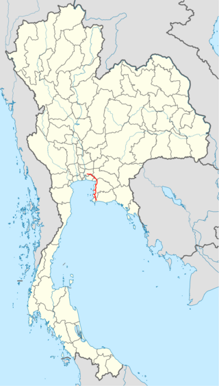
Chonburi is a province of Thailand (changwat) located in eastern Thailand. Its capital is also named Chonburi. Neighbouring provinces are Chachoengsao, Chanthaburi, and Rayong, while the Bay of Bangkok is to the west. Pattaya, a major tourism destination in Thailand, is located in Chonburi, along with Laem Chabang, the country's primary seaport. The population of the province has grown rapidly and now totals 1.7 million residents, although a large portion of the population is floating or unregistered. The registered population as of 31 December 2018 was 1.535 million.

<span class="mw-page-title-main">Aranyaprathet district</span> District in Sa Kaeo, Thailand

Aranyaprathet is a district (amphoe) in Sa Kaeo province in Thailand. It borders Cambodia to the east.

<span class="mw-page-title-main">State Railway of Thailand</span> State-owned rail operator of Thailand

The State Railway of Thailand (SRT) is the state-owned rail operator under the jurisdiction of the Ministry of Transport in Thailand.

<span class="mw-page-title-main">Bay of Bangkok</span> Bay in the Gulf of Thailand

The Bay of Bangkok, also known as the Bight of Bangkok, is the northernmost part of the Gulf of Thailand, roughly extending from Hua Hin District to the west and Sattahip District to the east. Three of the major rivers of central Thailand empty into the bay - the Chao Phraya and its distributary Tha Chin, the Mae Klong and the Bang Pakong River. The bay forms the coast of 8 provinces, them being clockwise: Prachuap Khiri Khan, Phetchaburi, Samut Songkhram, Samut Sakhon, Bangkok, Samut Prakan, Chachoengsao, and Chonburi.

<span class="mw-page-title-main">Thai highway network</span>

The Thai highway network follows the left-hand traffic rule of the road. The network is the twin responsibility of the Department of Highways, and the Department of Rural Roads, under the oversight of the Transportation ministry of Thailand. Public highways are also called public roads, especially when part of urban streets. The network spans over 70,000 kilometers across all regions of Thailand. Most are single carriageways. Dual carriageways have frequent u-turn lanes and intersections slowing down traffic. Coupled with the increase in the number of vehicles and the demand for a limited-access motorway, the Thai Government issued a Cabinet resolution in 1997 detailing the motorway construction master plan. Some upgraded sections of highway are being turned into a "motorway", while other motorways are not being built from highway sections.

Khlong Sip Kao Junction railway station is a railway station located in Yothaka Subdistrict, Bang Nam Priao District, Chachoengsao, Thailand. The station is a class 3 railway station, and is located 85.6 km (53.2 mi) from Bangkok railway station. Khlong Sip Kao is named after Khlong 19, which is a man-made irrigation canal, located nearby. It is also the junction for the Eastern Line Aranyaprathet Main Line and the Phra Phutthachai Line for freight trains only to Kaeng Khoi Junction.

<span class="mw-page-title-main">Aranyaprathet railway station</span>

Aranyaprathet railway station is a railway station located in Aranyaprathet Subdistrict, Aranyaprathet District, Sa Kaeo, Thailand. The station is a class 1 railway station located 254.5 km (158.1 mi) from Bangkok railway station. Aranyaprathet Railway Station opened in 8 November 1926 as part of the Eastern Line Kabin Buri–Aranyaprathet section.

Si Racha Junction Railway Junction is a railway station located in Surasak Subdistrict, Si Racha District, Chon Buri. It is a class 3 railway station located 130.605 km (81.2 mi) from Bangkok railway station. It opened in July 1989 as part of the Chachoengsao Junction–Sattahip Port section. Later, the Laem Chabang Port Line, for freight trains only, opened in 1992, thus turning this station into a junction.

<span class="mw-page-title-main">Pattaya railway station</span> Railway station in Chonburi, Thailand

Pattaya railway station is a railway station located in Nong Prue Subdistrict, Bang Lamung District, Chon Buri, located 3 km east of downtown Pattaya. It is a class 3 railway station located 155.145 km (96.4 mi) from Bangkok railway station. It opened in July 1989 as part of the Eastern Line Chachoengsao Junction–Sattahip Port section. Pattaya Station has the highest daily ridership of all the stations on the Chuk Samet Main Line.

Khao Chi Chan Junction railway station is a railway station located in Bang Sare Subdistrict, Sattahip District, Chon Buri. It is a class 3 railway station located 180.0 km (111.8 mi) from Bangkok railway station. The station opened in July 1989 as part of the Eastern Line Chachoengsao Junction–Sattahip Port section. It is the junction for the Chuk Samet Main Line and the Map Ta Phut Port Line.

Ban Phlu Ta Luang railway station is a railway station located in Phlu Ta Luang Subdistrict, Sattahip District, Chon Buri. It is a class 3 railway station located 184.033 km from Bangkok railway station.

<span class="mw-page-title-main">Makkasan railway station</span> Railway station in Bangkok

Makkasan railway station is a railway station in Makkasan Subdistrict, Ratchathewi District, Bangkok. It is a class 1 railway station 5.171 km (3.2 mi) from Bangkok railway station. The station opened in January 1908 as part of the Eastern Line Bangkok–Chachoengsao Junction section. It is the location of the Makkasan Depot, which opened in 1897 when the railway started operations. Makkasan Depot was destroyed during the Second World War, and was rebuilt using loans from the World Bank.

<span class="mw-page-title-main">Laem Chabang</span> City Municipality in Chonburi, Thailand

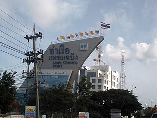
Laem Chabang is a port city municipality in Si Racha and Bang Lamung districts of Chonburi Province, Thailand. It includes Thung Sukhla subdistrict (tambon) and parts of subdistricts Bueng, Nong Kham and Surasak of Si Racha District and part of Bang Lamung township of Bang Lamung District. As of 2019 it had a population of 88,271. The city has grown up around the port, but also serves as a major stop on the coastal highway linking Pattaya and Bangkok via Sukhumvit Road. The city is also known for hosting a Japanese retirement community with specialty stores geared towards them.

<span class="mw-page-title-main">Eastern Economic Corridor</span> Special Economic Zone in Eastern Thailand, Thailand

The Eastern Economic Corridor (Abrv: EEC; Thai: ระเบียงเศรษฐกิจภาคตะวันออก, romanized: Rabīang Sētthakit Phāk Tawan-ǭk, RTGS: Rabiang Setthakit Phak Tawan-ok, pronounced[rā.bīa̯ŋsèːt.tʰā.kìtpʰâːktā.wān.ʔɔ̀ːk]) officially the Eastern Special Development Zone (ESDZ), is a special economic zone of three provinces in eastern Thailand. Collectively, these provinces occupy an area of 13,266 km2 (5,122 sq mi), and in 2016 had an estimated population of over 2.8 million.

<span class="mw-page-title-main">Khlong Tan railway station</span> Train station in Thailand

Khlong Tan railway station is a railway station in Bang Kapi Subdistrict, Huai Khwang District, Bangkok. The station is a part of eastern railway line and is a class 2 railway station located 9.85 km (6.1 mi) from Hua Lamphong.

<span class="mw-page-title-main">Ban Klong Luk Border railway station</span> Railway station in Thailand

Ban Klong Luk Border railway station is a railway station in Thailand and is the last stop of the Aranyaprathet Main Line of the Eastern Line located in Thailand, before entering Cambodia. It is located in Aranyaprathet Subdistrict, Aranyaprathet District, Sa Kaeo Province on the border between Thailand and Cambodia.

<span class="mw-page-title-main">Motorway 7 (Thailand)</span> Highway in Thailand

The Bangkok−Ban Chang Motorway, designated Motorway Route 7, is a motorway in Thailand, connecting Bangkok to Chonburi, Pattaya, and Map Ta Phut. The country's first intercity motorway, it is part of the Asian Highway Network as AH Route 19 and AH Route 123. The entire length from Bangkok to Pattaya is 125.865 kilometres (78.209 mi) and the posted speed limit is 120 kilometres per hour (75 mph), enforced primarily by speed cameras. An extension between Pong and Map Ta Phut opened in May 2020. It is part of the transport network development project in the eastern seaboard.

<span class="mw-page-title-main">Hua Mak station</span> Monorail station in Bangkok, Thailand

Hua Mak station is a station on the Eastern Line of the State Railway of Thailand, an Airport Rail Link station and an MRT station on the Yellow Line, located on Srinagarindra Road in Suan Luang District, Bangkok. Three rail operators run the station complex separately at their respective stations, with no interchanges between the three stations.

U Taphao railway station is a railway station located in Phlu Ta Luang Subdistrict, Sattahip District, Chon Buri. It is a class 1 railway station located 189.00 km from Bangkok railway station. U-Tapao International Airport is located nearby the station.

Chuk Samet railway station is a railway station located in Sattahip Subdistrict, Sattahip District, Chon Buri. It is a class 1 railway station located 195.00 km from Bangkok railway station. It is the railway station located closest to Sattahip town and serves Sattahip Naval Base, including HTMS Chakri Naruebet.

References

  1. 1 2 3 4 History of Thai railway (in Thai)
  2. 1 2 "Thai Railway Travel" p.339
  3. 1 2 "เปิด 2 สถานีรถไฟใหม่ภาคตะวันออก สถานีอู่ตะเภา และ จุกเสม็ด".
  4. Cambodia and Thailand reconnected by rail after 45 years; The Straits Times, 22 April 2019
  5. "Border checkpoints with Cambodia in Sa Kaeo to close". Bangkok Post. Retrieved 2020-12-19.
  6. "ไทย-กัมพูชาเปิดขบวนรถไฟรอบปฐมฤกษ์ เส้นทางมาบตาพุด-คลองลึก-ปอยเปต-พนมเปญ". Manager Online. 27 July 2023.
  7. "เปิดแล้วรถไฟสายตะวันออก หัวลำโพงปลายทางจุกเสม็ด ตู้โดยสารชั้น 3 วันละ 1 เที่ยว".
  8. New Eastern rail line gets on track, The Bangkok Post, 13/01/2012