
Thompson Water, Carr and Common is a 154.7-hectare (382-acre) biological Site of Special Scientific Interest north of Thetford in Norfolk. Most of it is managed by the Norfolk Wildlife Trust as Thompson Common. It is a Nature Conservation Review site, Grade I, and part of the Norfolk Valley Fens Special Area of Conservation. It is crossed by the Great Eastern Pingo Trail Local Nature Reserve.
Marston Marsh is a Local Nature Reserve in southwest Norwich, Norfolk, England.

Sweetbriar Road Meadows is a 9.7-hectare (24-acre) biological Site of Special Scientific Interest in Norwich in Norfolk.
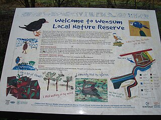
Wensum Local Nature Reserve or Wensum Valley is a Local Nature Reserve in Norwich in the English county of Norfolk. The reserve consists of two sites; Mile Cross Marsh52.6419°N 1.2657°E and Sycamore Crescent Wood which are linked by the Riverside Path a public footpath via the Sycamore Crescent footbridge
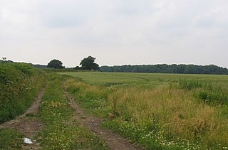
Burbage Wood and Aston Firs is a 51.1-hectare (126-acre) biological Site of Special Scientific Interest in Leicestershire.

Barnham Cross Common is a 69.1-hectare (171-acre) biological Site of Special Scientific Interest on the southern outskirts of Thetford in Norfolk. It is owned by Thetford Town Council and is registered common land. It is also a Local Nature Reserve and a Nature Conservation Review site, Grade 1. It is part of the Breckland Special Area of Conservation and Special Protection Area.
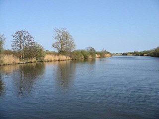
Bure Broads and Marshes is a 741.1-hectare (1,831-acre) biological Site of Special Scientific Interest north-east of Norwich in Norfolk. Most of it is a Nature Conservation Review site, Grade I and National Nature Reserve. Two areas are nature reserves managed by the Norfolk Wildlife Trust, Cockshoot Broad and Ranworth Broad. It is part of the Broadland Ramsar site and Special Protection Area and The Broads Special Area of Conservation,

Cantley Marshes is a 272.1-hectare (672-acre) biological Site of Special Scientific Interest south-east of Norwich in Norfolk. It is managed by the Royal Society for the Protection of Birds, It is part of the Broadland Ramsar site and Special Protection Area, The Broads Special Area of Conservation and the Mid-Yare National Nature Reserve.

Southrepps Common is a 5.6-hectare (14-acre) biological Site of Special Scientific Interest north of North Walsham in Norfolk. A larger area of 12.9-hectare (32-acre) is a Local Nature Reserve. It is owned by Southrepps Parish Council and managed by Southrepps Common Group. It is part of the Norfolk Valley Fens Special Area of Conservation.

Bowthorpe Marsh is a 5.9-hectare (15-acre) Local Nature Reserve in Norwich in Norfolk. It is owned and managed by Norwich City Council.

Dunston Common is a 3.8-hectare (9.4-acre) Local Nature Reserve south of Norwich in Norfolk. It is owned and managed by South Norfolk District Council.

Whitlingham Marsh is a 15.5-hectare (38-acre) Local Nature Reserve in Norwich in Norfolk. It is owned by South Norfolk District Council and managed by the Whitlingham Charitable Trust and the Broads Authority.
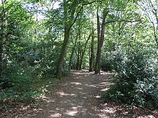
Lion Wood is a 8.9-hectare (22-acre) Local Nature Reserve in Norwich in Norfolk. It is owned and managed by Norwich City Council.

Eaton Chalk Pit is a 0.16-hectare (0.40-acre) biological Site of Special Scientific Interest on the southern outskirts of Norwich in Norfolk.
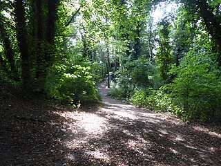
Danby Wood is a 3.9-hectare (9.6-acre) Local Nature Reserve on the southern outskirts of Norwich in Norfolk. It is owned and managed by Norwich City Council.
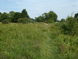
Marston Marshes is a 25.9-hectare (64-acre) Local Nature Reserve on the southern outskirts of Norwich in Norfolk. It is owned and managed by Norwich City Council.

Smockmill Common is a 10-hectare (25-acre) Local Nature Reserve on the eastern outskirts of Newton Flotman in Norfolk. It is owned by the Shotesham Estate and managed by South Norfolk District Council.

Earlham Park Woods is a 8.1-hectare (20-acre) Local Nature Reserve on the western outskirts of Norwich in Norfolk. It is owned and managed by Norwich City Council.


