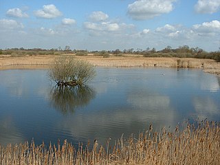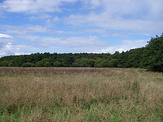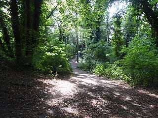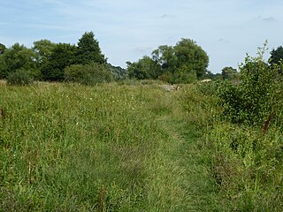
The Broads is a network of mostly navigable rivers and lakes in the English counties of Norfolk and Suffolk. Although the terms "Norfolk Broads" and "Suffolk Broads" are correctly used to identify specific areas within the two counties respectively, the whole area is frequently referred to as the Norfolk Broads.

The Wash is a rectangular bay and multiple estuary at the north-west corner of East Anglia on the East coast of England, where Norfolk meets Lincolnshire and both border the North Sea. One of Britain's broadest estuaries, it is fed by the rivers Witham, Welland, Nene and Great Ouse. It is a 620 km² biological Site of Special Scientific Interest. It is also a Nature Conservation Review site, Grade I, a National Nature Reserve, a Ramsar site, a Special Area of Conservation and a Special Protection Area. It is in the Norfolk Coast Area of Outstanding Natural Beauty and part of it is the Snettisham Royal Society for the Protection of Birds nature reserve.

Great Eastern Pingo Trail is a 9.2 kilometres long footpath along a disused railway line north of Thetford in Norfolk. It is a 4.2-hectare (10-acre) Local Nature Reserve, and it crosses three Sites of Special Scientific Interest, Thompson Water, Carr and Common, Breckland Forest and Cranberry Rough, Hockham. It also crosses Thompson Common, which is a nature reserve managed by the Norfolk Wildlife Trust and is a Nature Conservation Review site, Grade I. It further crosses Norfolk Valley Fens Special Area of Conservation and Breckland Special Protection Area.

Thompson Water, Carr and Common is a 154.7-hectare (382-acre) biological Site of Special Scientific Interest north of Thetford in Norfolk. Most of it is managed by the Norfolk Wildlife Trust as Thompson Common. It is a Nature Conservation Review site, Grade I, and part of the Norfolk Valley Fens Special Area of Conservation. It is crossed by the Great Eastern Pingo Trail Local Nature Reserve.

Woodwalton Fen is a 209 hectare biological Site of Special Scientific Interest in the parish of Woodwalton, west of Ramsey in Huntingdonshire, Cambridgeshire, England. It is a Ramsar wetland site of international importance, a National Nature Reserve, a Special Area of Conservation and a Nature Conservation Review site, Grade I. The site is managed by Natural England.

Sweetbriar Road Meadows is a 9.7-hectare (24-acre) biological Site of Special Scientific Interest in Norwich in Norfolk.

Roydon Fen is a 17.2 hectare Local Nature Reserve south of Roydon, on the western outskirts of Diss in Norfolk. It is owned by South Norfolk District Council and managed by the Suffolk Wildlife Trust.

Fen Alder Carr is a 1.7 hectare Local Nature Reserve south-east of Creeting St Peter in Suffolk. It is owned by Suffolk County Council.

Cranberry Rough is an 81.1-hectare (200-acre) biological and geological Site of Special Scientific Interest in the parish of Hockham, east of Attleborough in Norfolk. It is a Nature Conservation Review site, Grade 2, and the Great Eastern Pingo Trail, which is a Local Nature Reserve, goes through the site. Part of it is a Geological Conservation Review site, and it is part of the Breckland Special Protection Area.

Southrepps Common is a 5.6-hectare (14-acre) biological Site of Special Scientific Interest north of North Walsham in Norfolk. A larger area of 12.9-hectare (32-acre) is a Local Nature Reserve. It is owned by Southrepps Parish Council and managed by Southrepps Common Group. It is part of the Norfolk Valley Fens Special Area of Conservation.

Upper Thurne Broads and Marshes is a 1,185.9-hectare (2,930-acre) biological Site of Special Scientific Interest north of Great Yarmouth in Norfolk. Part of it is a Nature Conservation Review site, Grade I, and it is in the Norfolk Coast Area of Outstanding Natural Beauty. It is part of the Broadland Ramsar site and Special Protection Area, and The Broads Special Area of Conservation. Two areas, Hickling Broad and Martham Broad, are national nature reserves managed by the Norfolk Wildlife Trust.

Yare Broads and Marshes is a 744.5-hectare (1,840-acre) biological Site of Special Scientific Interest east of Norwich in Norfolk, England. Part of the site, is a Nature Conservation Review site, Grade I and most of it is in the Mid-Yare National Nature Reserve. It is part of the Broadland Ramsar site and Special Protection Area, and The Broads Special Area of Conservation. Two ares are Royal Society for the Protection of Birds nature reserves, Strumpshaw Fen and Surlingham Church Marsh.

Bowthorpe Marsh is a 5.9-hectare (15-acre) Local Nature Reserve in Norwich in Norfolk. It is owned and managed by Norwich City Council.

South Walsham Fen is a 1.4-hectare (3.5-acre) Local Nature Reserve west of South Walsham in Norfolk. It is owned and managed by Norfolk County Council.

Danby Wood is a 3.9-hectare (9.6-acre) Local Nature Reserve on the southern outskirts of Norwich in Norfolk. It is owned and managed by Norwich City Council.

Marston Marshes is a 25.9-hectare (64-acre) Local Nature Reserve on the southern outskirts of Norwich in Norfolk. It is owned and managed by Norwich City Council.

Smockmill Common is a 10-hectare (25-acre) Local Nature Reserve on the eastern outskirts of Newton Flotman in Norfolk. It is owned by the Shotesham Estate and managed by South Norfolk District Council.


