Related Research Articles
The Electoral district of City of Sydney was an electorate of the New South Wales Legislative Council.

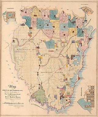
The Electoral district of County of Bathurst was an electorate of the New South Wales Legislative Council at a time when some of its members were elected and the balance were appointed by the Governor.

The Electoral district of County of Camden was an electorate of the New South Wales Legislative Council at a time when some of its members were elected and the balance were appointed by the Governor.

The Electoral district of Pastoral Districts of Clarence and Darling Downs was an electorate of the New South Wales Legislative Council at a time when some of its members were elected and the balance were appointed by the Governor. It was a new electorate created in 1851 by the expansion of the Legislative Council to 54, 18 to be appointed and 36 elected. It included the Clarence Valley and the Darling Downs region, which became part of Queensland on its establishment in 1859.
The Electoral district of Sydney Hamlets was an electorate of the New South Wales Legislative Council at a time when some of its members were elected and the balance were appointed by the Governor. It was a new electorate created in 1851 by the expansion of the Legislative Council to 54 members, with 18 to be appointed and 36 elected. The electoral district included what were then outer suburbs of Sydney and are now the inner suburbs of Glebe, Camperdown, O'Connell Town, Chippendale, Redfern, Surry Hills, Paddington, St Leonards and Balmain.

The Electoral district of County of Durham was an electorate of the New South Wales Legislative Council at a time when some of its members were elected and the balance were appointed by the Governor. It was named after Durham County, which lies on the north side of the Hunter River.
The Electoral district of Stanley Boroughs was an electorate of the New South Wales Legislative Council at a time when some of its members were elected and the balance were appointed by the Governor. It was a new electorate created in 1851 by the expansion of the Legislative Council to 54 members, with 18 to be appointed and 36 elected. The previous district of Counties of Gloucester, Macquarie, and Stanley was split into the districts of Gloucester & Macquarie, Stanley and Stanley Boroughs. The district included North Brisbane, South Brisbane, Kangaroo Point and Ipswich.

The Electoral district of Counties of Gloucester, Macquarie, and Stanley and from 1851, Gloucester and Macquarie, was an electorate of the partially elected New South Wales Legislative Council, created for the first elections for the Council in 1843. The counties of Gloucester and Macquarie were the settled coastal areas north of Northumberland County, while the County of Stanley was the area surrounding Brisbane, in what became part of Queensland after its separation in 1859. Polling took place at Raymond Terrace, Port Macquarie, Dungog, Stroud, Brisbane, Ipswich and Mr Rowley's residence on the Manning River. The County of Stanley was removed from the district with the expansion of the Council in 1851 and became the districts of County of Stanley and Stanley Boroughs.
The electoral district of Cumberland Boroughs, also known as the united towns of Windsor, Richmond, Liverpool and Campbelltown, was an electorate of the New South Wales Legislative Council at a time when two thirds were elected, one sixth were official members, that is they held a government office and the balance were appointed by the Governor.
The Electoral district of Counties of Hunter, Brisbane and Bligh and from 1851, Phillip, Brisbane and Bligh, was an electorate of the partially elected New South Wales Legislative Council, created for the first elections for the Council in 1843. The electoral district included the north western counties of Hunter, Brisbane, Bligh. Polling took place in the towns of Jerrys Plains, nearby Merton, Muswellbrook, Scone, as far north as Murrurundi, Watson's on the Macdonald River, Cassilis and as far west as Montefiores. With the expansion of the Council in 1851 Phillip, the other north west county, was added to the district, replacing Hunter which was combined with the lower Hunter county of Northumberland as Counties of Northumberland and Hunter.
The Electoral district of Counties of Roxburgh, Phillip and Wellington and from 1851, Roxburgh and Wellington, was an electorate of the partially elected New South Wales Legislative Council, created for the first elections for the Council in 1843. The electoral district included the western counties of Roxburgh, Phillip, Wellington County. Polling took place at Montefiores, Mudgee, Bathurst and Hartley. The County of Phillip was removed from the district with the expansion of the Council in 1851 and became part of the Counties of Phillip, Brisbane and Bligh.
The Electoral district of Northumberland Boroughs was an electorate of the partially elected New South Wales Legislative Council, created for the first elections for the Council in 1843. From 1843 until 1851 the electorate covered the major towns or boroughs of Northumberland County, East Maitland, West Maitland and Newcastle, and polling took place at East Maitland, West Maitland and Newcastle. Morpeth was added to the electorate from 1851 while Newcastle was removed from the electorate to form, with Raymond Terrace, the North Eastern Boroughs. The rest of Northumberland County was covered by the County of Northumberland from 1843 until 1951, and Counties of Northumberland and Hunter from 1851 until 1856.
The 1851 New South Wales colonial election, was held between 12 and 25 September. It involved a re-distribution of electorates as a result of the separation of Victoria, which had 6 seats in the previous council, and the expansion of the council from 24 elected members to 36 elected members representing 31 electorates. The major changes were the addition of 8 pastoral districts and the separate representation for the northern regions of what would later become Queensland. These had previously been a part of the single district of Gloucester, Macquarie, and Stanley and from 1851 were covered by the separate districts of Stanley, Stanley Boroughs and the pastoral districts of Moreton, Wide Bay, Burnett, and Maranoa. The other 8 additional seats were distributed among the nineteen counties of New South Wales.
The Electoral district of Pastoral Districts of Lachlan and Lower Darling was an electorate of the New South Wales Legislative Council at a time when some of its members were elected and the balance were appointed by the Governor. It was a new electorate created in 1851 by the expansion of the Legislative Council to 54, 18 to be appointed and 36 elected. The district covered the south west of New South Wales was named after the Lachlan and Darling Rivers. On its eastern side were the districts of County of Bathurst and Counties of King and Georgiana, to the north was the Pastoral Districts of Wellington and Bligh and to the south was the Counties of Murray and St Vincent. Polling was to occur in the towns of Binalong, Wagga Wagga, Balranald, Canowindra, Gundagai and Yass.
The Electoral district of Pastoral Districts of Liverpool Plains and Gwydir was an electorate of the New South Wales Legislative Council at a time when some of its members were elected and the balance were appointed by the Governor. It was a new electorate created in 1851 by the expansion of the Legislative Council to 54, 18 to be appointed and 36 elected. The district was named after the Liverpool Plains and Gwydir River and covered what is now known as the North West Slopes region. On its eastern side was the Pastoral Districts of New England and Macleay and to the south was the Pastoral Districts of Wellington and Bligh. Polling was to occur in the towns of Murrurundi, Tamworth, Wee Waa, Warialda and the Woolshed on the Namoi River.
The Electoral district of Pastoral District of Maneroo was an electorate of the New South Wales Legislative Council at a time when some of its members were elected and the balance were appointed by the Governor. It was a new electorate created in 1851 by the expansion of the Legislative Council to 54, 18 to be appointed and 36 elected. The district covered the Maneroo region now known as Monaro in the south east of New South Wales. To its north was the Electoral district of Counties of Murray and St Vincent. Polling was to occur in the towns of Goulburn, Eden, Cooma and Bombala.
The Electoral district of Pastoral District of Murrumbidgee was an electorate of the New South Wales Legislative Council at a time when some of its members were elected and the balance were appointed by the Governor. It was a new electorate created in 1851 by the expansion of the Legislative Council to 54, 18 to be appointed and 36 elected. The district is located in the west of the state and was named after the Murrumbidgee River. Polling was to occur in the towns of Tumut, Gundagai, Albury, Wagga Wagga, Moulamein and Yass.
The Electoral district of Pastoral Districts of New England and Macleay was an electorate of the New South Wales Legislative Council at a time when some of its members were elected and the balance were appointed by the Governor. It was a new electorate created in 1851 by the expansion of the Legislative Council to 54, 18 to be appointed and 36 elected. The district is located in the north of the state and covered the Northern Tablelands region of New England and part of the Mid North Coast region, including the area to the north of the Macleay River, but excluding the area south of the Macleay River which was included in the Counties of Gloucester and Macquarie. To the north was the Pastoral Districts of Clarence and Darling Downs and to the west the Pastoral Districts of Liverpool Plains and Gwydir. Polling took place in the towns of Wellingrove, Armidale, Tenterfield, Walcha and Kempsey.
The Electoral district of Pastoral Districts of Moreton, Wide Bay, Burnett, and Maranoa was an electorate of the New South Wales Legislative Council at a time when some of its members were elected and the balance were appointed by the Governor. It was a new electorate created in 1851 by the expansion of the Legislative Council to 54, 18 to be appointed and 36 elected. The district was named after the early settlements of Moreton Bay; Wide Bay, near Maryborough; the Burnett River, near Bundaberg; the Maranoa region of South-western Queensland. These became part of Queensland on its establishment in 1859.

The Electoral district of County of Stanley was an electorate of the New South Wales Legislative Council at a time when some of its members were elected and the balance were appointed by the Governor. It was a new electorate created in 1851 by the expansion of the Legislative Council to 54 members, with 18 to be appointed and 36 elected. The previous district of Counties of Gloucester, Macquarie, and Stanley was split into the districts of Gloucester & Macquarie, Stanley and Stanley Boroughs, which included North Brisbane, South Brisbane, Kangaroo Point and Ipswich.
References
- 1 2 An Act to provide for the division of the Colony of New South Wales after the separation of the District of Port Phillip therefrom into Electoral Districts and for the Election of Members to serve in the Legislative Council (PDF) (48). Australasian Legal Information Institute. 2 May 1851. Retrieved 10 September 2014.
- 1 2 "Mr James Brindley Bettington (1796-1857)". Former members of the Parliament of New South Wales . Retrieved 3 May 2019.
- ↑ "Mr Charles Wray Finch (1809-1873)". Former members of the Parliament of New South Wales . Retrieved 21 May 2019.
- ↑ "Wellington and Bligh". The Sydney Morning Herald . 25 September 1851. p. 3. Retrieved 29 May 2019– via Trove.
- ↑ "Who represents the colony?". The Empire . 10 December 1853. p. 4. Retrieved 23 April 2019– via Trove.