Related Research Articles
Southern Boroughs was an electoral district for the Legislative Assembly in the Australian state of New South Wales created in 1856. It included the towns of Goulburn, Braidwood, Yass and Queanbeyan, while the surrounding rural area were in the electoral districts of Argyle, United Counties of Murray and St Vincent and King and Georgiana. It was replaced by Goulburn, Braidwood, Queanbeyan and Yass in 1859.
This is a list of members of the New South Wales Legislative Council from 1843 to 1851. The 1843 Electoral Act prescribed 36 members, 24 to be elected, 6 appointed by virtue of their office and 6 nominated. The appointments and elections were for five year terms and thus occurred in 1843, and 1848. The Speaker was Alexander Macleay until 19 May 1846 and then Charles Nicholson. The parliament was dissolved on 30 June 1851 as a result of the 1851 Electoral Act which increased the number of members in the Council to 54.
The Electoral district of City of Sydney was an electorate of the New South Wales Legislative Council.

The Electoral district of County of Bathurst was an electorate of the New South Wales Legislative Council at a time when some of its members were elected and the balance were appointed by the Governor.

The Electoral district of County of Argyle was an electorate of the New South Wales Legislative Council at a time when some of its members were elected and the balance were appointed by the Governor.

The Electoral district of County of Camden was an electorate of the New South Wales Legislative Council at a time when some of its members were elected and the balance were appointed by the Governor.

The Electoral district of County of Durham was an electorate of the New South Wales Legislative Council at a time when some of its members were elected and the balance were appointed by the Governor. It was named after Durham County, which lies on the north side of the Hunter River.

The Electoral district of County of Cumberland was an electorate of the New South Wales Legislative Council at a time when some of its members were elected and the balance were appointed by the Governor.

The Electoral district of Counties of Gloucester, Macquarie, and Stanley and from 1851, Gloucester and Macquarie, was an electorate of the partially elected New South Wales Legislative Council, created for the first elections for the Council in 1843. The counties of Gloucester and Macquarie were the settled coastal areas north of Northumberland County, while the County of Stanley was the area surrounding Brisbane, in what became part of Queensland after its separation in 1859. Polling took place at Raymond Terrace, Port Macquarie, Dungog, Stroud, Brisbane, Ipswich and Mr Rowley's residence on the Manning River. The County of Stanley was removed from the district with the expansion of the Council in 1851 and became the districts of County of Stanley and Stanley Boroughs.

Larbert is a locality in the Queanbeyan-Palerang Region of the Southern Tablelands region of New South Wales. It lies mostly north of the Kings Highway between Bungendore and Braidwood where it crosses the Shoalhaven River. At the 2021 census, it had a population of 34.
The 1848 New South Wales colonial election was held between 29 July and 2 August. No candidates were nominated for Port Phillip as a result of the campaign for independence from New South Wales, and a fresh writ was issued for an election on 3 October.
The Electoral district of Counties of St Vincent and Auckland was an electorate of the partially elected New South Wales Legislative Council, created for the first elections for the Council in 1843. The electoral district consisted of the two south coast counties of St Vincent and Auckland, extending from Jervis Bay south to Eden and west to Braidwood. Polling took place at Jervis Bay, Ulladulla, Braidwood, Broulee and Eden. The district was abolished with the expansion of the Council in 1851. St Vincent was combined with Murray to the west as the Counties of Murray and St Vincent while Auckland became part of the Pastoral District of Maneroo.
The Electoral district of Counties of Roxburgh, Phillip and Wellington and from 1851, Roxburgh and Wellington, was an electorate of the partially elected New South Wales Legislative Council, created for the first elections for the Council in 1843. The electoral district included the western counties of Roxburgh, Phillip, Wellington County. Polling took place at Montefiores, Mudgee, Bathurst and Hartley. The County of Phillip was removed from the district with the expansion of the Council in 1851 and became part of the Counties of Phillip, Brisbane and Bligh.
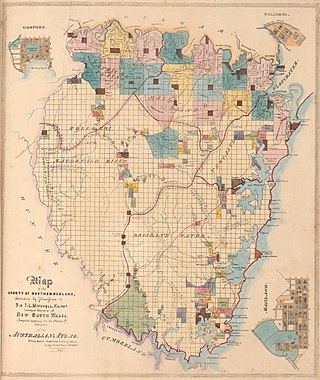
The Electoral district of County of Northumberland and from 1851, Northumberland and Hunter, was an electorate of the partially elected New South Wales Legislative Council, created for the first elections for the Council in 1843. The County of Northumberland was bounded by the part of the Hawkesbury River to the south, the Macdonald River to the south-west, and the Hunter River to the north, however the electoral district did not include the towns of East Maitland, West Maitland and Newcastle which made up the district of Northumberland Boroughs. Polling took place at Gosford, Newcastle, East Maitland, Wollombi, Singleton and Watson's on the Macdonald River. The County of Hunter was added to the district with the expansion of the Council in 1851 and elected two members.
The 1851 New South Wales colonial election, was held between 12 and 25 September. It involved a re-distribution of electorates as a result of the separation of Victoria, which had 6 seats in the previous council, and the expansion of the council from 24 elected members to 36 elected members representing 31 electorates. The major changes were the addition of 8 pastoral districts and the separate representation for the northern regions of what would later become Queensland. These had previously been a part of the single district of Gloucester, Macquarie, and Stanley and from 1851 were covered by the separate districts of Stanley, Stanley Boroughs and the pastoral districts of Moreton, Wide Bay, Burnett, and Maranoa. The other 8 additional seats were distributed among the nineteen counties of New South Wales.
The Electoral district of Pastoral Districts of Lachlan and Lower Darling was an electorate of the New South Wales Legislative Council at a time when some of its members were elected and the balance were appointed by the Governor. It was a new electorate created in 1851 by the expansion of the Legislative Council to 54, 18 to be appointed and 36 elected. The district covered the south west of New South Wales was named after the Lachlan and Darling Rivers. On its eastern side were the districts of County of Bathurst and Counties of King and Georgiana, to the north was the Pastoral Districts of Wellington and Bligh and to the south was the Counties of Murray and St Vincent. Polling was to occur in the towns of Binalong, Wagga Wagga, Balranald, Canowindra, Gundagai and Yass.
The Electoral district of Pastoral District of Maneroo was an electorate of the New South Wales Legislative Council at a time when some of its members were elected and the balance were appointed by the Governor. It was a new electorate created in 1851 by the expansion of the Legislative Council to 54, 18 to be appointed and 36 elected. The district covered the Maneroo region now known as Monaro in the south east of New South Wales. To its north was the Electoral district of Counties of Murray and St Vincent. Polling was to occur in the towns of Goulburn, Eden, Cooma and Bombala.
The Electoral district of Southern Boroughs was an electorate of the New South Wales Legislative Council at a time when some of its members were elected and the balance were appointed by the Governor. It was a new electorate created in 1851 by the expansion of the Legislative Council to 54, 18 to be appointed and 36 elected. The district consisted of the towns of Goulburn, Braidwood, Yass and Queanbeyan, while the surrounding rural area were in the districts of Argyle, Counties of Murray and St Vincent and Counties of King and Georgiana.
The Electoral district of Counties of Murray and St Vincent was an electorate of the New South Wales Legislative Council at a time when some of its members were elected and the balance were appointed by the Governor. It was a new electorate created in 1851 by the expansion of the Legislative Council to 54, 18 to be appointed and 36 elected. The district consisted of the rural areas of Murray County, which had previously been part of Counties of Murray, King and Georgiana, and St Vincent County, which had previously been part of Counties of St Vincent and Auckland. The towns of Braidwood and Queanbeyan were not part of the district, being included in Southern Boroughs.

James Larmer was a government surveyor in the colony of New South Wales. Between 1830 and 1859, he surveyed land, roads and settlements in New South Wales. He was an Assistant Surveyor to the Surveyor-General, Sir Thomas Mitchell, from 1835 to 1855. In 1835, he was second in command of Mitchell’s second expedition. He is also noteworthy for his recording of Aboriginal words from various parts of New South Wales.
References
- 1 2 "An Act to provide for the division of the Colony of New South Wales into Electoral Districts and for the Election of Members to serve in the Legislative Council.". Act No. 16 of 23 February 1843 (PDF). Australasian Legal Information Institute. Retrieved 27 May 2019.
- ↑ "Polling places". The Sydney Morning Herald . 14 July 1848. p. 2. Retrieved 28 May 2019– via Trove.
- ↑ "An Act to provide for the division of the Colony of New South Wales after the separation of the District of Port Phillip therefrom into Electoral Districts and for the Election of Members to serve in the Legislative Council.". Act No. 48 of 2 May 1851 (PDF). Australasian Legal Information Institute. Retrieved 27 May 2019.
- ↑ "Sir Terence Aubrey Murray (1810-1873)". Former members of the Parliament of New South Wales . Retrieved 11 May 2019.
- ↑ "Mr James Chisholm (1806-1888)". Former members of the Parliament of New South Wales . Retrieved 6 June 2019.
- ↑ "The south western counties". The Sydney Morning Herald . 22 June 1843. p. 2. Retrieved 23 May 2019– via Trove.
- ↑ "Yass". The Sydney Morning Herald . 1 August 1848. p. 2. Retrieved 26 May 2019– via Trove.
- ↑ "Yass: Election for the Counties of King and Georgiana". The Sydney Morning Herald . 17 September 1851. p. 2. Retrieved 30 May 2019– via Trove.