Elephant Butte, Sierra County, New Mexico

Last updated

Elephant Butte is a populated place on the southeast end of the Elephant Butte Reservoir in Sierra County, New Mexico. [1] It should not be confused with the modern city of Elephant Butte, New Mexico that is on the west side of the reservoir to the north west of this place. This site lies at an elevation of 4,465 feet / 1,361 meters and overlooks Elephant Butte to the north, the geographic feature that gives its name to all these locations. [1]

Elephant Butte Reservoir Reservoir on the Rio Grande in New Mexico, United States

Elephant Butte Reservoir is a reservoir on the Rio Grande in the U.S. state of New Mexico, 5 miles (8.0 km) north of Truth or Consequences. This reservoir is the 84th largest man-made lake in the United States, and the largest in New Mexico by total surface area and peak volume. It is the only place in New Mexico where one can find pelicans perched on or alongside the lake. There are also temporary US Coast Guard bases stationed at Elephant Butte. It is impounded by Elephant Butte Dam and is part of the largest state park in New Mexico, Elephant Butte Lake State Park.

Sierra County, New Mexico U.S. county in New Mexico

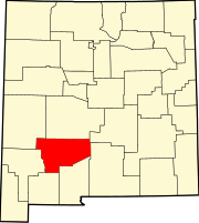
Sierra County is a county in the U.S. state of New Mexico. As of the 2010 census, the population was 11,988. Its county seat is Truth or Consequences.

Elephant Butte, New Mexico City in New Mexico, United States

Elephant Butte is a city in Sierra County, New Mexico, United States, near Elephant Butte Reservoir and State Park. The population was 1,390 at the 2000 census.

Elephant Butte was a town formed to house people and activities supporting the construction of the Elephant Butte Dam and had its own post office from 1919 until 1920, when the mail was sent to Engle. [2] Elephant Butte Cemetery lies on a hillside to the east at 33°08′40″N107°10′24″W / 33.14444°N 107.17333°W / 33.14444; -107.17333 . [3] Interments at the cemetery date from 1912 to June 20, 1989. [4] The site of Elephant Butte is currently the location of the Elephant Butte Dam Site Resort & Marina. [1]

Elephant Butte Dam dam in Elephant Butte, New Mexico

Elephant Butte Dam or Elephant Butte Dike is a concrete gravity dam on the Rio Grande river near Truth or Consequences, New Mexico. The dam impounds Elephant Butte Reservoir, which is used mainly for agriculture, and also provides for recreation, hydroelectricity and flood control. The construction of the dam has reduced the flow of the Rio Grande to a small stream for most of the year, with water released only during the summer irrigation season, or during times of exceptionally heavy snow melt.

Engle, New Mexico Unincorporated community in New Mexico, United States

Engle is an unincorporated community in Sierra County, New Mexico, United States.

Related Research Articles

Fra Cristobal Range

The Fra Cristobal Range, is a 17 mi (27 km) long, mountain range in central-north Sierra County, New Mexico. Its northern extreme above Fra Cristoblal Mountain extends into Socorro County. The range borders the eastern shore of Elephant Butte Reservoir on the Rio Grande, and the range lies towards the southwest of the Jornada del Muerto, the desert region east of the river.

Hot Springs Landing, New Mexico Census-designated place in New Mexico, United States

Hot Springs Landing is a census-designated place in Sierra County, New Mexico, United States. Its population was 110 as of the 2010 census. The community is located on the western shore of Elephant Butte Reservoir.

Cuchillo Negro Creek is a stream in Sierra County, in the U.S. state of New Mexico. The stream is a tributary of the Rio Grande.

Elephant Butte is a summit now located in the Elephant Butte Reservoir and within the Elephant Butte Lake State Park in Sierra County, New Mexico. It has an elevation of 4,639 feet (1,414 m). It was named for its shape, said to look like an elephant.

McRae Canyon is a canyon in the southern Fra Cristobal Range in Sierra County, New Mexico. Its waters are tributary to the Rio Grande, and today flow into the Elephant Butte Reservoir at the head of an inlet in the flooded lower canyon, at an elevation of 4,354 feet / 1,327 meters. Its source is at 33°13′52″N107°05′50″W, at an elevation of 5,070 feet / 1,545 meters in the southern Fra Cristobal Range.

Elephant Butte is a summit in Hidalgo County, New Mexico. It lies at an elevation of 6,361 feet / 1,939 meters, on the Cowboy Rim of the Animas Mountains.

Fort McRae was a Union Army post, established in 1863, then a U.S. Army post from 1866 and closed in 1876, in what is now Sierra County, New Mexico. The post was named for Alexander McRae (1829–1862) a slain hero of the 1862 Battle of Valverde.

Alamosa Creek, also known as Alamosa Arroyo and Alamosa River is a tributary stream of the Rio Grande in Socorro and Sierra County, New Mexico. Alamosa Creek has its source at 33°49′13″N107°38′43″W at an elevation of 7600 ft / 2,316 meters on the western slope of the San Mateo Mountains in Soccoro. Its mouth was originally at its confluence with the Rio Grande, before that river was flooded by the Elephant Butte Reservoir created by the Elephant Butte Dam. Its mouth is now on the western edge of that reservoir at the mouth of Monticello Canyon.

References

  1. 1 2 3 U.S. Geological Survey Geographic Names Information System: Elephant Butte
  2. U.S. Geological Survey Geographic Names Information System: Elephant Butte Post Office (historical)
  3. U.S. Geological Survey Geographic Names Information System: Elephant Butte Cemetery
  4. "Elephant Butte Cemetery". interment.net. Clear Digital Media.

Coordinates: 33°08′55″N107°11′05″W / 33.14861°N 107.18472°W / 33.14861; -107.18472

Geographic coordinate system Coordinate system

A geographic coordinate system is a coordinate system that enables every location on Earth to be specified by a set of numbers, letters or symbols. The coordinates are often chosen such that one of the numbers represents a vertical position and two or three of the numbers represent a horizontal position; alternatively, a geographic position may be expressed in a combined three-dimensional Cartesian vector. A common choice of coordinates is latitude, longitude and elevation. To specify a location on a plane requires a map projection.