Ellis, Illinois

Last updated
Ellis, Illinois
Unincorporated community
USA Illinois location map.svg
Red pog.svg
Ellis, Illinois
Usa edcp location map.svg
Red pog.svg
Ellis, Illinois
Coordinates: 39°35′24″N89°31′44″W / 39.59000°N 89.52889°W / 39.59000; -89.52889 Coordinates: 39°35′24″N89°31′44″W / 39.59000°N 89.52889°W / 39.59000; -89.52889
Country United States
State Illinois
County Christian
Elevation 594 ft (181 m)
Time zone Central (CST) (UTC-6)
  Summer (DST) CDT (UTC-5)
Area code(s) 217
GNIS feature ID 422664 [1]

Ellis is an unincorporated community in Christian County, Illinois, United States. [1] It lies at 39°35′24″N89°31′44″W / 39.59000°N 89.52889°W / 39.59000; -89.52889 . [2]

Unincorporated area Region of land not governed by own local government

In law, an unincorporated area is a region of land that is not governed by a local municipal corporation; similarly an unincorporated community is a settlement that is not governed by its own local municipal corporation, but rather is administered as part of larger administrative divisions, such as a township, parish, borough, county, city, canton, state, province or country. Occasionally, municipalities dissolve or disincorporate, which may happen if they become fiscally insolvent, and services become the responsibility of a higher administration. Widespread unincorporated communities and areas are a distinguishing feature of the United States and Canada. In most other countries of the world, there are either no unincorporated areas at all, or these are very rare; typically remote, outlying, sparsely populated or uninhabited areas.
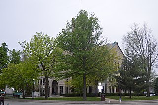
Christian County, Illinois County in the United States

Christian County is a county located in the U.S. state of Illinois. As of the 2010 census, the population was 34,800. Its county seat is Taylorville.

Illinois State of the United States of America

Illinois is a state in the Midwestern region of the United States. It has the 5th largest Gross Domestic Product by state, is the 6th-most populous U.S. state and 25th-largest state in terms of land area. Illinois is often noted as a microcosm of the entire United States. With Chicago in the northeast, small industrial cities and great agricultural productivity in northern and central Illinois, and natural resources such as coal, timber, and petroleum in the south, Illinois has a diverse economic base, and is a major transportation hub. Chicagoland, Chicago's metropolitan area, contains over 65% of the state's population. The Port of Chicago connects the state to other global ports around the world from the Great Lakes, via the Saint Lawrence Seaway, to the Atlantic Ocean; as well as the Great Lakes to the Mississippi River, via the Illinois Waterway on the Illinois River. The Mississippi River, the Ohio River, and the Wabash River form parts of the boundaries of Illinois. For decades, Chicago's O'Hare International Airport has been ranked as one of the world's busiest airports. Illinois has long had a reputation as a bellwether both in social and cultural terms and, through the 1980s, in politics.

Related Research Articles

Buckhart Township, Christian County, Illinois Township in Illinois, United States

Buckhart Township is one of seventeen townships in Christian County, Illinois, USA. As of the 2010 census, its population was 1,792 and it contained 822 housing units.

Locust Township, Christian County, Illinois Township in Illinois, United States

Locust Township is one of seventeen townships in Christian County, Illinois, USA. As of the 2010 census, its population was 1,825 and it contained 263 housing units.

May Township, Christian County, Illinois Township in Illinois, United States

May Township is one of seventeen townships in Christian County, Illinois, USA. As of the 2010 census, its population was 1,581 and it contained 668 housing units.

Mosquito Township, Christian County, Illinois Township in Illinois, United States

Mosquito Township is one of seventeen townships in Christian County, Illinois, USA. As of the 2010 census, its population was 390 and it contained 162 housing units.

Mount Auburn Township, Christian County, Illinois Township in Illinois, United States

Mount Auburn Township is one of seventeen townships in Christian County, Illinois, USA. As of the 2010 census, its population was 1,028 and it contained 458 housing units.

Rosamond Township, Christian County, Illinois Township in Illinois, United States

Rosamond Township is one of seventeen townships in Christian County, Illinois, USA. As of the 2010 census, its population was 421 and it contained 162 housing units.

South Fork Township, Christian County, Illinois Township in Illinois, United States

South Fork Township is one of seventeen townships in Christian County, Illinois, USA. As of the 2010 census, its population was 2,788 and it contained 1,309 housing units.

Stonington Township, Christian County, Illinois Township in Illinois, United States

Stonington Township is one of seventeen townships in Christian County, Illinois, USA. As of the 2010 census, its population was 1,131 and it contained 481 housing units.

Hewittsville, Illinois Unincorporated community in Illinois, United States

Hewittsville is an unincorporated community in Christian County, Illinois, United States. It lies at 39°32′10″N89°13′00″W.

Langleyville, Illinois Census-designated place in Illinois, United States

Langleyville is an unincorporated census-designated place in Christian County, Illinois, United States. It lies at 39°33′44″N89°21′19″W. As of the 2010 census, its population was 432. Langleyville has an area of 0.393 square miles (1.02 km2), all land.

Millersville, Illinois Unincorporated community in Illinois, United States

Millersville is an unincorporated community in Christian County, Illinois, United States. It lies at 39°27′4″N89°9′29″W, at an elevation of 656 feet.

Old Stonington, Illinois Unincorporated community in Illinois, United States

Old Stonington is an unincorporated community in Christian County, Illinois, United States. It lies at 39°36′41″N89°8′52″W.

Radford, Illinois Unincorporated community in Illinois, United States

Radford is an unincorporated community in Christian County, Illinois, United States. It lies at 39°34′39″N89°2′4″W.

Bolivia, Illinois Unincorporated community in Illinois, United States

Bolivia is an unincorporated community in Christian County, Illinois, United States. It lies at 39°44′32″N89°20′49″W.

Midway, Christian County, Illinois Unincorporated community in Illinois, United States

Midway is an unincorporated community in Christian County, Illinois, United States. It lies at 39°40′11″N89°9′31″W.

Osbernville, Illinois Unincorporated community in Illinois, United States

Osbernville is an unincorporated community in Christian County, Illinois, United States. It lies at 39°45′40″N89°10′43″W.

Sicily, Illinois Unincorporated community in Illinois, United States

Sicily is an unincorporated community in Christian County, Illinois, United States. It lies at 39°35′24″N89°29′28″W.

Vanderville, Illinois Unincorporated community in Illinois, United States

Vanderville is an unincorporated community in Christian County, Illinois, United States. It lies at 39°25′31″N89°17′51″W.

Velma, Illinois Unincorporated community in Illinois, United States

Velma is an unincorporated community in Christian County, Illinois, United States. It lies at 39°30′53″N89°13′57″W.

Zenobia, Illinois Unincorporated community in Illinois, United States

Zenobia is an unincorporated community in Christian, Montgomery, and Sangamon counties in the U.S. state of Illinois. It lies at 39°31′43″N89°32′1″W.

References