
Longreach is a town and a locality in the Longreach Region, Queensland, Australia. It is the administrative centre of the Longreach Regional Council, which was established in 2008 as a merger of the former Longreach, Ilfracombe, and Isisford shires. Longreach is a well known tourist destination due to its aviation history and importance. In the 2021 census, the locality of Longreach had a population of 3,124.

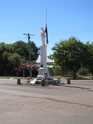
Blackall is a rural town and locality in the Blackall-Tambo Region, Queensland, Australia. The town is the service centre for the Blackall-Tambo Region. The dominant industry in the area is grazing with over 70 homesteads in the locality. In the 2021 census, the locality of Blackall had a population of 1,365 people.
Aramac is a rural town and locality in the Barcaldine Region, Queensland, Australia. In the 2021 census, the locality of Aramac had a population of 372 people.

Isisford is a rural town and locality in the Longreach Region, Queensland, Australia. In the 2021 census, the locality of Isisford had a population of 218 people.

Chillagoe is a rural town and locality in the Shire of Mareeba, Queensland, Australia. In the 2021 census, the locality of Chillagoe had a population of 214 people.
Hughenden is a rural town and locality in the Flinders Shire, Queensland, Australia. In the 2021 census, the locality of Hughenden had a population of 1,113 people.

Anakie Siding is a rural locality in the Central Highlands Region, Queensland, Australia. It contains the town of Anakie. It is a sapphire mining area. In 2021 census, the locality of Anakie Siding had a population of 155 people.

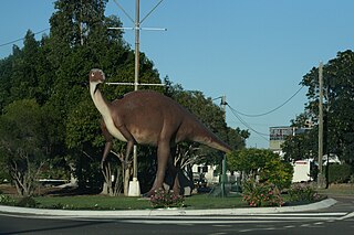
Muttaburra is an outback town and locality in the Barcaldine Region, Queensland, Australia. Muttaburra was the discovery site of the Muttaburrasaurus, one of Australia's most famous dinosaurs.

Yaraka is a rural town and locality in the Longreach Region of Queensland, Australia. Until 2021, the town of Yaraka was part of the locality of Isisford.

Ilfracombe is a rural town and locality in the Longreach Region, Queensland, Australia. In the 2021 census, the locality of Ilfracombe had a population of 310 people.

The Shire of Longreach was a local government area located in central western Queensland, centred on the town of Longreach, from which the shire was administered. It covered an area of 23,561.4 square kilometres (9,097.1 sq mi), and existed as a local government entity from 1900 until 2008, when it amalgamated with the Shires of Ilfracombe and Isisford to form the Longreach Region.

Mount Surprise is a rural town and locality in the Shire of Etheridge, Queensland, Australia. In the 2021 census, the locality of Mount Surprise had a population of 138 people.

Kingsthorpe is a rural town and locality in the Toowoomba Region, Queensland, Australia. In the 2021 census, the locality of Kingsthorpe had a population of 2,159 people.
Adavale is a rural town and locality in the Shire of Quilpie, Queensland, Australia. In the 2021 census, the locality of Adavale had a population of 72 people.

Theebine is a rural town and locality split between the Gympie Region and the Fraser Coast Region, both in Queensland, Australia.

Morella was a rural locality within Longreach Region, Queensland, Australia. Since January 2019, it has been amalgamated into the locality of Longreach.

Almaden is a rural town and locality in the Shire of Mareeba, Queensland, Australia. In the 2021 census, the locality of Almaden had a population of 41 people.

Willows is a rural locality in the Central Highlands Region, Queensland, Australia. In the 2021 census, Willows had a population of 139 people.

Petford is a rural locality in the Shire of Mareeba, Queensland, Australia. In the 2021 census, Petford had a population of 22 people.
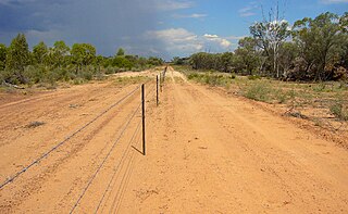
Isisford–Blackall Road is a continuous 122-kilometre (76 mi) road route in the Longreach and Blackall-Tambo local government areas of Queensland, Australia. It is a state-controlled regional road, rated as a local road of regional significance (LRRS).


