Morella, Queensland

Last updated

Map all coordinates using: OpenStreetMap  
Download coordinates as: KML
Morella
Queensland
Landscape, Morella, 2019 01.jpg
Landscape, 2019
Australia Queensland location map.svg
Red pog.svg
Morella
Coordinates 22°59′53″S143°51′18″E / 22.9980°S 143.8550°E / -22.9980; 143.8550 (Morella (centre of locality)) Coordinates: 22°59′53″S143°51′18″E / 22.9980°S 143.8550°E / -22.9980; 143.8550 (Morella (centre of locality))
Population33 (2016 census) [1]
Postcode(s) 4730
Time zone AEST (UTC+10:00)
Location
LGA(s) Longreach Region
State electorate(s) Gregory
Federal division(s) Maranoa
Suburbs around Morella:
Chorregon Chorregon Bangall
Vergemont Morella Camoola
Maneroo Maneroo Longreach

Morella was a rural locality within Longreach Region, Queensland, Australia. [2] Since January 2019, it has been amalgamated into the locality of Longreach.

Contents

Geography

The Landsborough Highway passed from south-east to north-west through the locality. [3]

History

Morella railway station ( 22°58′56″S143°52′06″E / 22.9823°S 143.8682°E / -22.9823; 143.8682 (Morella railway station) ) on the Central Western railway line was named by the Queensland Railways Department on 7 August 1925. It is an Aboriginal word meaning small hill. [4]

Morella Post Office opened on 1 July 1927 and closed in 1979. [5]

Town lots were sold in November 1948 centred on 22°58′52″S143°52′06″E / 22.9812°S 143.8683°E / -22.9812; 143.8683 (Township of Morella) . [6]

Local women formed the Morella branch of the Queensland Country Women's Association in October 1944. Initially they met at the Hereward and Tandara homesteads. [7] About September 1951 they opened their own hall ( 22°58′50″S143°52′03″E / 22.9805°S 143.8676°E / -22.9805; 143.8676 (Morella QCWA Hall) ). [8]

Evesham State School opened on 23 January 1967. It was mothballed on 31 December 2009 and then permanently closed on 31 December 2010. [9] [10] The school was on Silsoe Road. The school's website has been archived. [11]

In the 2016 census, Morella had a population of 33 people. [1]

In January 2019, it was decided to reduce the number of localities within Longreach Region by amalgamating the localities to the north and west of the town of Longreach into the locality of Longreach. The localities amalgamated were: Camoola, Chorregon, Ernestina, Maneroo, Morella, Tocal, and Vergemont. [12] As a consequence of this amalgamation, the Longreach Region has only three localities: Longreach, Ilframcombe and Isisford. [13]

Heritage listings

Darr River Downs woolshed, 1998 Darr River Downs woolshed (1998).jpg
Darr River Downs woolshed, 1998

Morella had a number of heritage-listed sites, including:

Amenities

Queensland Country Women's Association hall, Morella, 2019 Queensland Country Women's Association hall, Morella, 2019 01.jpg
Queensland Country Women's Association hall, Morella, 2019

There was a branch of the Queensland Country Women's Association in Morella off Morella Road ( 22°58′50″S143°52′03″E / 22.9805°S 143.8674°E / -22.9805; 143.8674 (Morella Country Women's Association) ). [15]

Related Research Articles

Longreach, Queensland Town in Queensland, Australia

Longreach is a town and a locality in the Longreach Region, Queensland, Australia. In the 2016 census, Longreach had a population of 2,970 people. It is the administrative centre of the Longreach Regional Council, which was established in 2008 as a merger of the former Longreach, Ilfracombe, and Isisford shires. Longreach is a well known tourist destination due to its aviation history and importance.

Aramac, Queensland Town in Queensland, Australia

Aramac is a rural town and locality in the Barcaldine Region, Queensland, Australia. In the 2016 census, Aramac had a population of 299 people.

Isisford, Queensland Town in Queensland, Australia

Isisford is a rural town and locality in the Longreach Region, Queensland, Australia. In the 2016 census, the locality of Isisford had a population of 218 people.

Muttaburra Town in Queensland, Australia

Muttaburra is a town and locality in the Barcaldine Region, Queensland, Australia. In the 2016 census, Muttaburra had a population of 88 people. The undeveloped town of Scarrbury is within the locality.

Yaraka Town in Queensland, Australia

Yaraka is a rural town and locality in the Longreach Region of Queensland, Australia. Until 2021, the town of Yaraka was part of the locality of Isisford.

Richmond, Queensland Town in Queensland, Australia

Richmond is a rural town and locality in the Shire of Richmond, Queensland, Australia. In the 2016 census, the locality of Richmond had a population of 648 people.

Ilfracombe, Queensland Town in Queensland, Australia

Ilfracombe is a rural town and locality in the Longreach Region, Queensland, Australia. In the 2016 census, the locality of Ilfracombe had a population of 259 people.

Shire of Longreach Local government area in Queensland, Australia

The Shire of Longreach was a local government area located in central western Queensland, centred on the town of Longreach, from which the shire was administered. It covered an area of 23,561.4 square kilometres (9,097.1 sq mi), and existed as a local government entity from 1900 until 2008, when it amalgamated with the Shires of Ilfracombe and Isisford to form the Longreach Region.

Barcaldine Region Local government area in Queensland, Australia

The Barcaldine Region is a local government area in Central West Queensland, Australia. Established in 2008, it was preceded by three previous local government areas which had existed for over a century.

Longreach Region Local government area in Queensland, Australia

The Longreach Region is a local government area in Central West Queensland, Australia. Established in 2008, it superseded three previous local government areas that had existed for more than a century.

Darr River Downs

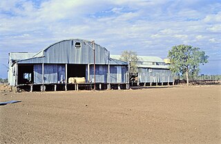
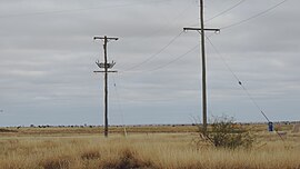
Darr River Downs is a heritage-listed homestead at Landsborough Highway, Morella, Longreach Region, Queensland, Australia. It was built from 1870s circa to 1900s circa. It was added to the Queensland Heritage Register on 27 June 2003.

Vergemont was a rural locality in the Longreach Region, Queensland, Australia. It was amalgamated into the locality of Longreach.

Tocal was a rural locality in the Longreach Region, Queensland, Australia. It was amalgamated into the locality of Longreach.

Camoola was a rural locality within the Longreach Region, Queensland, Australia, situated between the towns of Longreach and Muttaburra. It has been amalgamated into the locality of Longreach.

Chorregon was a rural locality in the Longreach Region, Queensland, Australia. It is now part of the locality of Longreach.

Ernestina was a rural locality in the Longreach Region, Queensland, Australia. It is now part of Longreach.

Maneroo was a rural locality in the Longreach Region, Queensland, Australia. It is now part of Longreach.

Tablederry is a former rural locality in the Barcaldine Region, Queensland, Australia. In the 2016 census, Tablederry had a population of 32 people.

Sardine is a former rural locality in the Barcaldine Region, Queensland, Australia. In the 2016 census, Sardine had a population of 5 people.

Tara Station is a former rural locality in the Barcaldine Region, Queensland, Australia. In the 2016 census, Tara Station had a population of 10 people.

References

  1. 1 2 Australian Bureau of Statistics (27 June 2017). "Morella (SSC)". 2016 Census QuickStats. Retrieved 20 October 2018. OOjs UI icon edit-ltr-progressive.svg
  2. "Morella (entry 47054)". Queensland Place Names. Queensland Government . Retrieved 13 September 2015.
  3. "Queensland Globe". State of Queensland . Retrieved 1 September 2016.
  4. "Morella – railway station in the Longreach Region (entry 22796)". Queensland Place Names. Queensland Government . Retrieved 21 September 2020.
  5. Premier Postal History. "Post Office List". Premier Postal Auctions. Retrieved 10 May 2014.
  6. "MORELLA TOWNSHIP BLOCKS FOR SALE". Queensland Country Life . Vol. 14, no. 13. Queensland, Australia. 7 October 1948. p. 7. Retrieved 21 September 2020 via National Library of Australia.
  7. "Q.C.W.A." The Longreach Leader . Vol. 22, no. 1177. Queensland, Australia. 21 October 1944. p. 5. Retrieved 21 September 2020 via National Library of Australia.
  8. "Mobile Meeting Supports Divisional Loans". The Longreach Leader . Vol. 30, no. 1858. Queensland, Australia. 5 September 1952. p. 4. Retrieved 21 September 2020 via National Library of Australia.
  9. "Opening and closing dates of Queensland Schools". Queensland Government . Retrieved 28 July 2019.
  10. "Evesham school's $250K upgrade on hold". ABC News . Australian Broadcasting Corporation. 3 September 2009. Archived from the original on 29 July 2019. Retrieved 29 July 2019.
  11. "Evesham State School". Evesham State School. 10 January 2007. Archived from the original on 10 January 2007. Retrieved 8 April 2022.
  12. "Recent place name decisions: Job number 17-050: Longreach". Queensland Government. Archived from the original on 28 July 2019. Retrieved 29 July 2019.{{cite web}}: CS1 maint: unfit URL (link)
  13. "Queensland Globe". State of Queensland . Retrieved 28 July 2019.
  14. "Darr River Downs (entry 600666)". Queensland Heritage Register . Queensland Heritage Council. Retrieved 10 July 2013.
  15. "Branch locations". Queensland Country Women's Association . Archived from the original on 26 December 2018. Retrieved 26 December 2018.

Further reading

Commons-logo.svg Media related to Morella, Queensland at Wikimedia Commons